Download
1 / 11
110 likes | 236 Vues
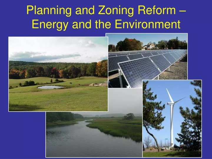
Planning and Zoning Reform – Energy and the Environment. Appropriate Areas and Actions: Energy Perspective. Goals : Site renewable and other clean energy facilities Concentrate growth to realize energy and emissions benefits Implement green building practices Enhance energy efficiency.

E N D
Appropriate Areas and Actions: Energy Perspective • Goals: • Site renewable and other clean energy facilities • Concentrate growth to realize energy and emissions benefits • Implement green building practices • Enhance energy efficiency
Appropriate Areas and Actions: Energy Perspective • EEA proposes that municipalities implement certain energy measures as a condition of plan endorsement. Possibilities include: • Adopt an expedited application and permitting process for clean energy generating facilities or clean energy research and development or manufacturing facilities; • Adopt an ordinance or bylaw requiring any new developments to minimize the life-cycle cost of the facility by utilizing green building, energy efficiency, water conservation, and other clean energy technologies; • Produce or enter into a contract to purchase a fixed percentage of electricity consumed by municipally owned buildings, street and traffic lights from clean energy sources; and/or • Designate growth districts that meet minimum density standards and mandate use of TDR and cluster in conservation districts. MA Audubon’s White Conservation Center
Location and Size of Appropriate Areas: Conservation Perspective Step One: Issue planning goals that elaborate upon the Sustainable Development Principles and specify “core” conservation objectives Three Examples of Conservation Objectives • PVPC - Valley Vision 2: • Rare species priority habitats • Aquifer Protection Overlay Zones • 200 foot buffers around water bodies • Zone II wellhead protection areas for Public Wells • Interim wellhead protection areas • Watersheds for public water supply reservoirs • Wetlands and 100 foot buffers • Steep slopes over 15% • Active Farmland • 100 year floodplains • Land prioritized for protection in local Open Space Plans • E.O. 418 “Community Development Plan” (selected layers): • Water Resources: • Riparian Corridors • Wetlands and wetland buffer areas • Areas of current or potential significance for groundwater recharge (based on best available surficial geology) • Watershed areas • Current public water supplies and areas of contribution • Flood hazard areas (FEMA Flood Insurance Maps) • Habitat: • Critical habitat areas including habitat of rare, threatened, and endangered species • Areas of significance for biodiversity • Natural communities, particularly significant or unusual natural communities • Linkages between riparian corridors, wetlands, and upland habitat. • Land Use: • Existing and potential greenways or trail corridors (link protected lands) • Landscapes of historic, scenic, or “community character” significance • Working landscapes such as lands currently used for or with the potential for agricultural or silvicultural use • Large areas of undeveloped/unfragmented land • Areas of Critical Environmental Concern • ELM List: • Drinking water protection • Threatened and endangered species • Large contiguous parcel of land • Prime agricultural soils/farmland • Habitat connector/corridor • Serves underserved urban population • Coastal salt marsh • Vernal pools • Rail-to-trail possibility • Superlative scenic resource • Contains unique natural resources • Old growth forests
Location and Size of Appropriate Areas: Conservation Perspective Step Two: Utilize the GIS data layers that correspond to the core conservation objectives to objectively rank land by level of conservation value – the most important lands are deemed “priority conservation areas.” (objectives and/or weighting could vary by region) An example of how GIS might be used to “weight” conservation interests and establish a conservation rating Conservation Rating
Location and Size of Appropriate Areas: Conservation Perspective Step Two (continued):Adjust the criteria based on analysis of the amount of “priority” land area designated in each community in order to reasonably balance environmental stewardship, local control, and other state interests. • The amount of land in a municipality deemed a “priority conservation area” will vary based on resources present. Town of Raynham E.O. 418 Natural Resource Priorities Map
Location and Size of Appropriate Areas: Conservation Perspective Step Three: A MassGIS planning tool provides an easily accessible “Conservation Priority” data layer so that plans and implementing regulations can be completed with reasonable assurance that they will be endorsed as consistent. "OLIVER" -- The MassGIS Online Data Viewer ~~ Enhanced Version 2.4 Released on June 8, 2005 ~~
Location and Size of Appropriate Areas: Conservation Perspective Ripton, MA Step Four: Establish a performance requirement. Endorsement requires utilization of a listed conservation zoning best practice for >50% (working number pending further analysis) of a community’s land designated a “priority conservation area.” • The amount of land in a municipality deemed a “priority conservation area” will vary based on resources present. “Priority Conservation Areas” “Municipally Designated Conservation Area”
Location and Size of Appropriate Areas: Conservation Perspective Listed conservation zoning best practices would include mandatory: growth area preservation area Open Space Residential (Cluster) Development Transfer of Development Rights Agricultural or Natural Resource Based Zoning Low Impact Development
Location and Size of Appropriate Areas: Conservation Perspective Urban/developed communities lacking priority conservation areas instead address deficiencies in park and recreational space and/or restore current environmental degradation. Municipal land use practices continue to be assessed via Commonwealth Capital and remain a factor in state funding decisions in order to address sprawl outside “priority conservation areas.”