Download
1 / 21
210 likes | 369 Vues
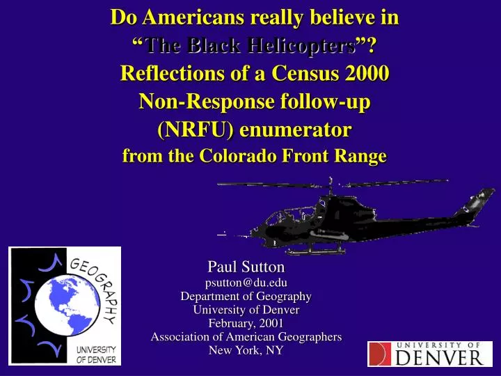
Do Americans really believe in “ The Black Helicopters ”? Reflections of a Census 2000 Non-Response follow-up (NRFU) enumerator from the Colorado Front Range. Paul Sutton psutton@du.edu Department of Geography University of Denver February, 2001 Association of American Geographers

E N D
Do Americans really believe in “The Black Helicopters”? Reflections of a Census 2000 Non-Response follow-up (NRFU) enumeratorfrom the Colorado Front Range Paul Sutton psutton@du.edu Department of Geography University of Denver February, 2001 Association of American Geographers New York, NY
Outline • What’s wrong with me? Why be an NRFU enumerator? • Interesting Facts about Census 2000 • How the state of Colorado fared in Census 2000 • Characterizing the Ex-urban 285 commuter shed • Practical Problems encountered as an enumerator • Errors/Inconsistencies I personally experienced • Interagency Cooperation: Fact or Fiction? • How or should NRFU enumeration be done in 2010?
‘What? Are you Crazy?You’ll get shot by crazy people.’ • I wanted to meet my new neighbors • I needed the money ~$13/hour • I am an insulated academic who never meets the ‘real people’ and I was curious how ‘different’ they were • People who refuse to fill out their census form are more likely to be ‘out there’ and I wanted to meet them. • I use census data all the time and have always been curious about ‘error’ and going to where ‘the rubber meets the road’ as to census data seemed like a good idea • I’ve never sworn an oath to the U.S. Constitution and this gave me an opportunity to do so and I liked it.
Everything you ever wanted to know about Census 2000 but were afraid to ask • Cost: 6.7 Billion Dollars ($24 per person counted) • Privacy: Yes…..but not after 72 years • Temp Labor Force: 860,000 (~1 in 325 Americans) • Response Rates*: 1990 – 65% 2000 – 67% * the universe of households that had responded to the census and would not need a personal visit by an enumerator • Too many Questions? Short form only 7 questions shortest form since 1820 • Congress and Senate represent those counted in Census, not just voters • Final Tally: 281,421,906 13.2 % increase since 1990 • How many significant figures do you think are in the above number?
Some interesting Census stats on Colorado • Population Colorado 1990: 3,294,394 • Population Colorado 2000: 4,301,261 • 31 % Growth over decade (3rd fastest state) • Colorado gained a 7th congressional seat • Jefferson County most populous • More skier visits (11 million) than population • More chickens (4.47 million) than people • Cattle are close (3.1 million) (more on that later ) • Vehicle/person ratio almost 1 (4,130,345 vehicles)
Newspaper statementson Errors in Population Counts Denver Rocky Mountain News (October 20, 2000) Population of the city and county of Denver Census Bureau: 499,775 DRCOG: 511,000 Colorado Demographer 542,000 Denver Post (July 7, 2000) ‘………official estimates of Park County population vary from one agency of the government to the next. However, all estimates are probably underestimates because a large fraction of the homes and population live way out in the boonies at the end of long dirt roads.”
Metro Denver Area with inset ofHighway 285 Commuter Shed South West of Denver
Pine Meadows Area Day & Night Denver Below:
Homes and scenes in the ex-urban 285 ‘urban’ commuter-shed
Maps for Enumerators(GIS products are not always better ) What the Census Bureau provided: What we actually used: We also used Jefferson County’s web-based ‘Address Wizard’…..
Interagency Cooperation:The U.S. Census Bureau & Jefferson County The high and mighty of both Jefferson County Government and the The U.S. Census Bureau were committed to cooperation… Needless to say, none of the enumerators really noticed. We used Jeffco resources for identifying land owners with The address wizard via the web; however, beyond that interoperability issues interfered with most of the potential Opportunities for interagency cooperation. I sincerely hope that these interagency-interoperability issues are Resolved by Census 2010. The potential benefits are enormous and the rewards will be great.
The Pseudo-GIS ‘Address Wizard’ and other data available via Jefferson County Web Page Jefferson County’s GIS database and the human capital backing it up Are state-of-the-art. Unfortunately, they missed that ‘Sesame Street’ Episode about “SHARING”.
The ‘Pandora’ enterprise GIS available at the ‘Taj Majal’ if you say ‘Mother may I’.The cadastral GIS layer used in these images is yours for a mere $20,000 (no joke) Jefferson County Government Building referred to by locals As: ‘The Taj Majal’ These screen-shots of the ‘Pandora’ System Showing speaker’s property e-mailed to author Courtesy of recent department graduate who is An employee of Jeffco IT department.
Why is this talk ‘Data Free’? Because Data is not free. Jefferson County demands $20,000 for their cadastral GIS data. (BTW: they haven’t sold one copy as far as I know) I wanted to compare the Census Bureau counts for Jefferson County to the Cadastral data that Jefferson County Assembled. My reasoning was that the vested interest nature that property taxation engenders would ensure higher data quality. The parcel data Jeffco has has a ‘# of housing units’ Attribute for every polygon. This could easily be compared at the block, block group, or tract Level to the Census 2000 results and shed some light on the Nature and magnitude of the errors in the Census data. (Assuming Jefferson County has a better data set) Stay tuned… I’m still working on this
Where are the ‘Black Helicopters’ in this talk? What Are Black Helicopters? Black Helicopters (BH) are not just helicopters with a black paint-job as you may have been told. They are, in fact, autonomous agents—lifeforms—created by New World Order agencies via nanobiotechnology. Their purpose is to spy on the activities of Americans in order to gather tactical information and discover "subversives" who are not bowing to the will of the Liberati's UN-backed Federal Government. Furthermore, when the NWO Invasion takes place in the not-to-distant future, they will round-up citizens for internment in concentration camps or carry out the elimination of the more vocally anti-Liberati. The Reproductive Cycle Of Black Helicopters Black Helicopters have a complex reproductive cycle with different phases. They start out as seed crystals that are injected in a biological host organism, typically cattle but occasionally humans, by either human technicians or other Black Helicopters. The seed crystal uses nanobiotechnology, a combination of robotics and genetics on a microscopic scale, to grow with material synthesized from the host's organs. After being injected into the head of a cattle, the seed crystal of a typical BH usually enters the blood stream where it travels to the intestines, along the way gathering various needed compounds from different systems. Once there, it quickly develops into a Microscopic Black Helicopter (MBH). From the following web site: http://www.zapatopi.net/blackhelicopters.html Strangely enough, I did not encounter anyone who was concerned about these black helicopters
Who were my ‘Non-respondents’?(the weren’t ‘black helicopter’ people) • Old people who intentionally didn’t fill out the form so someone would come talk to them. (and I discovered unique errors in both Jeffco and Census data from these chats) • Single parents who were so swamped they lost or simply didn’t care to fill out the form • People who never received a form…. ….the scariest error: next slide BTW: many people on the street thanked me for Working as a census enumerator (I think they thought I was a volunteer)
The Scariest Error • The 285 corridor is chock full of small ‘towns’ like Indian Hills, Kittredge, Tiny Town, and Idledale. The denizens of these towns pick up their mail at local post offices. • Many of the ‘Non-Response’ cases I was assigned had a street address for one community but a ‘town’ or post office address for another.
How did the enumerators deal with this? • The heat was on to ‘complete’ tasks. • Many enumerators simply recorded these cases as DNEs (Does Not Exist) • I was a good enumerator and tracked them down to the other local post office community. Invariably the people I talked to claimed they never received a census form. (there were many) • How many of these kinds of people were never counted? This is a question that I believe could be answered by using the Jeffco Cadastral data.
Errors Schmerrors who cares? • We had trouble counting the votes in the 2000 presidential election in Florida when the people being counted made an effort to show up at a polling place and wanted to be counted. • The Census Bureau’s challenge is much more difficult. The Census has to go out and enumerate every living person in the United States (citizens, non-citizens, voters, non-voters, men, women, children….) • The errors in Florida may have been as great at 3%. I have a hard time believing that Census 2000 did better than that. Were you counted? Are you sure?
NRFU enumeration in 2010?…Yes • The internet won’t catch everyone. NRFU enumeration will be needed for the for-seeable future. • Census Enumeration could be improved via cooperation with local agencies to enumerate more effectively 1) use GIS to distance and network based hierarchically allocate enumeration tasks 2) Assess coverage by comparing census results with local cadastral data layers 3) Reduce undercount • Disclaimer: I worked for the Department of Commerce’s Census 2000. Census 2000 was carefully and prudently executed. My comments here are not meant to disparage the efforts or the results of Census 2000
Conclusions….. • Cooperation between the Census Bureau and local government could greatly improve accuracy of census enumeration. • Errors in the U.S. Census are non-trivial and census errors in other parts of the world are undoubtedly worse. • One reason the Kyoto meeting on global warming and CO2 emissions foundered was because of the un-enforcibility of measuring CO2 emissions. • Will counting humans ever be part of assessing the human dimensions of global change?