Download
1 / 56
560 likes | 722 Vues
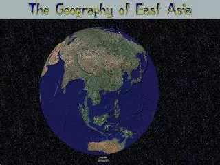
East & Southeast Asia. Physical Geography. Tectonic forces created: Himalayas Plateau of Tibet Kunlun Shan Altun Shan Tian Shan Arakan yoma Annamese *Shan = mountain. Himalaya Mountains. Plateau of Tibet “Roof of the World”. Highest and largest plateau in world

E N D
Physical Geography • Tectonic forces created: • Himalayas • Plateau of Tibet • Kunlun Shan • Altun Shan • Tian Shan • Arakanyoma • Annamese *Shan = mountain
Plateau of Tibet“Roof of the World” • Highest and largest plateau in world • ~2.5 million square miles large (4x Texas) • Headwater to the Salween, Mekong, and Yangtze River systems
Ring of Fire • Lies along the Pacific Ocean rim • Japan – mount Fuji: 12,388 ft asl, highest mountain in Japan • Java Island – Part of Indonesia; 35 active volcanoes • Approx. 20% of the world’s earthquakes occur in SE Asia
Plains and Rivers • Most of the population lives on river plains or along rivers
Human Geography • This region makes up 11% of the land in the world • 25% of the world’s population lives in this region. • 20% of the world’s population lives in China • Uneven population in China • East: 250 people per square mile • West: Less than 25 people per square mile • Dense in the lowland areas with mild and wet climates
Japan • ½ the population of the US but is only the size of California • 858 people per square mile over all but population distribution is not even • majority of the population lives along the coast = 5,800 people per square mile Java • Huge population: 1500 people per square mile
China • 75% of China’s population is rural but it still has cities with populations over 5 million. • Cities are the ports and are used for trade and industry • Restrictive residence laws so it controls urban growth • More people in just it’s cities than the entire USA!
More Urbanization • Japan: 80% urban, many of the cities have populations greater than 10 million people • Southeast Asia has a growing urban population because of economic opportunities (jobs)
Vegetation • Terraces – vegetation or crops being grown on the side of a mountain • Rice – staple crop
China: largest producer of rice in the world • Indonesia & Thailand: produce more rice per capita or per person • Fish is a large part of the economy • Fish Farming: growing fish in tanks for mass selling or export (aquaculture)
China, Mongolia, and Tibet • Landform: • China is the 3rd largest country in the world: in size (#1 is Russia, #2 is Canada) • 40% of China’s land is mountainous • Himalayas – world largest or highest mountain range • Mt. Everest – world’s highest peak; 29,035 ft asl • Plateau of Tibet • World’s highest plateau; 16,000 ft asl • Turpan Depression • Lowest point in China, 426 ft bsl
Rivers: • Huang He / Yellow (gets color from Loess) • Yangtze • Xi Jiang / Pearl
Climate • Affected by monsoons • Winter: Dry, cold • Summer: Humid, rainy • Rainfall decreases from North to West • Subtropical Climate: in Taiwan & SE China • Humid Continental Climate: in NE China • Dry Highland Climate: Western China • Affected by rain shadow effect • Winters: -50 F • Summers: High temps cause fires
Animals • 3 animals extinct in whole world, except in China Chinese Alligator Giant Panda Chinese Paddlefish
Vegetation: • Dry Northwest: steppe grasslands, drought resistant plants • Humid Southeast: swamps, tropical rainforest • Worlds largest producer of ducks, peanuts, rice • South China grows tea, sugarcane, fruits • North China grows wheat, millet, soybeans • Western China grows cattle • Aquaculture: raising fish in ponds
Natural Resources • World leading producer of coal, lead, tin, tungsten • Exports: oil & natural gas • Hydroelectricity: • Three Gorges Dam • Located on Chang (Yangtze) River • When completed it will be the largest dam in the world; full operation by 2012
Agriculture Resources • Yangtze River Region: • Paddy Fields: wetlands where rice is grown • Intensive Agriculture – using a great amount of human labor to farm a small amount of land • Double Cropping: Harvesting 2 crops in the same plot in order to add nutrients to the soil. • Huang He/Yellow River Region: • Loess: yellowish, fertile soil, being eroded by the river • Summer: river overflows its banks *add nutrients to area surrounding the river
Yangtze “Chang Jiang” River • Longest river in Asia and 3rd largest in world • Chang Jiang means “long river” • Headway-Plateau of Tibet • Mouth-East China Sea • 1/3 of China’s populations lives along the river
Yellow “Huang He” River • 2nd largest river in China; 6th in world • Mouth- Bohai Sea • “Cradle of Chinese civilization” because it was the most prosperous region of early ancient civilizations • Appears to be yellow from Loess
China • Official Religion- Atheist (due to communist government) • 47% urban • Government- Communist State • Economy- moving toward a market economy from a command economy
China’s Social Issues Censorship is strictly enforced – Google stopped operation for a period of time in protest Dissenters are not tolerated and can face jail time China controls Tibet even though they want autonomy and therefore China views the Dali Lama as a dissenter = bad news for the Dali Lama
Tiananmen Square • 1989, Beijing China • Protests led mainly by students and intellectuals in an attempt to incite political reforms on the communist government • 241 dead, 7000 wounded (official from China)
Japan • 126 million people • 80% Urban • Largest City- Tokyo (capital) 8.9 million • Religion- Shintoism and/or Buddhism 86% • Language- Japanese • Government- Constitutional Monarchy with a parliamentary government and a Prime Minister.
Japan - Landforms • 4 main islands: Run North to South • Hokkaido • Shikoku • Kyushu • Honshu – largest, most populated 70% of Japan is mountains Japanese Alps – large mtn. range *located on Honshu Mount Fuji – Peak 12,388 ft asl 30% is coastal plains
Islands are located in the subduction zone, where the Pacific plate has pushed under the Eurasian and Philippine plates: therefore, it is a hotbed for tectonic activity
Japan – Climate • Precipitation – 40-60 inches/year • Typhoons – Eastern version of hurricane (summer-fall) • Chishima Current – warm ocean current which brings warm, moist air to Japan
Japan - Vegetation • Limited habitat due to population growth & deforestation (cutting & burning of forests) Japan - Animals • Located in the Flyway Zone – migration route
Japan - Current • 65% of forest is protected -- timber is imported • Hydroelectricity & nuclear energy • Marine life – Whaling is legal in Japan
Taiwan • Political status is disputed because since 1949, China has claimed ownership • 23 million people • 98% Han Chinese ethnicity “native Taiwanese” • Language- Mandarin Chinese and Taiwanese • Religion- 93% Buddhism, Taoism, Confucianism
Korea • 2 countries on 1 peninsula • There are no active volcanoes
South Korea • 49 million people • 83% urban • Largest city- Seoul (capital) 9.7 million • Religion- Christianity 26% • Language- Korean (English is widely taught in school) • Government- Republic • One of the worlds top 20 largest economies
North Korea • 24 million people • 60% urban • Language- Korean • Government- Communist State • Large amounts of money is spent on the military
Korea: Climate • North Korea – Humid Continental: cold winter, warm summer • South Korea – Humid Subtropical: mild winter warm summer Korea: Vegetation • Limited habitat due to population growth and deforestation
Korea: Natural Resources • North Korea: Iron ore, copper, lead, coal • South Korea: Fish
Mainland: Climate • Tropical and Subtropical climate dominate the region • Precipitation is very high • Monsoons – bring wet/dry seasons • Wet – floods common • Dry – fires or drought common
Mainland: Animals • Arboreal: tree dwelling animals (monkey, bird) Mainland: Natural Resources • Rainforest – hardwoods (floors) • Deforestation – endangered species: tiger & elephants (on list) • Thailand – natural gas • Myanmar – oil • Vietnam – coal • Laos - Hydroelectricity


![The Most InDemand Talent in South East Asia [Infographic]](https://cdn4.slideserve.com/7359969/slide1-dt.jpg)