Download
1 / 34
340 likes | 425 Vues
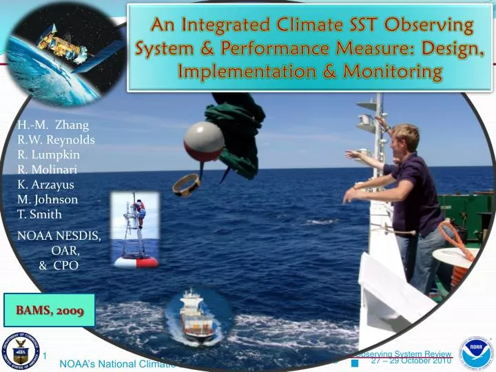
An Integrated Climate SST Observing System & Performance Measure: Design, Implementation & Monitoring. H.-M. Zhang R.W. Reynolds R. Lumpkin R. Molinari K. Arzayus M. Johnson T. Smith NOAA NESDIS, OAR, & CPO. BAMS, 2009. Content. Project Goals Design Strategy

E N D
An Integrated Climate SST Observing System & Performance Measure: Design, Implementation & Monitoring H.-M. Zhang R.W. Reynolds R. Lumpkin R. Molinari K. Arzayus M. Johnson T. Smith NOAA NESDIS, OAR, & CPO BAMS, 2009
Content • Project Goals • Design Strategy • Simulation Experiments for Needed In-Situ Network • Research to Operation • Monitoring & Iterative Process • A Few Other Slides
GOAL Using Observing System Simulation Experiments for a Cost-Benefit conscious design, implementation and operational monitoring of a global ocean observing system consisting of satellite and in-situ observations for a required climate assessment accuracy using sea surface temperature (SST)
Rationale • Surface temperature observations, ~ 70% from sea surface, are used for climate change assessment & monitoring
Rationale • Surface temperature observations, ~ 70% from sea surface, are used for climate change assessment & monitoring • For meaningful assessment, sufficiently accurate data are need. GCOS requirements for SST accuracy: • 0.2 – 0.5ºC for weekly satellite bias correction on 500km scale
Rationale • Surface temperature observations, ~ 70% from sea surface, are used for climate change assessment & monitoring • For meaningful assessment, sufficiently accurate data are need. GCOS requirements for SST accuracy: • 0.2 – 0.5ºC for weekly satellite bias correction on 500km scale • Q: What is the minimum and/or optimal observing system for the above requirement?
Rationale • Surface temperature observations, ~ 70% from sea surface, are used for climate change assessment & monitoring • For meaningful assessment, sufficiently accurate data are need. GCOS requirements for SST accuracy: • 0.2 – 0.5ºC for weekly satellite bias correction on 500km scale • Q: What is the minimum and/or optimal observing system for the above requirement? • Approach: OSSEs to find the relationship between sat bias reduction and needed in-situ data density
Major SST Observing Systems & associated Random Errors: (Reynolds & Smith 1994) 1) Buoy: ~ 0.5ºC 2) Ship: ~ 1.3ºC (thus ~ 7 ships = 1 buoy) 3) NOAA Operational Satellites - AVHRR Day: ~ 0.5ºC - AVHRR Night: ~ 0.3ºC
Complementary Nature of In-Situ & Satellite Observations • In-situ observations provide ground truth but are sparse over the global ocean • Satellite observations provide superior spatial coverage but may have large scale biases
Complementary Nature of In-Situ & Satellite Observations • In-situ observations provide ground truth but are sparse over the global ocean • Satellite observations provide superior spatial coverage but may have large scale biases • Blended Analysis (combined sampling) Errors (e.g. using OA/OI) are small enough for the required accuracy
Complementary Nature of In-Situ & Satellite Observations • In-situ observations provide ground truth but are sparse over the global ocean • Satellite observations provide superior spatial coverage but may have large scale biases • Blended Analysis (combined sampling) Errors (e.g. using OA/OI) are small enough for the required accuracy • Need dense enough in-situ data to sufficiently reduced the satellite biases to the required accuracy
System Design Strategy • Res Q: What is the needed in-situ network to efficiently and sufficiently reduce satellite biases to the required accuracy • STEP I: Need to understand the satellite bias characteristics • STEP II: Run simulated satellite bias reduction vs. buoy data density using OSSEs • STEP III: Evaluate combined actual ship and buoy obs to determine where additionally obs are needed
STEP I: Characterization of Satellite Biases • for monthly AVHRR SST from 1990 – 2002 • i=1: Pinatubo • EOF Analysis:
STEP I: Characterization of Satellite Biases • for monthly AVHRR SST from 1990 – 2002 • i=2: Seasonal clouds & Saharan desert dust • EOF Analysis:
STEP II: OSSE Design • Needed in-situ data density depends on both the magnitude and spatial patterns/scales of the biases. • E.g., if the biases are the same over the global ocean, only 1 accurate in-situ data would be needed to correct the constant bias. Generally, the more complicated the bias patterns, the more in-situ data would be needed
STEP II: OSSE Design • Needed in-situ data density depends on both the magnitude and spatial patterns/scales of the biases. • E.g., if the biases are the same over the global ocean, only 1 accurate in-situ data would be needed to correct the constant bias. Generally, the more complicated the bias patterns, the more in-situ data would be needed • Large satellite biases are related to atmospheric phenomena • Characterization of past biases by EOF analysis
STEP II: OSSE Design • Needed in-situ data density depends on both the magnitude and spatial patterns/scales of the biases. • E.g., if the biases are the same over the global ocean, only 1 accurate in-situ data would be needed to correct the constant bias. Generally, the more complicated the bias patterns, the more in-situ data would be needed • Large satellite biases are related to atmospheric phenomena • Characterization of past biases by EOF analysis • Monte Carlo simulations are used for future biases to find the relationship between in-situ data density and satellite bias reduction
Simulation Experiments • SSTs are simulated by ‘truths’ + typical random noises: • The ‘truths’ are chosen as the climatological monthly means • Simulated buoys are placed at regular grids • Experiments on varyinggrid size to find the corresponding satellite bias reduction • Simulated buoy SST: Tb(x,t) = Tg(x,t) + A * e(t) • Tg = ground truth (monthly climatology) • A = amplitude of buoy random error = 0.5°C • e(t) is a Gaussian random time series with a zero mean and standard deviation of 1 • Simulated satellite data are placed at the actual monthly satellite observations • Simulate monthly satellite observations (e.g., no retrievals with clouds), from January 1990 to December 2002 (t=1 to 156) • Simulated satellite SST: Tsi(x,t) = Tg(x,t) + Bi(x)* a(t) • i=1 to 6 for six simulated bias regimes, represented by the chosen six EOFs: Bi(x)=EOFi(x) with a global max of 2°C • Tg = ground truth (monthly climatology) • a(t) is a Gaussian random time series with a zero mean and a standard deviation of 1 • Random noises have little effects because of large number of monthly satellite observations
2°C • Satellite Bias Reduction vs. Simulated Buoy Density (BD) per 10° box. • Dash line is an exponential model fit. PSBE reduces rapidly initially and then levels off with increasing buoy density. • Optimal BD range is 2-5. A BD of 2 (vertical thin dash line) or more is required to reduce a 2°C bias to below 0.5°C.
STEP III In-Situ System Evaluation • In-situ (ship + buoy) data density computed on 10° grid boxes as Equivalent-Buoy-Density (EBD): • Typical random errors are 1.3°C for ships and 0.5°C for buoys, thus roughly 7 ships = 1 buoy to achieve the buoy accuracy, n ≈ 7 from
STEP III In-Situ System Evaluation • EBD maps in traffic light style • EBD >=2: Green – ok • 1 EBD < 2: Yellow • EBD < 1: Red
STEP III In-Situ System Evaluation • EBD maps in traffic light style • EBD >=2: Green – ok • 1 EBD < 2: Yellow • EBD < 1: Red • Improvement in S. Ocean
STEP III In-Situ System Evaluation • EBD maps in traffic light style • EBD >=2: Green – ok • 1 EBD < 2: Yellow • EBD < 1: Red • Improvement in S. Ocean Actual EBD to Bias Error avg (60S, 60N)
PSBE YEAR
PM for Managers PSBE • PSBE used as a GPRA Performance Measure (PM) • OMB Gov Performance Results Act (GPRA 1993): • Achieving program results • Improving program effectiveness • Communicating effectiveness & efficiency YEAR
PM for Managers PSBE • PSBE used as a GPRA Performance Measure (PM) • Major budget commitment in 2005 with fastest PM improvement • OMB Gov Performance Results Act (GPRA 1993): • Achieving program results • Improving program effectiveness • Communicating effectiveness & efficiency YEAR
PM for Managers PSBE • PSBE used as a GPRA Performance Measure (PM) • Number of surface drifters • OMB Gov Performance Results Act (GPRA 1993): • Achieving program results • Improving program effectiveness • Communicating effectiveness & efficiency YEAR
Conceptual Model: Research-to-Operation & Decision Making GPRA PM Gov Performance Measure $$$$ Budgeting
Impact on SST PM by Reduced Ship TimesObserving System Simulation Experiments (OSSEs):Scenarios related to various TAO buoy maintenance schemes • Issue: What are the effects on the SST Performance Measure by reduced TAO buoy-maintenance cruises, particularly by the aging Kaimimoana ship? • Related scenarios: • 1) Reduced/eliminated (Kaimimoana) cruises also leads to reduced surface drifter deployments in the tropical area • 2) No TAO buoy maintenance leads to reduced or unusable TAO data, but drifters are some how maintained as it have been (may be logistically difficult) • 3) Is TAO array is enough w/o drifters in this area?
SUMMARY: PSBE increases for FOUR Scenarios No surface drifters: Error increase by about 0.5°C No moored AND Kaimimoana-dropped buoys: Error increase between 0.1 to 0.2°C (combined) No moored OR Kaimimoana-dropped buoys: Error increase between 0.05 and 0.1°C (by each)
Satellite Retrievals: Surface Air Temp & Humidity etc - Need to reduce the RMS errors • Need More In-Situ Data: • Different special regimes • All seasons • (Simulations w/o TAO Buoys)
Conceptual END-TO-END PROCESS From Data Ingest to Blended Products & Services Interactive Data Services Marine Surface Observations Global Gridded Products http://www.ncdc.noaa.gov/oa/rsad Shown is for 6-hourly sea winds; note the simultaneous Typhoon Talim and Hurricane Katrina • USERS • Climate • Research • Decision • making • (observing • network • design & • monitoring) • Weather & • ocean • forecasts • Ecosystem • Marine • transportation • Wind/wave • energy • Outreach • (education) GTS Ingest N C D C QC; Blending NoaaPort Satellite Ingest
SURFA – Surface Flux Analysis WCRP SURFA: Surface Flux Analysis • Driver: Surface processes are key in improving NWP & climate model forecast skills • Objective: SURFA is to develop the evaluation of near real-time NWP, Reanalysis & Climate model fluxes and related fields with high quality reference data • Initiation: WCRP WGSF, WGNE, OOPC … • Status: • NCDC as central archive & service • Documents: NWP archive specifications; Submission Agreements • Current Participation: • NWP Centers: ECMWF, German DWD, Japan (JMA), Meteor-France, UK • In-Situ: Ocean Reference Stations, Flux Towers, Climate Reference Network • Data available from NCDC: • http://www.ncdc.noaa.gov/oa/rsad/air-sea.html