Download
1 / 27
270 likes | 374 Vues
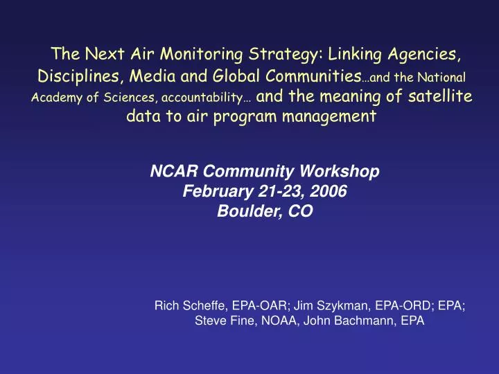
The Next Air Monitoring Strategy: Linking Agencies, Disciplines, Media and Global Communities …and the National Academy of Sciences, accountability… and the meaning of satellite data to air program management. NCAR Community Workshop February 21-23, 2006 Boulder, CO.

E N D
The Next Air Monitoring Strategy: Linking Agencies, Disciplines, Media and Global Communities…and the National Academy of Sciences, accountability… and the meaning of satellite data to air program management NCAR Community Workshop February 21-23, 2006 Boulder, CO Rich Scheffe, EPA-OAR; Jim Szykman, EPA-ORD; EPA; Steve Fine, NOAA, John Bachmann, EPA
Sequence • Current air program priorities • Subsequent air issues • Air program perspective on linkage with satellites and advanced integrated systems
The Air Quality Management Process ESTABLISH GOALS • - National Ambient Air Quality Standards (NAAQS) • -Regional Haze • - Monitoring • - Inventories • - Data Analysis & Modeling DETERMINE NECESSARY REDUCTIONS Scientific Research DESIGN CONTROL STRATEGIES EVALUATE RESULTS • - National, Regional Rules • e.g. Mobile, NSPS • NOx SIP call, CAIR • - Develop State, Local, Tribal Plans • - Assess Progress • - Evaluate Effectiveness & Efficiency IMPLEMENT • - State Implementation Plans (SIPs) • - Permits • - Compliance & Enforcement
Air program drivers • Pollutant category • Criteria: PM2.5, ozone • Mercury • HAPs • Pollutant sectors • Energy • Transportation • Natural • Other (chemical facilities, minerals, coatings, etc.) • New Themes • Multiple pollutant • Accountability • Multiple media Response to 2004 NAS Report: AQM in U.S.
Setting Priorities in a Changing Policy Landscape - Air Quality Policy Context: Which NAAQS are most important? Nonattainment areas for 8-hour ozone only Nonattainment areas for fine particlesonly Nonattainment areas for both 8-hour ozone and fine particles No. Counties with Monitors>NAAQS CO 0 Lead 1 SO2 0 NO2 0 PM 10 46 PM 2.5 82 O3 297 Areas Designated Nonattainment for Ozone and PM2.5 2004 Ozone and PM are our highest priority
National NOx and SO2 Power Plant Emissions:Historic and Projected with CAIR SO2 NOx Projected, w/ CAIR Source: EPA
Legend Area Count Both PM and Ozone Nonattainment 3 PM Only Nonattainment 14 Ozone Only Nonattainment 7 Nonattainment areas projected to attain 105 Areas Projected to Exceed the PM2.5 and 8-Hour Ozone Standards in 2015 with CAIR/CAMR/CAVR and Some Current Rules* Absent Additional Local Controls **Areas forecast to remain in nonattainment may need to adopt additional local or regional controls to attain the standards by dates set pursuant to the Clean Air Act. These additional local or regional measures are not forecast here, and therefore this figure overstates the extent of expected nonattainment. *Current rules include Title IV of CAA, NOx SIP Call, and some existing State rules.
PM NAAQS Proposal • Annual NAAQS 15 ug/m3 • 24 hour 98th percentile NAAQS 35 ug/m3 • Replace PM10 with ‘qualified’ coarse standard • focus on urban coarse PM resuspended by heavy traffic, industrial sources, and construction • excludes rural dust uncontaminated by urban, industrial sources (excludes agriculture, mining, wind blown dust
Counties Exceeding the Proposed PM2.5 NAAQS- 2015 Base Case Annual 15 ug/m3 and 24-Hour 35 ug/m3 New (proposed) standards increase relevancy of satellite data and comprehensive observational systems *EPA models assume implementation of CAIR/CAMR/CAVR, mobile source and other federal rules and existing state programs. Air quality is expected to be better than shown. This approach does not forecast actions states will take to meet current PM standards. Also note that modeled air quality forecasts are subject to a number of uncertainties.
High Risk Counties often Coincide with Locations where Criteria Pollutant Issues are Significant - 1999 NATA - National Scale Assessment Predicted County Level Carcinogenic Risk 2010 remaining issues Ozone PM Both PM & Ozone Some areas of predicted high air toxic risk are expected to have O3 and PM problems in the future (2010) Impetus for multi-pollutant strategies
US (All 50 States) Emissions of HAPs by Source Sector * After 2010, stationary source emissions are based only on economic growth. They do not account for reductions from ongoing toxics programs such as the urban air toxics program, residual risk standards and area source program, which are expected to further reduce toxics. In addition, mobile source reductions are based on programs currently in place.Programs currently under development willresult in even further reductions. Without CAA • Key Findings • CAA has been very effective in reducing overall tonnage of air toxics • In absence of CAA, total emissions would be more than twice those projected in 2020 Base Year ------------ Projected Emissions ------------
Mercury Deposition From All Sources: 2001 Mercury, current and future AQ challenge requiring multiple – scale approach Mercury Deposition from US Power Plants: 2001 Mercury Deposition from US Power Plants: 2020 with CAIR & CAMR
New findings on roadway pollution Relative Particle Number, Mass, Black Carbon, CO Concentration near a major LA freeway High exposure to ultrafine particles, CO, other pollution near roadway Increased risk near and on roadways
Emerging Challenges for Air Policy • Meeting NAAQS for O3 and PM2.5 and Reducing Regional Haze • Designing and Implementing Controls for Hazardous Air Pollutants • Protecting Human Health and Welfare in the Absence of a Threshold • Ensuring Environmental Justice • Assessing and Protecting Ecosystem Health • Intercontinental and Cross-Border Transport • Maintaining AQM System Efficiency in the face of Changing Climate
Accountability and Indicators Pipeline Source emissions Direct NO, SO2, VOC, CO, metals, Increasing influence in confounding factors and perceived value to public policy Ambient precursors and intermediates NO, NOy, CO, VOC, SO2, metals, radicals, peroxides Ambient target species O3, PM, HAPs Secondary and deposition loads Visibility, acidification, eutrophication, metals Exposures Inhalation, digestion Increasing confidence In characterization Ecosystem + effects Defoliation, Visibility ↓ biodiversity, Metals concentration Health effects Asthma, cardio-pulmonary ↓, Cancer, death Perceived (measured?) Life quality Feedback/correction
Tons Reduction -33,000 - 0 0 - 27,000 28,000 - 73,000 74,000 - 110,000 120,000 Largest decline in ozone occurs in and downwind of EGU NOx emissions reductions (2002-2004) Decline in “Seasonal Average” 8-Hour Daily Maximum Ozone EGU NOx Tons Reduced Met. Adj. • The major EGU NOx emissions reductions occurs after 2002 (mostly NOx SIP Call) • Average rate of decline in ozone between 1997 and 2002 is 1.1%/year. • Average rate of decline in ozone between 2002 and 2004 is 3.1%/year.
Building an integrated observation-modeling complex: an air program perspective • Health • effects/outcomes associations (PHASE) • Public health warnings/forecasting • Air program support • defining attainment/nonattainment areas (and projection, current practice) • developing emission strategies • accountability • Environmental • Ecosystem deposition assessments/support • AQ trends in National Parks • Regional haze assessments • Atmospheric science • Diagnosing emissions and models Benefit from Air quality characterizations And benefit even more from rich (t,s,c) AQ characterizations Note: IGACO; AQ, ox eff., strat-O3, climate
Consequently • A simple overarching goal or vision, • Strive for maximum and efficient AQ characterization in time, space and compositional terms • the intersecting or common link between air programs and satellite data and integrated advanced systems
Total column depth (through Satellites) AQ model results Vertical Profiles Land AQ Monitors Integrated Observation- Modeling TGAS/Aerosol Satellite Measurements and Numerical Predictive Models • Assimilation of data to improve • air quality models for forecast • Current and • Retrospective assessments • Global-Regional Air Quality Connections • Climate-AQ connections Optimized PM2.5, O3 Characterizations Health ecosystems Air management
Stars aligned? Observation technologies {e.g., satellites} Collaboration (culture) empire building? Computational power Science, talent {embodied in AQ models and young geniuses} Alignment Budgets, agency collaboration resource/program accountability Information technologies {e.g., data sharing protocols} Accountability, ↓ regulatory assessments {e.g., NAS, CASAC}
National Ambient Air Monitoring Strategy Office of Air Quality Planning and Standards Research Triangle Park, NC December 2005 CENR/AQRS Barrow L1 Trinidad Head GAW L2 NCORE L3 Mauna Loa A. Samoa S. Pole http://www.cmdl.noaa.gov/ http://www.fz-juelich.de/icg/icg-ii/mozaic/home http://www.fz-juelich.de/icg/icg-ii/iagos/ GEOSS http://www.epa.gov/ttn/amtic/monstratdoc.html http://earthobservations.org/ EMEP http://www.al.noaa.gov/AQRS/ reports/monitoring.html http://www.empa.ch/gaw/gawsis/ http://www.emep.int/ NOAA CMDL NOAA NESDIS http://www.igospartners.org/ http://www.nesdis.noaa.gov/
+ + + + + Common parameters linking column totals and surface measurements NCORE Level 2 trace species
Contributions of Space Observations for Air Quality • Gap filling Inherent spatial averaging usable for air quality models vs. point in-situ observations (vertical profiles needed for linkage). • Fills in gaps over large water bodies and remote land areas • Critical support for inverse modeling and improved emission inventories • Uniformity overcomes inter-calibration issues for ground-based instruments. • Scale connection Synoptic views can inform inter-relations of processes of different scales (likely requires complementary geostationary and polar orbiting satellites), relevant for study of global-to-regional connections. • Process connection Observe and monitor the connections between emissions and weather phenomena. • Monitor the onset, progress, and decay of severe-episodic air quality events. • Identify and locate interactions between pollution and synoptic systems like troughs/ridges, jet streams, regions of intense convection, and convergence zones on a continuous basis. • Media connection Movement toward bi-directional multimedia assessments • Adding in carbon exchange, surface characterization, climate and other strategies that impact emissions and AQ • Require whole Earth..space based chracterizations
Process Scales relevant to Air Quality vs. Space Observations Long Range Transport Pollution Dynamics Global Composition/Climate Regional Transport Intercontinental Transport Regional Haze/Subsidence Strat/Trop Exchange RAQMS 330K NOy 18Z July 17, 2004 Residual layer/Nocturnal Jet 12Z Convective exchange/rainout Urban Canyon 18Z
simply, Arithmetic injustice • Greater than 95% of air pollutant mass is located above 100m, yet we (air program community) focus 95 % of our characterization on the bottom 10 meters {compromises both predictive and current characterization phenomena}
Concerns, practical considerations, communications, steps • What is the most practical role for satellite data in surface applications? (Beyond conceptual model development) • Key in constraining and diagnosing model behavior • Real strength will be in chemical data assimilation in a modeling framework • Subsequent role in any air program related assessment • Increasing relative contribution of Hemispherical Transport • Adds increased reliance on satellite products for both conceptual model formulation and improved global-regional model linkage • Further enhanced with tighter daily aerosol standards • Identifying and building known integration steps • Vertical profiles (ground, aircraft (MOZAIC/IAGOS), space (TES, Calipso)\ • Chemical data assimilation-model fusion • Data storage, harmonization, interpretation and delivery
NAS, CAAAC CASAC, OMB GEOSS NOAA EPA PM research NASA Eco-informatic Test beds CDC PHASE Organizations Private Sector NPS Programs AQ forecasting Risk/exposure assessments States/Tribes/RPO’s Interstate orgs. USDA Accountability/ indicators NAAQS setting DOE NARSTO Coordination Cluster Mess Enviros SIPs, nat. rules designations Academia NADP Satellite data Intensive studies IMPROVE, NCore PM monit, PAMS PM centers Supersites Data sources CASTNET Health/mort. records Other networks: SEARCH, IADN.. Lidar systems Emissions Meteorology CMAQ GEOS-CHEM