Download
1 / 34
340 likes | 341 Vues
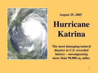
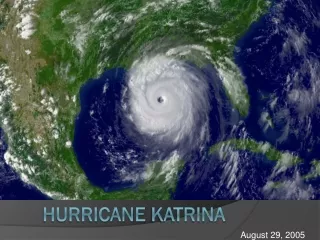
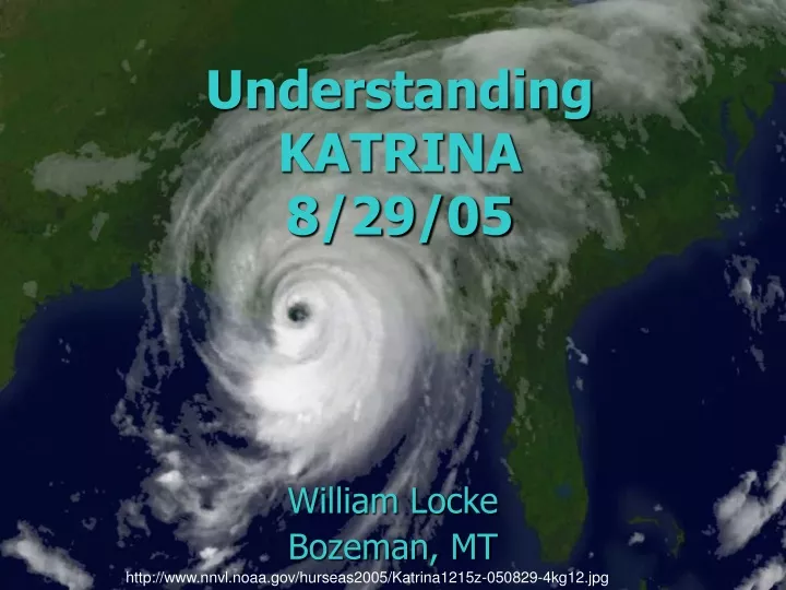
Understanding KATRINA 8/29/05. William Locke Bozeman, MT. http://www.nnvl.noaa.gov/hurseas2005/Katrina1215z-050829-4kg12.jpg. On promontories, not bays 2 category 5s, 7 cat. 4s. http://www.nhc.noaa.gov/gifs/hur5005.jpg. South Florida = most frequent South Texas and Miss. Delta = second

E N D
UnderstandingKATRINA8/29/05 William Locke Bozeman, MT http://www.nnvl.noaa.gov/hurseas2005/Katrina1215z-050829-4kg12.jpg
On promontories, not bays • 2 category 5s, 7 cat. 4s http://www.nhc.noaa.gov/gifs/hur5005.jpg
South Florida = most frequent South Texas and Miss. Delta = second Katrina Rita History (1900-1996)http://www.nhc.noaa.gov/pastall.shtml Percent per year probability (historical) per 50-mile (80 km) coastline
Hurricane history http://www.nhc.noaa.gov/gifs/atlhist_lowres.gif Named storms Hurricanes Cat. 3+
Hurricane history But – see http://wind.mit.edu/~emanuel/anthro2.htm Named storms Hurricanes Cat. 3+
Miss. delta • Sea level? • Lake Pontchartrain • Lake Borgne • SW Pass SW PASS http://www.mpcnetwork.com/marinersinfo/charts/gm/2neworleans.gif
Mississippi delta in flood • Note: • Sediment to Gulf1,000,000 ton/day • Flooded outer delta • Dry diked areas • Vegetation/land use on natural levees BayouLafourche http://jan.ucc.nau.edu/~rcb7/MissDelta.jpg
Topography of New Orleans • Much of north N.O. lies well below sea level • Sea water gains access through canals • An uneasy truce is maintained by ~350 miles of levees. From Brian Hayes (2005), American Scientist, v. 93, p. 496-499 [original map from Louisiana State University]
Natural levees • Result from multiple floods • Extend 2+ km from river channel • Are poorly engineered!
Which way to the ocean? • Miss. R. is twice as long (half as steep) as shortcuts via the Atchafalaya R. or Lake P. Mississippi Atchafalaya http://www.ssec.wisc.edu/~gumley/modis_gallery/images/MississippiDelta_20040127_1940_1000m.jpg
Mississippi River deltas • Sea level stable for ~6000 yr • Delta front moves as river avulses • Average duration <1000 yr • Modern delta for ~1300 yr • Time for a change! http://www.uwgb.edu/dutchs/graphic0/geomorph/missdlt.gif
Recent sediment thickness • Greatest near edge of shelf[max. ~ 100 m] • Can’t restore wetlands • Can’t armor coast • Can compact and subside (1-10 mm/yr)! • S.L. 1-3 mm/yr • N.O. -8’ to 15’ “above” sea level. http://coastal.er.usgs.gov/LA-subsidence/figure2.html
Levee history & failure • Overtopping • Seepage through/under the levee • Not protection - postponement Courtesy USACOE http://web.umr.edu/~rogersda/flood_hazards/Should%20I%20Trust%20That%20Levee.htm
Katrina http://www.ssd.noaa.gov/GOES/katrina.html
Sea-surface temperatures • Note extremely warm water • Shallow coastal waters commonly lack cold layers Image courtesy NASA-JPL
Katrina by strength and warnings • Tropical depression • Tropical storm • Hurricane 1 • Hurricane 2 • Hurricane 3 • Hurricane 4 • Hurricane 5 http://www.nhc.noaa.gov/archive/2005/KATRINA_graphics.shtml
Katrina modeled rainfall • Note max. EAST of track of storm eye • Same for wind
Hurricane Structure • Cyclonic (CCW) winds >74 mph • Right side = storm wind + forward motion • Left side = storm wind – forward motion Biloxi N.O. Waveland
Storm surge • Key variables • Onshore winds • Central pressure • State of the tide • Configuration of the coast • Can exceed 8 m (25’) in worst case scenario
Katrina comes ashore • [Surviving]tide gauges
Katrina storm surge (model hindcast) http://hurricane.lsu.edu/floodprediction/katrina32/images/katrina32.JPG • It missed New Orleans • Max. impact on Miss. Coast • Funneling?
Flooding at New Orleans • Observed at Miss. River gauge • Not (quite) to flood stage~12 foot storm surge • Big sigh of relief as storm passed but…
Damage (courtesy of USGS) • Biloxi http://coastal.er.usgs.gov/hurricanes/katrina/ • PassChristian • Biloxi
Deadliest (through 1996)http://www.nhc.noaa.gov/pastall.shtml
Who’s to blame? • Individuals who assumed risk, then didn’t listen and follow instructions • New Orleans, for not having a real evacuation plan • The Corps of Engineers, for a century and more of false promises and wasted billions • FEMA et al., for not recognizing the scope of the impending disaster • Congress, for not funding adequate maintenance/upgrades of levee system
What do we do about it? • Abandon New Orleans? • Rebuild New Orleans only along the natural levees? • Rebuild, but zone/plan undersea areas for only unoccupied ground floors? • Rebuild and raise the levees? • Rebuild