Download
1 / 35
350 likes | 574 Vues
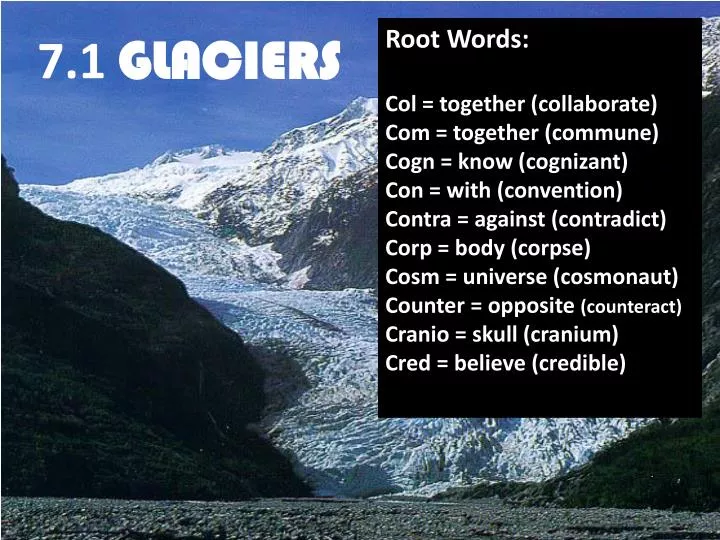
Root Words: Col = together (collaborate) Com = together (commune) Cogn = know (cognizant) Con = with (convention) Contra = against (contradict) Corp = body (corpse) Cosm = universe (cosmonaut) Counter = opposite (counteract) Cranio = skull (cranium) Cred = believe (credible).

E N D
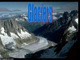
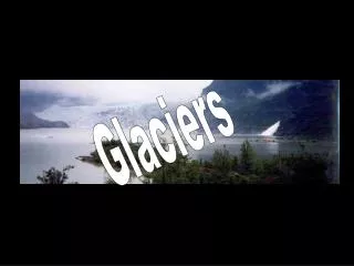
Root Words: Col = together (collaborate) Com = together (commune) Cogn = know (cognizant) Con = with (convention) Contra = against (contradict) Corp = body (corpse) Cosm = universe (cosmonaut) Counter = opposite (counteract) Cranio = skull (cranium) Cred = believe (credible) 7.1 GLACIERS
15,000 years ago… Ice Age People Constructed Mammoth-Bone Shelters on the East European Plain
15,000 years ago… Humans developed a relationship with dogs.
15,000 years ago… Humans had travelled spread throughout Europe, Africa and the Americas.
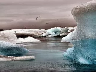
15,000 years ago… The Earth was 30% covered in GLACIERS! Glacier
French Alps Long Island Fjords of Norway Yosemite Valley Cape Cod All shaped by glaciers! Great Lakes
GLACIER = thick mass of ice that forms over hundreds or thousands of years. ICE AGE = a period of time when much of Earth’s land is covered by glaciers. Flash: Earth’s Changing Climates
SNOWLINE = the lowest elevation in a particular area that remains cover in snow all year. Antarctica snowline Peru
Glaciers form when new snow falls onto old snow year after year after year building up the snow. As the newer snow piles up it exerts pressure on the older snow causing it to recrystallize into coarse grains of ice.
Valley Glacier = a stream of ice that flows between steep rock walls from a place near the top of the mountain valley.
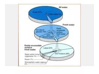
Ice sheet = ice that covers a large region where the climate is extremely cold. Only two ice sheets remain now. Antarctica Nearly 2/3 of Earth’s Freshwater! If the Antarctica ice melted, it would raise seal level 60-70 meters! Greenland
How Glaciers Move PLASTIC FLOW = movement within the ice as the ice distorts and changes shape. Beginning at about 50 meters below the glacier surface the weight of overlying ice puts pressure on ice below causing it to flow.
Basal Slips = Gravity causes the entire ice mass to slip and slide downhill along the ground. Zone of Fracture = the brittle outermost zone of the glacier. When the glacier flows over uneven ground cracks calledCREVASSESform which can be up to 50 meters deep but snow cover the tops making travel over glaciers very dangerous!
GLACIAL BUDGET = balance between accumulation of snow/ice at the upper end of the glacier and loss/wastage at the lower end. Zone of Accumulation Snowline Crevasses Zone of Wastage Iceberg
Glacial Advance and Retreat If more ice accumulates at the beginning of the glacier than is lost at the end of the glacier, then the glacier will advance.
Glacial Advance and Retreat If more ice is lost a the end of the glacier than accumulates at the beginning, then the glacier will retreat. Regardless if ice is gained or lost, the glacier still flows downhill.
CALVING = when large chunks of ice break off the end of an iceberg. ICEBERG = very, very large chunk of ice that has calved from an iceberg and is floating in the ocean. Only about 10% is visible above the surface of the water. Just the “tip of the iceberg!”
LANDFORMS CREATED BY GLACIAL EROSION Glaciated Valleys = valleys that are widened from their original V-shape to a U-shape called a glacial TROUGH.
Hanging Valleys = valleys cut by smaller glaciers that enter into a valley cut by a larger glacier. Hanging valleys are not cut as deep so are left standing higher than the main valley. Pg. 193 Fig. 7
CIRQUE = bowl-shaped depression a the head of a glacial valley that is surrounded on three sides by steep rock walls.
^ ARETE = snaking, sharp-edged ridges where cirques occur on opposite sides of a divide. Yosemite HORN = sharp pyramid-like peaks had cirques surrounding them. Matterhorn, Switzerland
GLACIAL DEPOSITION LANDFORMS New England pasture (rocky) Midwest farmland (rolling) Dakota wheat field
TYPES OF GLACIAL DRIFT (All types of sediments of glacial origin.) • TILL = deposited directly by the glacier as it melts. • (typically contains many different sizes of particles)
2. Stratified Drift = sediment deposits that are sorts according to particle size and weight.
Boulders deposited by glaciers can be identified because they have a different composition (glacial erratics) to that of the bedrock upon which they rest. Glacial Erratics of New England
MORAINES = layers or ridges of till left by glaciers 1. Lateral Moraines = ridges that from along the sides of glacial walls as the glacier gather debris from the walls of the valley.
2. End Moraines = deposit of till at the end of a glacier that has been stationary for long periods of time. This till is carried from the beginning of the glacier to the end of the glacier within the glacier itself. The Pas Moraine shows a stagnant stage in the retreat of the large ice sheet. The fluted stripes in the landscape (E) show the direction of the ice flow. The dark ridge in the middle is the end of the ice sheet where glacial tills and end moraine formed a significant elevation in the landscape.
3. Ground Moraines = glacial till that forms as a glacier begins to recede usually creating a rocky plain. Often results in poorly drained swamp lands.
Terminal Moraines = as a glacier recedes it leaves several end moraines. The farthest end moraine is called the Terminal Moraine. Recessional Moraines = the end moraines that form all along as the glacier melts are called recessional moraines. (Page 197 Figure 12) Terminal Moraine Recessional Moraine
Outwash Plains = broad, ramp-like structure made as the glacial milk washes out of the end moraine.
Kettle = depressions and small lakes within end moraines and outwash plains that form when a block of glacial ice doesn’t flow with the glacial milk and is buried then melts later. Older kettle moraine; Walden Pond, MA New kettle moraine, New Zealand
Rochester, NY Drumlins = streamlined hills composed of till that are taller and steeper at one end. (Drumlin Fields = cluster of drumlins) No, that’s a GRIMLIN! The steep side of the drumlin faces the direction the ice came from and the other side faces where the ice went.
Esker = snake-like ridges that formed from streams that flowed under glaciers. Manitoba, CANADA
The Most Recent Ice Age… began 2-3 million years ago. Pg 198 Figure 13
Glacial Change Alaska http://video.pbs.org/video/994540147/chapter/1/search/glaciers