Download
1 / 18
180 likes | 192 Vues
How Do I Study Geography?. Six Essential Elements of Geography and Types of Maps. #1 - The World in Spatial Terms. Geographers first take a look at where a place is located. Knowing the location of places helps to develop an awareness of the world around you. #2 - Places and Regions.

E N D
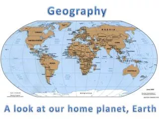
How Do I Study Geography? Six Essential Elements of Geography and Types of Maps
#1 - The World in Spatial Terms • Geographers first take a look at where a place is located. • Knowing the location of places helps to develop an awareness of the world around you.
#2 - Places and Regions • Place in geography not only describes where something is, but also what it is like. • Geographers also group places by regions. • Regions are united by one or more common characteristic • i.e. Desert Regions, Rainforest Regions
#3 - Physical Systems • When studying places and regions, geographers analyze how physical systems – such as hurricanes, volcanoes and glaciers – shape the earth’s surface.
#4 – Human Systems • Geographers also examine humans systems, or how people have shaped our world. • They observe political boundaries and why people settle in certain places. • A key theme is movement of people, ideas and goods.
#5 – Environment and Society • What is the relationship between people and their natural surroundings? This is what the theme of human/environment interaction investigates. • It also shows how people affect the environment
#6 – Uses of Geography • Knowledge of geography helps us understand people, places, and environment over time. • Knowing how to use the tools of geography prepares you for our modern society
How Do I Use Maps and Globes? • Geographers use a system of imaginary lines that crisscross the globe. • One of these lines is the EQUATOR – it circles the earth like a belt. • It runs east to west at 0* latitude
When the earth is divided into “half spheres” they are called HEMISPHERES. • The PRIME MERIDIAN is another imaginary line that runs north to south in the center of the earth.
Latitude and Longitude • Lines on globes and maps provide information that can help locate places on the earth. • These are called latitude and longitude lines. • These lines cross each other to form a grid pattern.
Latitude • Lines of latitude, or parallels, circle the earth parallel to the equator and measure the distance north or south of the equator in degrees. • The equator is at 0* latitude.
Longitude • Lines of longitude, or meridians, circle the earth from Pole to Pole. These lines measure distances east or west of the starting line, which is at 0* longitude – which is called the Prime Meridian
Common Maps • Equal-Area Maps – show continents close to their true shapes and sizes. • This type of map is useful when comparing land areas among continents.
A Mercator map shows true direction and land shapes fairly accurately, but not size or distance. Areas located away from the Equator are distorted. • For example – Greenland and Alaska look much larger on this type of map than an equal-area map
Parts of a Map • A Map Key explains the lines, symbols, and colors used on a map • Scale is usually a measuring bar that helps you figure distance on the map.
A Compass Rose – is a symbol that tells you where the cardinal directions – north, south, east and west - are positioned
Physical Maps • Physical maps call out landforms and water features. • A physical map shows rivers and mountains. • A Physical map will use colors to show types of land or even elevation
Political Maps – show the names and boundaries of countries, the location of cities and other human made features of a place, and often identify major physical features.