Download
1 / 24

E N D
Physical Oceanography Chapter 15
Major Oceans • The three major oceans are : 1._______-largest, deepest, coldest, least salty. 2.__________- second largest, shallow, warm, salty. 3. _________- intermediate in depth, temperature, and salinity. • The _______Ocean near the north pole, and the ____________ Ocean near the south pole contain vast expanses of sea ice. Pacific Atlantic Indian Arctic Antarctic
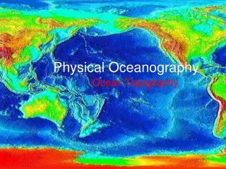
Methods of Studying the Ocean The Topex/Poseidon _____________ orbits 1331 km above the Earth, gathering information about the oceans. satellite Sonar _____________ maps ocean floor topography by timing how long it takes sound waves to bounce off the ocean floor. submersibles Underwater vessels called _________________ investigate the deepest ocean trenches.
Sonar (also called echo-sounding) • Sound waves travel how fast in seawater? • How deep is the water if it takes ten seconds for the sound wave to go from ship to ocean floor and back to ship? 1,454 m/s 7,270 m Calculation: (10 s times 1,454 m/s divided by 2 )
submersible • The picture below is of a _____________.
Salinity The amount of salt per unit water is known as salinity. NaCl The most abundant salt in seawater is ________, but there are many other salts present in the form of ions. The average salinity of seawater is _____ ppt. Therefore, for every 1,000 ml water, there are ___ grams of dissolved salts. 35 35 Near the equator salinity is __________ than average due to ___________________. lower greater precipitation lower Near the poles salinity is __________ than average due to _______________. melting sea ice higher In the Mediterranean the salinity is __________than average due to __________. evaporation
The salinity here would likely be: • 35 ppt • 34 ppt • 36 ppt
Colorful Seawater • What makes the ocean water in the picture to the left different colors? • Why would a shrimp that appears bright red at the surface appear black at greater depths, and why might this be beneficial? differences in depth Longer (red) wavelengths are absorbed before reaching deep water. Shrimp can hide and not become a meal.
Ocean Temperature Variation 15.1 The Composition of Seawater The ocean’s surface water temperature varies with the amount of solar radiation received, which is primarily a function of latitude. • The thermocline is the layer of ocean water between about 300 meters and 1000 meters where there is a rapid change of temperature with depth. • Thethermoclineis a very important structure because it creates a barrier to marine life.
Ocean Density Variation 15.1The Composition of Seawater Density is defined as mass per unit volume. It can be thought of as a measure of how heavy something is for its size. Factors Affecting Seawater Density • Seawater density is influenced by two main factors: salinity and temperature.
Ocean Density Variation 15.1 The Composition of Seawater Density Variation with Depth • The pycnocline is the layer of ocean water between about 300 meters and 1000 meters where there is a rapid change of density with depth.
Ocean Layering 15.1 The Composition of Seawater Oceanographers generally recognize a three-layered structure in most parts of the open ocean: a shallow surface mixed zone, a transition zone, and a deep zone. Surface Zone • Shallow (300 to 450 meters) • Zone of mixing • Sun-warmed zone
Ocean Layering 15.1The Composition of Seawater Transition Zone • Between surface layer and deep zone • Thermoclineand pycnocline Deep Zone • Sunlight never reaches this zone. • Temperatures are just a few degrees above freezing. • Constant high-density water
Ocean Layers Surface layer Thermocline Bottom layer
Ocean Movements Label the wave diagram below with the following terms: wavelength, waveheight, trough, crest crest waveheight trough wavelength
Tides Label the key with the correct tide cycle names: semidiurnal mixed diurnal
Seafloor Topography H A Match the following terms to their correct letter in the diagram: B H. Island Continental shelf Continental slope Abyssal plain Seamount Continental rise Trench Guyot F A. B. E D. C F. C. D G. D E. G
Listed below are some of the major surface currents. The force which generates these currents is ____________. wind
Chapter Review • What is the average salinity of seawater? • What is the deepest area of the seafloor? • What is the largest ocean? • Why is the ocean “blue”? • What is the force responsible for surface currents? • What causes density currents? • What causes tides? • List the 3 tidal patterns. • What is the highest part of a wave called? • Name the ocean that borders Virginia. 35 ppt trench Pacific shorter wavelengths not absorbed wind differences in temperature and salinity gravity of the sun and moon diurnal, semidiurnal, mixed crest Atlantic