Download
1 / 17
170 likes | 272 Vues
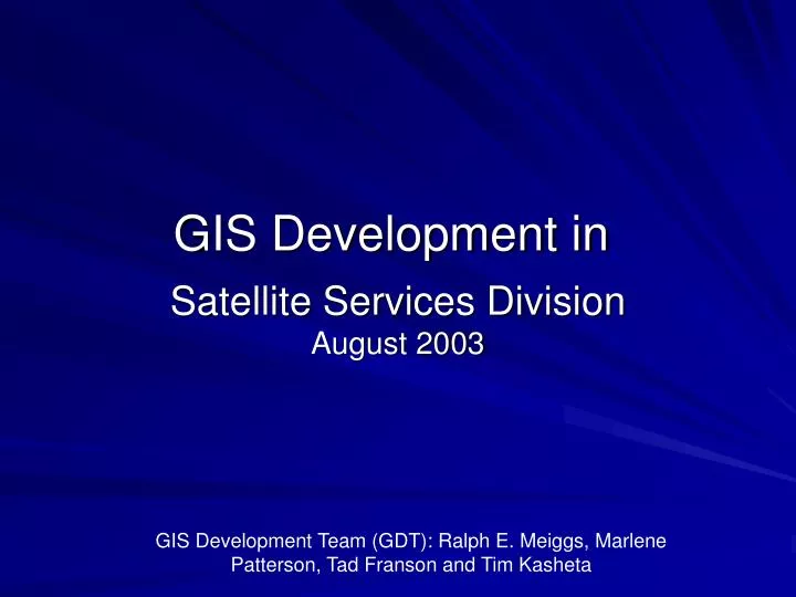
Satellite Services Division August 2003. GIS Development in. GIS Development Team (GDT): Ralph E. Meiggs, Marlene Patterson, Tad Franson and Tim Kasheta. Mission. Produce SSD suite of products in a GIS compatible format using commercial off-the-shelf software (COTS).

E N D
Satellite Services DivisionAugust 2003 GIS Development in GIS Development Team (GDT): Ralph E. Meiggs, Marlene Patterson, Tad Franson and Tim Kasheta
Mission • Produce SSD suite of products in a GIS compatible format using commercial off-the-shelf software (COTS). • Generate FGDC compliant metadata for all GIS data.
Objectives • Provide users with ability to layer and manipulate SSD products. • Provide products via interactive website and FTP. • Provide OSEI products as a more useful GeoTIFF. • Produce these products on-the-fly.
GOES SST any McIDAS Area file GOES East/West GMS METEOSAT AVHRR (LAC, GAC and HRPT) ASCII Text files GOES image derived winds NH Snow and Ice OSEI – RGB images MODIS Family of Services surface data Global Vegetative Index (GVI) Historical data (ORA collaboration) Volcanic Ash Plume Current Datasetsas of 8/11/03
Future Datasets • NCEP Model Data • Upper Air heights and thicknesses
Currently • Developing Interactive Mapping Service • Various ArcIMS websites under development, including NOAA’s fire detection page, www.firedetect.noaa.gov • Obtained ENVI image processing software • To process RGB imagery • Procured 3D Analyst • To produce 3 dimensional datasets and contours • Procured Spatial Analyst • To produce animation of shapefiles and geotiffs
Geodatabase Development • ArcSDE has been installed with Oracle 9i • NGDC is providing expertise in use of a geodatabase. • In conjunction with development of the geodatabase, the “on demand metadata generator” is being developed to keep track of data in the SSD GIS environment
Advantages • Product flow can be automated with minimal effort. • Enormous potential for gaining users with ability to integrate various products in a GIS environment. • Relatively low cost with high yield. • “A Big Bang for the Buck!” – Susan Ladenheim • Meeting user requests for geolocated RGB (OSEI) images.
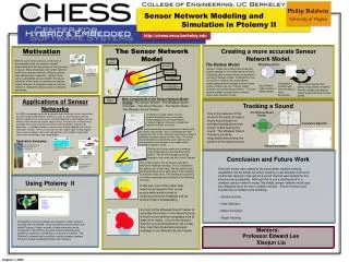
NOAA-16 HRPT RGB georeferenced GeoTIFF image produced with ENVI software, with Hazard Mapping System (HMS) wildfire detection, surface wind direction and speed over GOES West image. Replacement of IAXE software for OSEI image production which allowed in-house software to be replaced by COTS. Ability to overlay many SSD products in a GeoTIFF format. Also compatible with any GIS platform
GIS Production ConfigurationSSDGIS1 and SSDGIS2 backup system
GOES (IR) East/West, HRPT (IR), GOES SST, MODIS (Ocean Color)
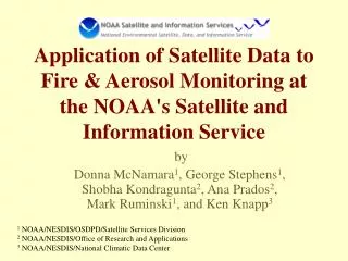
Color image produced for OSEI using Envi and ArcGIS software demonstrating overlay capabilities. Imagery is geolocated allowing the user to integrate this image with other GIS compatible products. Provides for virtually endless user defined value added products. This type of product will enable a more diverse user base to use SSD produced products.
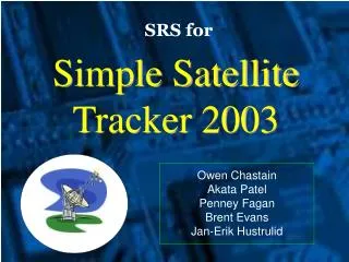
RGB image overlaid with ESRI map, Latitude – Longitude lines, DEM and cities.