Download
1 / 55
550 likes | 686 Vues
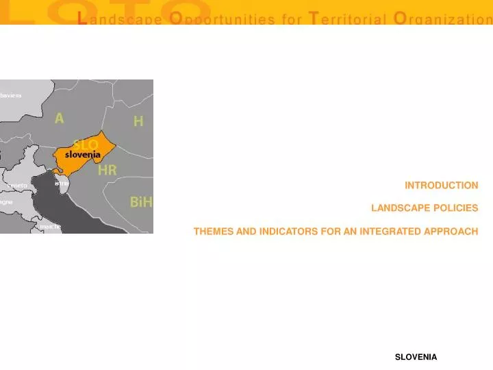
INTRODUCTION. LANDSCAPE POLICIES. THEMES AND INDICATORS FOR AN INTEGRATED APPROACH. Slovenia is a small country (20.256 km2), situated at the Adriatic see, with the Alps in the north and with Panonnian and Carst areas. Its capital is Ljubljana with approximately 300.000 inhabitants.

E N D
INTRODUCTION LANDSCAPE POLICIES THEMES AND INDICATORS FOR AN INTEGRATED APPROACH
Slovenia is a small country (20.256 km2), situated at the Adriatic see, with the Alps in the north and with Panonnian and Carst areas. Its capital is Ljubljana with approximately 300.000 inhabitants. In Slovenia, we have a long tradition in spatial planning, The planning system from early sixties combined economic, social and spatial aspects in one, so called long-term and medium-term social plan. Within the context of the spatial development strategy, we stress the priorities of: achieving a balanced urban structure and urban network; the effective management of urban growth; the balancing of the housing market; and improving the land and real estate policy. In Slovene legislation the landscape is defined as part of the territory where the natural elements predominate and is (landscape) a result of action and interaction of natural and human factors. The procedures of landscape planning which are integral parts of spatial planning deal with vulnerability studies and attractiveness studies which in their results provide the spatial planning procedures with planning decisions towards sustainable development. Due to extremely diverse geographical historic and cultural conditions, the landscapes of Slovenia are very diverse, too, and are of great importance as inevitable parts of national spatial identity. There are two spatial planning acts on national level: the Spatial Development Strategy of Slovenia (for the whole Slovenia) and the Spatial order of Slovenia (for the whole Slovenia). For certain infrastructure objects of national importance there also the detailed plan of National importance prepared at national level. On the local level there are three spatial planning documents: the Spatial Development Strategy of the Municipality, the Spatial Order of the Municipality and the Local detailed plan The new spatial law defines also the regional Conception of Spatial Development, a regional spatial plan). In Slovenia, the landscape issues are included in all parts of spatial planning, design and environmental impact assessments. The landscape is taken into consideration in the analytical phases and in the planning outputs of the plans (in the designs and in the guidelines for implementation activities). That is the reason why the landscape issue is integral part of the spatial planning no matter what the scope and importance of the planning issue are and not regarding the scale of layouts. The involving of the landscape usually means also involving of the environmental aspects into spatial planning procedures. Our spatial planning legislation also defines a special planning act - the Conception of the Landscape Development and Protection - for the nature protection areas, for the areas where spatial development with greater impacts on landscape, cultural heritage, nature or natural resources is expected due to the planned activities, for the areas with contradictory spatial development aims or for the derelict land. It is part of the Spatial planning strategy of the Municipality. Besides the including of landscape issues into the spatial planning acts, a great effort is made in improving the planning procedures with the main goal – to provide enough possibilities for the landscape and environmental issues and through this, to provide sustainable spatial development. The majority of landscape planning acts, studies and procedures are carried out by landscape architects. Since 1976, the landscape architecture study program with an interdisciplinary curriculum has been implemented in University of Ljubljana, Biotechnical Faculty, department of Landscape Architecture.
CARTOGRAPHY AERIAL PHOTOGRAPHS THEMATIC CARTOGRAFY HISTORICAL CARTOGRAPHY INVENTORIES THEMES AND INDICATORS FOR AN INTEGRATED APPROACH
THE RULES SYSTEM FOR THE LANDSCAPE MANAGEMENT SUBJECT AND ADMINISTRATIVE BODIES LANDSCAPE PLANNING AND DESIGN INSTRUMENTS AND RELATIVE PERFORMANCES LANDSCAPE POLICIES RELATIONSHIPS (IF ANY) WITH URBAN PLANNING INSTRUMENTS LANDSCAPE POLICIES RELATIONSHIPS (IF ANY) WITH THE PUBLIC WORK SECTOR RELATIONSHIPS WITH OTHER POLICIES LANDSCAPE PROJECTS ECONOMICAL/FINANCIAL RESOURCES AVAILABLE GENERAL COMMENTS ON LANDSCAPE POLICIES LANDSCAPE POLICIES
INDICE DELLE PRINCIPALI CARTOGRAFIE DISPONIBILI 1 : 1 000 000 IS USED FOR THE SPATIAL STRATEGY OF SLOVENIA 1 : 50 000 (OR SMALLER DEPENDING OF THE AREA) FOR THE REGIONAL CONCEPTION OF SPATIAL DEVELOPMENT 1 : 50 000 OR 1 : 25 000 IS USED FOR THE SPATIAL STRATEGY OF THE MUNICIPALITY 1 . 10 000 FOR THE CONCEPTION OF LANDSCAPE DEVELOPMENT AND PROTECTION AND THE CONCEPTION OF URBAN DEVELOPMENT 1 . 1000 FOR THE DETAILED PLAN BACK
THEMATIC CARTOGRAPHY VEGETATION MAP- POTENTIAL VEGETATION OF SLOVENIA ARCHAELOGICAL MAP ROAD MAP MAP OF TECHNOLOGICAL NETWORKS MAP OF RISKS FLOOD AREAS ACTIVITY MAP MAP OF NATURAL RESERVES MAP OF SEA RESERVES FLORA NAD FAUNA MAP PROTECTED AREAS MAP LANDSCAPE TYPOLOGY IN SLOVENIA LAND COVER – CORINE OUTSTANDING LANDSCAPE WATERS - HYDROGRAPHIC AREAS BASIC TOPOGRAPHIC MAP SAT 1:5.000 AND 1:10.000 TOPOGRAPHIC MAPS AT 1:25.000 AND 1:50.000 GENERAL MAPS MAPS OF ADMINISTRATIVE UNITS (REGISTER) LAND USE ARCHITECTURAL AREAS (ARCHITECTURAL IDENTITY IN SLOVENIA) URBAN AREAS AND CENTRES BACK
LAND USE • sources: Ministry for Agriculture, Forestry and Food • surface area of territory:Slovenia • availability of databanks: on request • availability in digital format:Shape • degree of accessibility (high, average, low) • www link: http://www.gov.si/mkgp/ BACK
OUTSTANDING LANDSCAPE • sources: Office for Spatial Development (Ministry of the Environment, Spatial Planning and Energy) • surface area of territory: Slovenia • availability of databanks: on request • availability in digital format: Shape • degree of accessibility (high, average, low) • www link: http://www.gov.si/upp/ BACK
LANDSCAPE TYPOLOGY IN SLOVENIA • Sources: Office for Spatial Development (Ministry of the Environment, Spatial Planning and Energy) • surface area of territory: Slovenia • availability of databanks: on request • availability in digital format: Shape • degree of accessibility: (high, average, low) • www link: http://www.gov.si/upp/ BACK
URBAN AREAS AND CENTRES • sources: Office for Spatial Development (Ministry of the Environment, Spatial Planning and Energy) • surface area of territory: Slovenia • availability of databanks: on request • availability in digital format: Shape • degree of accessibility (high, average, low) • www link: http://www.gov.si/upp/ BACK
ARCHITECTURAL AREAS (ARCHITECTURAL IDENTITY IN SLOVENIA) • sources: Office for Spatial Development (Ministry of the Environment, Spatial Planning and Energy) • surface area of territory: Slovenia • availability of databanks: on request • availability in digital format: Shape • degree of accessibility (high, average, low) • www link: http://www.gov.si/upp/ BACK
HISTORICAL CARTOGRAPHY CADASTRIAN MAPS HISTORICAL MAPS BACK
CADASTRIAN MAPS • sources: The Archives of the Republic of Slovenia • surface area of territory: Slovenia / • availability of databanks: on request • availability in digital format: Yes; jpg • degree of accessibility (high, average, low): High • www link: http://www.sigov.si/ars/ BACK
HISTORICAL MAPS • sources: The Archives of the Republic of Slovenia • surface area of territory: Slovenia / • availability of databanks: on request • availability in digital format: Yes; jpg • degree of accessibility (high, average, low): • www link: http://www.sigov.si/ars/ BACK
INVENTORIES CENSUS OF NATURE HERITAGE VALUABLE NATURAL FEATURES (REGISTER) ECOLOGICALLY IMPORTANT AREAS PROTECTED AREAS DATABASE CENSUS OF CULTURAL HERITAGE AREA OF COMPLEX PROTECTION OF CULTURAL HERITAGE CULTURAL MONUMENTS AT NATIONAL LEVEL CULTURAL MONUMENTS AT LOCAL LEVEL ARCHEOLOGIC CULTURAL HERITAGE BACK
VALUABLE NATURAL FEATURES (REGISTER) • sources: Environmental Agency (ARSO) • surface area of territory: Slovenia • availability of databanks: on request (Nature Information System) • availability in digital format: Shape format • degree of accessibility (high, average, low): • www link: http://www.arso.gov.si/ • http://nfp-si.eionet.eu.int/cds/ BACK
ECOLOGICALLY IMPORTANT AREAS • sources: Environmental Agency (ARSO) • surface area of territory: Slovenia • availability of databanks: on request (Nature Information System) • availability in digital format: Shape format • degree of accessibility (high, average, low): • www link: http://www.arso.gov.si/ • http://nfp-si.eionet.eu.int/cds BACK
PROTECTED AREAS DATABASE • sources: Environmental Agency (ARSO) • surface area of territory: Slovenia • availability of databanks: on request (Nature Information System) • availability in digital format: Shape format • degree of accessibility (high, average, low): • www link: http://www.arso.gov.si/ • http://nfp-si.eionet.eu.int/cds BACK
AREA OF COMPLEX PROTECTION OF CULTURAL HERITAGE • sources: Cultural Heritage Administration • surface area of territory: Slovenia • availability of databanks: on request • availability in digital format: Shape • degree of accessibility (high, average, low): • www link: http://www.gov.si/ukd/ BACK
CULTURAL MONUMENTS AT NATIONAL LEVEL • sources: Cultural Heritage Administration BACK
CULTURAL MONUMENTS AT LOCAL LEVEL • surface area of territory: Slovenia • (local communities for protection of cultural monuments at local level) • availability of databanks: On request • availability in digital format: Shape • degree of accessibility (high, average, low) • www link: http://www.gov.si/ukd/ BACK
ARCHEOLOGIC CULTURAL HERITAGE • sources: Cultural Heritage Administration • surface area of territory: Slovenia • availability of databanks: on request • availability in digital format: Shape • degree of accessibility (high, average, low): • www link: http://www.gov.si/ukd/ BACK
THE RULES SYSTEM FOR THE LANDSCAPE MANAGEMENT LAWS REGULATING THE LANDSCAPE AT A STATE/REGIONAL LEVEL THE SPATIAL PLANNING ACT LAWS THAT HAVE SIGNIFICAT EFFECTS ON THE LANDSCAPE BACK
THE SPATIAL PLANNING ACT • name: The Spatial Planning Act • date of approval: December 31 2002 • territory of pertinence: The territory of Slovenia • type of law (rules, guidelines…): rules • principal characteristics: • The law determines: • - the basic spatial planning goals, • - the system of spatial planning, • - the spatial planning instruments, • - the strategic and detailed spatial planning documents, • - the responsibilities of the state and local authorities, • - the general contents of spatial planning documents at national and local level, • - the public participation, • - the conditions of being a responsible spatial planner. • In Slovenia there is a regional level for spatial planning in between state and municipalities. • The spatial planning documents are prepared on state and on local level and for certain planning issues also on regional level. They are hierarchically arranged. The spatial planning documents of lower level must not be in contradiction with hierarchically higher spatial planning documents. The Spatial Planning Act defines the approval procedure. Other sector programmes or strategies must not be in contradiction with the Spatial Development Strategy of Slovenia and the Spatial order of Slovenia. • The spatial planning acts on national level: • - the Spatial Development Strategy of Slovenia • - the detailed plan of National importance (for certain structures, for example roads, hydro power plants, etc) • The spatial planning documents on the local level: • - the Spatial Development Strategy of the municipality for the whole territory of the municipality with the Conception of Urban Development for towns and other settlements and the Conception of Landscape Development and Protection for protected areas or for the areas with big spatial impacts • - the Spatial Order of the Municipality • - Local detailed plan • The common spatial planning documents • - the regional Conception of Spatial Development (A Regional Spatial Plan) • (in Slovenia we do not have regions as regional governments, but the spatial planning documents can be prepared for more then one municipality and with the state cooperation if the aim is to solve the certain important spatial problem on the broader territory) • expected effect: • - The Parliament has to adopt the Spatial Development Strategy of Slovenia at least by the end of 2004 • - the government has to adopt the Spatial Order of Slovenia at least by the end of 2005 • The local communities have to prepare: • - their spatial planning documents no later then tree years after adoption of the Spatial Development Strategy of Slovenia 1/2 >> BACK
2/2 << • The concept of the landscape in the Spatial planning Act: • The Spatial Planning Act defines landscape as part of the territory where the natural elements predominate and is (landscape) a result of action and interaction of natural and human factors. • Each Spatial planning document deals with the landscape as part of the green belts of the towns or its urban green structures, as agricultural and forest land, as area for tourism … where structure, elements, features or meanings of the landscape matters as much as technological or economical aspects of certain sector development plan . The Spatial Planning Act more specifically addresses to the landscape with an instrument, called the Conception of the landscape development and Protection. It is part of the Spatial planning strategy of the Municipality and it can be prepared for different types of the areas: for the nature protection areas, for the areas where spatial development with greater impacts on landscape, cultural heritage, nature or natural resources is expected due to the planned activities, for the areas with contradictory spatial development aims or for the derelict land. The Conception of the landscape development and Protection is not an instrument for nature conservation but an instrument of optimal spatial development in the case of different spatial planning issues. • The system of preparing a spatial planning document: • The Spatial Planning Act defines that the body, responsible for the preparation of the spatial plan (at the national level this is the Ministry, responsible for spatial planning, at the local level this is a single local community - municipality) has to gather guidelines from different organisations and among them also from the nature conservation authority as described below. • The preparation of the spatial plan has several phases. In the initial phase, the first spatial conference that can be defined as scoping, has to be organised. Then Terms of reference (so called: preparation programme) is prepared and approved. Then the ministries, states bodies, different public bodies or enterprises (nature and separately culture heritage, conservation offices, public roads offices, water management authority, foresters and authorities responsible for game management, agricultural offices and many others) are asked to prepare their guidelines for the specific spatial development document. Their guidelines have to derive from their sector acts and have to be applied to the current planning issue. Besides they can prepare specific studies if this is important for the spatial planning issue. The preparation of the studies is also defined in the Terms of reference (= preparation programme). The body, responsible for the preparation of the spatial development document hire the professional institution to prepare basic studies and draft spatial development document. The draft spatial development document together with the variants and studies is presented to the public in the local community (the public means inhabitants, non – governmental organisations and organisations that had prepared guidelines). Their comments and suggestions are collected and answers are prepared with clear distinctions and explanations about which suggestions will be taken into account in further planning and which will be refused. After the corrections of the spatial plan according to the suggestions from the public hearing, it has to be submitted to participants to acquire their opinion. After that the plan is submitted to the minister, responsible for spatial planning if it is the plan of local community and to the government and parliament if it is the state spatial plan. • Similar procedure is used also for detailed plans. In some cases (roads, electric power lines and similar) the variants have to be prepared as a pre-phase of the detailed plan. They have to be assessed for five criteria (economics, social acceptance, urban and regional development, impacts to the environment and technical aspects), amongst which the influence on the nature elements and cultural heritage also have to be described. On the bases of comparing of the pro and cons the best option is chosen for which the detailed plan is prepared as described above (draft, public hearing). In the case of detailed plans for the objects categorised as the objects with the environmental impact, the environmental assessment starts already in the phase of the preparation of the plan. Its draft report is presented to the public together with the draft detailed spatial plan but is finished in the phase when the project is prepared. The project is prepared after the adoption of the detailed spatial plan. • In last 10 years, the Environment impact Assessment has been prepared for the detailed plans and it has been proved successful as a very useful instrument to include the environmental aspects into the spatial planning. • Comments • Week and strong points • Week points: • - the Conception of the Landscape Development and Protection is obligatory only for the areas of nature conservation interest, for other types is recommendatory; • - the quality of the implementation on the municipality level is low, especially in the small municipalities that have the same duties regarding the spatial planning and management as bigger municipalities • - the role of sectors that are taking part of the planning procedures (with their guidelines and opinions) in not always effective. In some cases they simply do not react, in other cases they persist on their own requirements and are not willing to contribute to the consensus (agreement) • Strong points: • -the landscape issue is integral part of the spatial planning no matter what is the (scope and importance of the) planning issue and the scale of layouts • - the involving of the landscape usually means also involving of the environmental aspects into spatial planning BACK
There are other laws beside the Spatial planning Act that define landscape. The Nature conservation act defines: The landscape is certain territory of the nature where landscape structure is defined by the living or non-living nature characteristics and human influence The landscape diversity is defined by spatially structured natural or anthropologic landscape elements The landscape diversity and the characteristics of the landscape that are important for the bio-diversity are conserved The territorial development has to be planned and proceeded as to conserve the essential characteristics of the landscape and bio-divesity. The government defines what are the landscape characteristics that are important for bio-diversity. Among natural values there is also defined landscape. The concept of natural values is similar to natural heritage concept. As the natural value object can be classified geological features, minerals, fossils, surface or under surface karstic features, caves, gorges, glaciers, rapids, streams, waterfalls, marshes, springs, rivers with river banks, sea with sea coast, plant and animal specie, ecosystems, landscapes and designed nature (=gardens). The landscape that become a natural value can be classified as having state or local importance. The regional park is larger area of characteristic ecosystems and landscape with higher proportion of the wild nature and areas of natural values that are interchanging with the areas with higher, yet balanced human influence. The part of nature can be protected by governmental (natural reserve, natural monument, regional park, landscape park) or parliament act (national park) In the protection act the type, characteristics, protection regimes, guidelines for the spatial development of the protected territory and sometimes area of potential influence (something like buffer zone) is defined. Some areas, especially parks have the management authority, financed by the state. The nature conservation authority submit the guidelines for the nature conservation contents at the beginning of the preparation of the spatial planning documents (see above). The cultural heritage Act defines: The Act operates with cultural landscape. By definition it is a monument area where the structure, development and function is defined predominately by human activities. The cultural heritage Act firstly defines what are the elements of the cultural heritage and among them it define also the cultural landscape. The cultural heritage can be classified as cultural monument of state or local importance. The cultural monuments are usually protected by the act on state (governmental decree) or local level. The Culture heritage defines that for the assessment of the impacts on the culture heritage, including cultural landscape in the process of preparation the spatial development documents the prepared guidelines for culture heritage conservation has to be used. The Agricultural Act It does not defines landscape separately but it refers to it as important topic and one of the main objective by saying: for the purpose of the economic, spatial, ecological in social role of the agriculture and its nature friendly development the objectives of the agricultural policy in the Republic of Slovenia among others are: preserving the vital countryside and landscape the agricultural measures are among others orientating toward environmental friendly agriculture activity, preserving the vital countryside and landscape…. The agricultural act defines less favourable areas for agricultural production and as the third category there are areas with special natural problems, where the support of the agricultural activity is needed for the landscape conservation In the category of the environmental friendly agricultural activity the subsidies can be given if it will help to conserve or improve the landscape. In praxis there are subsidies for the landscape care in the protected areas. They also help to retain agricultural production in less favourable areas for the agricultural production, mostly in mountain areas, where the forest overgrowth is a threat to the cultural landscape. The agricultural plans are old and not up to date, they do not operate with the real problems of the countryside, so they are not much of help in the process of the spatial planning. Their main input are the areas of the first category of the agricultural areas, defined in the early eighties in the time where the construction pressure was high. At that time the agricultural land of best quality was protected by the law and acted as major urbanistic criteria for settlement development. The concept of the protection of the best agricultural land is not bad, but the problem was, that it should not become the absolute criteria. The Spatial development Act underpin the importance of good professional studies for decision making process. BACK
SUBJECT AND ADMINISTRATIVE BODIES THE PARLIAMENT THE GOVERNMENT THE MINISTRY OF ENVIRONMENT, SPATIAL PLANNING AND ENERGY THE REGION THE PROVINCE THE MUNICIPALITY BACK
THE PARLIAMENT • adopts the laws in the field of the landscape planning and management • adopts the Spatial strategy of Slovenia BACK
THE GOVERNMENT adopts the Spatial order of Slovenia adopts the Report on realisation of the Spatial Strategy of the Slovenia approve the proposed variant to prepare the state detailed plan for (it can be for any spatial arrangements that is classified as national important - the national road, electric power plant….) landscape planning instruments approval (after complain at the first level) BACK
THE MINISTRY OF ENVIRONMENT, SPATIAL PLANNING AND ENERGY prepares the draft law in the field of the landscape planning and management and spatial planning and management documents on state level coordinate the preparation of the detailed state plans (other ministries, institutions, spatial planners) coordinate the preparation of the Regional spatial conception approve (minister) the Spatial Strategy of the municipality prepares guidelines for spatial development of prepares statements of collisions of the sector programs or plans with Spatial Strategy of Sloveni give the building permissions for the objects that categorised as objects of state importance The inspectorate - control illegal construction The regionally distributed authorities – building permission BACK
THE REGION we do not have institutions that cover spatial planning at regional level, but the municipalities and state (ministry) can agree and prepare Regional Conception of Spatial Development:. The municipality can also work together especially when the landscape (planning) issues have to solved not only in one municipality. BACK
THE PROVINCE we do not have institutions that cover spatial planning at regional level; but the municipalities and state (ministry) can agree and prepare Regional Conception of Spatial Development . BACK
THE MUNICIPALITY Prepares and adopts the Spatial Strategy of the Municipality after approval of the ministry prepares and adopts the Spatial Order of the Municipality prepares local detailed plan for specific project (sewage plants, roads, apartment buildings…) BACK
LANDSCAPE PLANNING AND DESIGN INSTRUMENTS AND RELATIVE PERFORMANCES SPATIAL DEVELOPMENT STRATEGY SPATIAL RESTRICTION FOR DEVELOPMENT LANDSCAPE IDENTITY FROM THE CULTURAL AND SYMBOLIC ASPECT, AND LANDSCAPE NATURALE QUALITIES DRINKING WATER SUPPLY POTENTIALS USE OF NATURAL RESOURCES CONCEPTION OF THE LANDSCAPE DEVELOPMENT AND PROTECTION LIPICA CASE BACK
SPATIAL RESTRICTION FOR DEVELOPMENT • sources: • surface area of territory: • availability of databanks: • availability in digital format: • degree of accessibility • www link: BACK
LANDSCAPE IDENTITY FROM THE CULTURAL AND SYMBOLIC ASPECT, AND LANDSCAPE NATURALE QUALITIES • sources: • surface area of territory: • availability of databanks: • availability in digital format: • degree of accessibility • www link: BACK
DRINKING WATER SUPPLY POTENTIALS • sources: • surface area of territory: • availability of databanks: • availability in digital format: • degree of accessibility • www link: BACK
USE OF NATURAL RESOURCES • sources: • surface area of territory: • availability of databanks: • availability in digital format: • degree of accessibility • www link: BACK
LIPICA CASE BACK
LANDSCAPE POLICIES RELATIONSHIPS (IF ANY) WITH URBAN PLANNING INSTRUMENTS THE CONCEPTION OF THE URBAN DEVELOPMENT WHICH IS ALSO PART OF THE SPATIAL STRATEGY OF THE MUNICIPALITY AND IT HAS TO BE ADOPTED TOGETHER WITH IT, DOES NOT SPATIALLY INTERFERE WITH THE CONCEPTION OF THE LANDSCAPE DEVELOPMENT. THE CONCEPTION OF THE URBAN DEVELOPMENT IS PREPARED FOR THE TOWNS AND THE DEVELOPING SETTLEMENTS AND HAS TO COVER ALSO THE LANDSCAPE ISSUES THAT OCCUR (GREEN BELTS, CONSEPT OF THE APRKS OR OTHER GREEN AREAS IN THE TOWN, NATURAL ELEMENTS IN THE TOWN AND SIMILAR). BACK
LANDSCAPE POLICIES RELATIONSHIPS (IF ANY) WITH THE PUBLIC WORK SECTOR FOR THE ROAD DETAILED PLAN HAS TO BE PREPARED. USUALLY THE VARIANTS ARE STUDIED BEFORE STARTING TO PREPARE A DETAILED PLAN. IN THIS PHASE THE LANDSCAPE IS STUDIED AS HOW TO INTEGRATE THE ROAD IN THE LANDSCAPE IN THE BEST WAY. THE VARIOUS CHARACTERISTICS (NATURAL SETTING, CULTURAL ASSET AND VISUAL CATEGORY - SEE MORE ABOVE) OF THE LANDSCAPE AND ITS SPATIAL POTENTIAL FOR OTHER DEVELOPMENT PROGRAMS ARE STUDIED. INCLUDED AS IMPORTANT ELEMENT AS NAČRT CESTE SE DELA Z LOKACIJSKIM NAČRTOM KOT JE OPISANO ZGORAJ, KRAJINA JE NAČRTOVALSKA KATEGORIJA KJER SE GLEDA ČIM BOLJOTIMALNO UMESTITEV, FUNKCIONALNOST IN SE VSE TO PRESOJA BACK
RELATIONSHIPS WITH OTHER POLICIES RELATIONS WITH ENVIRONMENTAL POLICIES (PARKS, ECOLOGY, FORESTRY DEPARTMENTS) RELATIONS WITH CULTURAL POLICIES RELATIONS WITH TOURIST POLICIES RELATIONS WITH RURAL POLICIES RELATIONS WITH OTHER POLICIES BACK
ALL OF THE OTHER POLICIES ARE INTEGRATED IN THE PREPARATION OF THE SPATIAL PLANNING DOCUMENTS FROM THE VERY BEGINNING (SEE MORE ABOVE – A) BACK