Download

1 / 15
150 likes | 277 Vues
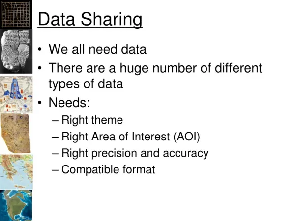
Mechanisms for pooling and sharing data (or How to get IPCC an GEOSS working together on this?) Jose A. Marengo INPE, Brazil TGICA Co-Chair with the help of Bob Chen and Richard Moss. Objective of the workshop: IPCC and GEOSS interaction

E N D
Mechanisms for pooling and sharing data (or How to get IPCC an GEOSS working together on this?) Jose A. Marengo INPE, Brazil TGICA Co-Chair with the help of Bob Chen and Richard Moss
Objective of the workshop: IPCC and GEOSS interaction To provide guidance on how the Global Earth Observation System of Systems (GEOSS) can improve the delivery of multi-disciplinary data and data products to the climate impacts, adaptation and vulnerability (IAV) research community, whose work is assessed by the Intergovernmental Panel on Climate Change (IPCC ) In part because it is so multi-disciplinary, the climate impacts, adaptation and vulnerability (IAV) community experiences gaps in the availability of observations data and information. It could use additional support in accessing Earth observation data and information. This workshop will therefore explore the potential of the Global Earth Observation System of Systems (GEOSS) to improve and accelerate access by this research community to a broad range of relevant information, relevant for the IPCC AR5 process.
TGICA and DDC: TheTaskGroupon Data andScenarioSupport for ImpactandClimateAnalysis (TGICA) from IPCC facilitatesdistributionand application ofclimatechangerelated data andscenarios The TGICA oversees a IPCC Data Distribution Centre (DDC)whichprovides data sets, scenariosofclimatechangeandotherenvironmentalandsocio-economicconditions, andothermaterials (e.g., technicalguidelinesonthe use ofscenarios). The TGICA contributes to buildingcapacity in the use of data andscenarios for climate-relatedresearch in developingandtransition-economyregionsand countries. The TGICA alsoconvenesexpert meetings onan as neededbasis. TGICA and DDC have limited resources and that we are interested in partnering with organizations that might be able to extend our resources.
http://www.ipcc-data.org/ - Climate observations, as global mean time series and gridded fields, Climate model projections and simulations: Monthly means and climatologies (decadal and 30-year means), -Socio-economic data, -Environmental data and Scenarios, -Guidelines and other supporting material. The identification, selection, and application of baseline and scenario data are crucial steps in the assessments of the potential impacts of future climate change. The need to provide a consistent collection of data covering a great diversity of different scenario elements can pose substantial challenges to researchers. The IPCC DDC seeks to provide access to such a collection of data and scenarios and to offer guidance on their application.
http://www.ipcc-data.org/ • Who runs the DDC? • The DDC is a shared operation : • The British Atmospheric Data Centre (BADC) in the United Kingdom; the World Data Center Climate at the Max-Planck-Institute for Meteorology (WDCC / MPI-M) in Hamburg, Germany for climatic data; • The Socioeconomic Data and Applications Center (SEDAC) operated by the Center for International Earth Science Information Network (CIESIN) at Columbia University, New York, USA. for socio economic data • Each of these institutions has voluntarily taken on responsibility for managing access to a subset of the data and information provided by the DDC. • The DDC is advised and guided by the IPCC -TGICA, co-chaired by Dr. Richard Moss and Dr. Jose Marengo. Both the DDC and the TGICA are supported by the IPCC Technical Support Units of Working Group I, Working Group II, and Working Group III, through whom they are accountable to the IPCC.
Given the • Needs of AR5, IAV research, and key users • Within TGICA capacity (DDC and TGICA members) • A realistic planning horizon (??) • TGICA will be focusing in the near term on responding to a few specific tasks that have been put on its agenda at the WG 2 LA meeting; and that in the longer term, we are interested in a broader set of issues to improve and support use of observations and scenarios in research on responses to climate change. • Mandate • Agreed areas of work (anthropogenic influences, climate observations, climate projections, other factors relevant to IAV) • Activities (DDC, guidelines, capacity building, expert meetings)
How can the TGICA IPCC fill in the gaps to address the following questions, and where GEOSS data can be very helpful? • What data sets/approaches are available for use? How can these be applied? • What additional data are needed for AR5? • Are there any large regional gaps? • How to select a new set of representative factors to associate with RCPs-(Representative Concentration Pathwaysnew IPCC AR5 emission scenarios) ? • How to support the use of new data in the development of new scenarios and model validation? • How to integrate all the different data streams much more effectively? • How do the scientific community, stake holders and the IAV community take advantage of the IPCC GEOSS interaction?
Moss et al (2010) Scenarios are generated and used by three broad types of models and analytic frameworks in climate change research: integrated assessment models, climate models, and models and other approaches used to help assess IAV models, data for validation and attribution studies
Amazon level measured at Manaus (Brazil) by tide gauges (green curve) and by Topex/Poseidon and Jason-2 in red dots Flood in Amazonia 2009 (IRD, CPRM-Manaus, UFRJ) Drought 2005 Flood 2009 In July 2009, the levels of the Rio Negro at Manaus harbor reached e new record level of 29.75 m for the 107 years of stage data available (Marengo et al 2011)
Current situation: For the GEO community, a key question is how can data from GEOSS be made more useful for the IPCC assessment process (and in any climate/global change study), both in the short and long term. From the IPCC, side is data quality and documentation, continuity and consistency of measurements. From the TGICA IPCC DDC viewpoint, a key question would be how satellite and other spatial data from GEOSS can help support monitoring of impacts and adaptation, e.g., changes in land use, sea level, settlement patterns, ecosystem health. How could such monitoring better support IAV assessments both at the global and regional levels (needed both for IPCC work or for global change studies and international negotiations).
Current situation: GEOSS is envisioned as the data system of systems designed to facilitate access to data from all of the space agencies around the world and lots of other environmental and related observing networks and resources. It could also provide value-added services for data, including improving continuity of parameters (across missions), a forum for prioritizing new instruments and measurements, a platform for linking national spatial data infrastructures, etc. GEOSS aims to support not just science but a range of societal benefit areas and decision making--which is partly why it is interested in talking with the IPCC community IAV and IPCC AR5 process. GEOSS data and IPCC requirements on data availability, continuity and quality
The GEO principles call for full and open access Quantities and varieties of data much larger than anything in the IPCC. Many organizations, including scientific institutions and individual scientists, do not come close to supporting full and open access, so GEOSS does represent significant progress For example, one of the major points in the implementation guidelines is the right to redistribute data, so that end users aren't forced to go back to the original source for data and recreate value-added analysis that others may have already performed. GEOSS data for IVA climate/global change related aspects and for IPCC AR5
The main point here is to articulate how wider, longer-term access to remote sensing and other data coming out of present and future missions could be harnessed in a more systematic way to support IPCC and national/regional scale decision making, e.g., in relationship to international agreements (e.g., protecting forests) and conventions (climate change, desertification and biodiversity), monitoring impacts, quantifying damages, and coordinating adaptation and response activities across countries and regions. GEOSS could provide a framework for rapid and transparent intercomparison of measurements coming from different platforms, for flexible integration of different data types to support analysis and prediction, for monitoring and detection of environmental changes and related impacts, for improving attribution efforts, and for strengthening local capacity to use data in mitigation, adaptation, and early warning.
There isn't an IPCC-wide policy on data accessibility, documentation, etc. other than data in the DDC, which is only a small portion of all of the data utilized in the IPCC assessment reports. Flexible access to GEOSS data is certainly a key ingredient needed for any of this to become a reality. Full and open access (any restriction?) vs free access Publications (scientific journals and non standard publication ) referred in the IPCC process
Conclusions This workshop could also help initiate greater efforts to get the broader IPCC community to share their data in an effective manner, taking advantage of GEOSS This could help increase the transparency of the IPCC process. It might also spur efforts to get people who publish peer-reviewed papers referred to in IPCC reports to also make their underlying data more available. Need to define the activities of the GEOSS and IPCC communities that might overlap in terms of data sharing and access. If some remote sensing data is being used both in IPCC-related research and in societal applications. Are there synergies in linking the users, systems, etc.?