Download
1 / 52
520 likes | 755 Vues
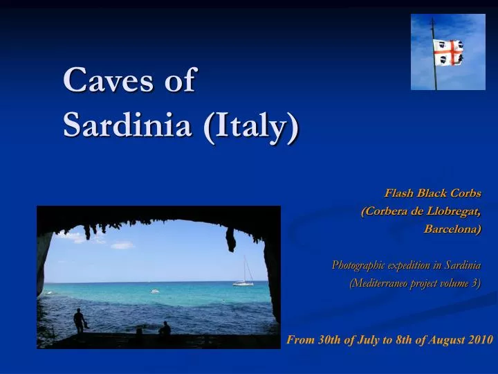
Caves of Sardinia (Italy). Flash Black Corbs (Corbera de Llobregat, Barcelona) Photographic expedition in Sardinia (Mediterraneo project volume 3). From 30th of July to 8th of August 2010. 2 – Flash Black Corbs.

E N D
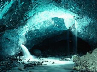
Caves ofSardinia (Italy) Flash Black Corbs (Corbera de Llobregat, Barcelona) Photographic expedition in Sardinia (Mediterraneo project volume 3) From 30th of July to 8th of August 2010
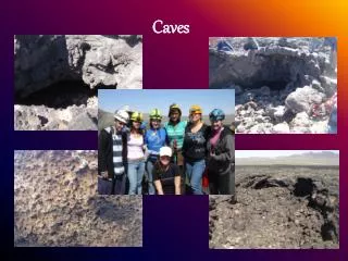
2 – Flash Black Corbs The Flash Black Corbs team is mainly composed of Catalan cavers of Barcelona, but also foreign people : Andalusian, French… Pedro Balti Bigot Jose Tania Alber Rober Maite Laura Montse Cisco Victor
3 – Porto Torres Industrial complex of Porto Torres Arrived in Porto Torres the 31th of July 2010, straight ahead to Capo Caccia to contact the people responsible of the Neptune Cave. The Porte Conte Bay is… more natural…
4 – The karstic Sardinia Distribution map of main Sardinian caves (by Jo De Waele, Acts of Kalamos, Greece, 2005). Areas visited
5 – Access to Neptune Cave Behind the cliff, Foradada Island (we can notice the Catalan word : forat = hole). The Neptune Cave stairs are cut in the cliffs of Capo Caccia.
6 – The Sassari region In the Sassari region, the Miocene deposits occur the same facies of these Bonifacio limestones in Corsica Island and form one of karst areas of the Sardinia.
7 – The nuragic towers The nuragic towers (Neolithic) dominate the hills for miles around. Altopiano di Campeda. Nuraghe di Santa Sabina.
8 – The cork oaks The cork oaks are exploited for their bark. They grow rather on the siliceous soils (granite) and basaltic soils.
9 – Supramonte Dorgali town is dominated by the Bardia mountain (882 m). Supramonte di Oliena. Karst relieves of Cala Gonone.
10 – Cala Gonone Our Sardinian contact agent is Gianfranco Fancello (on the left on the photograph), he lives in Dorgali and speaks the Spanish language. Finally, we can put ours stuffs at Cala Gonone, a small town located in Orosei Gulf. This village is dominated by little basaltic mesa covering the Jurassic limestones.
11 – Neptune Cave The 1st of August, we come back to the Neptune Cave for shooting, but we only can do authorization for touristy part.
12 – Neptune Cave The water of cave is salty, the level of lake correspond to the one of the sea.
13 – Su Bentu Cave The 2nd of August 2010, we visit Su Bentu Cave. The entrance of cave breathe out a hard airstreams.
14 – Su Bentu A great canyon of 20 to 30 m high (tube gallery cut by a canyon) where we progress above the gap along the rope and iron cables may to reach a large chamber and after the lakes area.
15 – Su Bentu This « giant pot » is not a mixing of baker, but a pool. The speleothems have been made by the stream during the river floodings.
16 – Su Gologone We can visit the karstic resurgence of Su Gologone. It isn’t the resurgence of Su Bentu Cave. The spring of Bue Marino is a very large basin more extended and it collects the waters of Su Bentu Cave.
17 – Bue Marino Cave The 3rd of August 2010, everybody boards in Cala Gonone Port into a ship of Zodiac type. The boat straight ahead to Bue Marino Cave.
18 – Seals ? The name Bue Marino significant seals that have been living in the cave entrance until seventies.
19 – A very popular cave The comings and goings of ships carrying the tourists is incessant. The Neolithic engraving have been discovered in one of the North Branch Entrances of Bue Marino Cave.
20 – The karstic collector The Bue Marino Cave is a part of gallery collecting Supramonte waters toward the sea. It’s a well-known network with the Su Palu and Su Spiria Caves. These caves are active sinkholes located in the bottom of Luna Canyon.
21 – Marine contamination The walls of Bue Marino Cave are covered by lithophage holes showing the variations levels of the sea. The oysters are stickled on the walls in the remote parts of the cave indicate that the sea waters kept in the fresh waters inside (« salty bevel »).
22 – Submarine canyons In the Orosei Gulf, The submarine canyons of Cedrino and Luna are visible on the bathymetric maps. These submarine canyons prove a real falling level of sea, probably in the Messinian period (fine Miocene).
23 – Lakes The advance after the end of touristy part has to swimming in the large and deep lakes. The water is quite cold, because this fresh water come from Supramonte. The Bue Marino Cave is a old spring working only during a floodings.
24 – Bue Marino The size of gallery is astonishing.
25 – Bue Marino Lakes and inundated galleries.
27 – San Giovanni Cave The 4th of August, we decide to visit San Giovanni Cave. It’s a hydrogeologic breakthrough to the Cambrian limestones. This bore was used by car, but, for safety reasons, today it’s open for only pedestrian people, cyclists and riders.
28 – A useful cave The natural tunnel of rio di San Giovanni through out the mountains has have been used in road by local people.
29 – The San Giovanni Tunnel The torrent running on the left of the road in the narrow river bed for 850 m. The complete development of the cave reaches 4500 m
30 – San Giovanni Discoid hammer with central drill found in the river bed. In the upriver part, the cave is located in the bottom of blind valley. This part was probably used by prehistoric people. A hammer of stone has been found in the deposits of the subterranean river.
31 – San Giovanni The bats are concentrated in a chamber of cave and also infested by very big ticks.
32 – Little caves of the coast The 5th of August is a day permitting to appreciate Cala Gonone region. In the little caves of the coast, during the hot weather, tree frogs are hidden, it’s Hyla sarda : a tree frog typically Sardinian… And Corsican of course.
33 – Cala Fuili Cave Cala Fuili is a beach located in the little canyon open on to the sea. Tourists appreciate it, but they ignore that it exists a little cave close to them. This cave is likely in relation with these of Bue Marino Cave.
34 – Canyon Fuili Cala Fuili beach and canyon. The Cala Fuili Cave is located on the right side of the canyon. Most of springs are located near the confluence with the sea or on the great faults. Cave
35 – Cala Fuili Cave The water drain away between the two disks of calcite. Inside, the speleothems are like to folia type. folia The cave is short but there are a few stalagmitic columns cut by disk speleothems.
36 – Tomba dei giganti The giant tomb of Sa Ena’e Thomes near Dorgali is a megalithic monument dated from nuragic period, typical of Sardinian Neolithic.
37 – Surroundings of Orosei Fire surroundings of Orosei, but the Palude di Osalla escaped the flames.
38 – All for Su Spiria In this season, the Codula di Luna canyon is completely dry. The 6th of August, our Sardinian guides are : Laura, Valerio, Roberto and Elisabeth. Our guides lead us to the bottom of Luna canyon (Codula di Luna) to the entrance of Su Spiria Cave, but wintry floodings blocked this entrance… We need a new idea to go caving…
39 – Serra Pirisi Limestones The contact granite / limestones is the reason of formation of many caves where the water can seep. This contact is marked by large depressions (polje) which the bottom is sandy (granite arena and Jurassic sandy clay). Granite
40 – Lovettecannas The Lovettecannas Cave is the most important caves of the depression of Su Canale (Serra Pirisi) visible in background. The cave, first labyrinth, end in a succession of large chambers filled of blocs.
41 – Drinking water ? Organic matter In caves, the water is not ever drinking water. In effect, the Lovettecannas Cave drains the depressions where many animals (cows, goats and pigs) live. The stygobies living in the water are not good indicators. It’s the case for the genus Asellus, this animal is fed by organic matters contained in the water…
42 – A special contact cave The Lovettecannas Cave develops in the contact granite / limestones. The development of gap (corrosion & digging) in the basement contact is the reason of collapses and the formation of large chambers. Jurassic limestones Granite
43 – Seracs chamber Lovettecannas Cave
44 – Ispinigoli Cave Entrance of the touristy cave, the 7th of August. The Ispinigoli Cave is a touristy cave located near the Orosei Gulf. We can visit the vertical part with high speleothems. The cave continue through a pit of 60 meters high and permitted a access to the subterranean river.
45 – Ispinigoli Cave A edge rock leads to the Helictites Gallery.
46 – Helictites Gallery One of the fossil galleries of the subterranean river is covered by amazing speleothems called helictites. It’s the star attraction of this cave. These speleothems develop particularly in no ventilated galleries preserved of floodings. The Helictites Gallery is a cul-de-sac where the local temperature and hygrometry promote the growth of particular type of speleothems.
48 –Ispinigoli : schematic system This profil shows the position of the pits of Ispinigoli Cave compared with subterranean rivers of San Giovanni Su Anzu Cave. First, the unusual position of Ispinigoli Cave shows clearly that it’s not a old sinkhole, but an old spring.
49 – Ispinigoli : the « confluenza » The « Confluenza » San Giovanni Su Anzu Cave On the map, Ispinigoli Cave connects exactly to the confluence of two subterranean rivers. North side of Monte S’Ospile This particular position is not a curious coincidence and show that linking drain is appeared between the confluence (alt.: 190m), where are concentrated the rates of flow, and the base level located upper about 300 m.
50 – Ispinigoli : speleogenesis Phase 1 : the network appear at the sea level (about 200 m). Phase 2 : when the sea level raise, the karst network respond by a linking conduit of 100 m high. The waters emerge at the sea level located about 300 m. Phase 3 : the base level falling cause to empting (excepted in Helictites Gallery) and a new utilization of old galleries.