Download
1 / 17
200 likes | 450 Vues
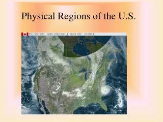
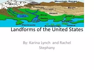
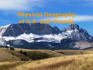
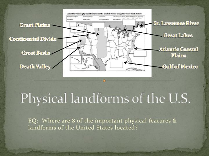
St. Lawrence River. Great Plains. Great Lakes. Physical landforms of the U.S. Continental Divide. Atlantic Coastal Plains. Great Basin. Death Valley. Gulf of Mexico. EQ: Where are 8 of the important physical features & landforms of the United States located?.

E N D
St. Lawrence River Great Plains Great Lakes Physical landforms of the U.S. Continental Divide Atlantic Coastal Plains Great Basin Death Valley Gulf of Mexico EQ: Where are 8 of the important physical features & landforms of the United States located?
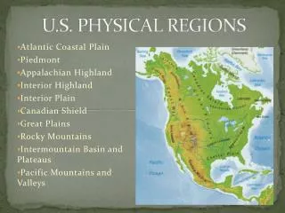
The Atlantic Coastal Plains • A flat area of land of the coast of the Atlantic Ocean from southern New York to Florida • Less than 200 meters above sea level on average • Goes inland for between 50-100 kilometers • Generally good for growing crops
Label the Atlantic Coastal Plains on your map. Atlantic Coastal Plains
St. Lawrence River • Flows southwest to northeast through North America • A river that connects the Great Lakes to the Atlantic Ocean • Serves as part of the border between Canada and the United States • Explored by John Cabot and Jacques Cartier • Named by Jacques Cartier after he sailed it
Label the St. Lawrence River on your map. St. Lawrence River Atlantic Coastal Plains
The Great Lakes • A collection of 5 freshwater lakes on the United States-Canada border • Largest surface area formation of freshwater lakes in the world • Hold 21% of the world’s freshwater • Are connected to the Atlantic Ocean by the St. Lawrence River
Label the Great Lakes on your map. 3 5 2 4 1 Great Lakes St. Lawrence River Atlantic Coastal Plains
The Gulf of Mexico • Ocean basin surrounded by FL, GA, AL, MS, LA, and TX • Part of the Atlantic Ocean • About half of it (light blue) is shallow water on the Continental Shelf • Is about 4,300 meters deep at its deepest • First European to explore it was Amerigo Vespucci in 1497
Label the Gulf of Mexico on your map. 3 5 2 4 1 Great Lakes St. Lawrence River Atlantic Coastal Plains Gulf of Mexico
The Great Plains • A large area of flat land made up mainly of grasslands and prairies • Located west of the Mississippi River and East of the Rocky Mountains • Cover Montana, Nebraska, Colorado, North and South Dakota, Kansas, Wyoming, Oklahoma, Texas, and New Mexico • Also reach into Canada
Label the Great Plains on your map. 3 5 2 4 1 Great Lakes Great Plains St. Lawrence River Atlantic Coastal Plains Gulf of Mexico
The Continental Divide • Imaginary boundary that separates waters that flow into the Atlantic Ocean & Gulf of Mexico from those that flow into the Pacific Ocean • Runs northwest to southeast from Alaska to northern South America
Label the Continental Divide on your map. 3 5 2 4 1 Great Lakes Great Plains Continental Divide St. Lawrence River Atlantic Coastal Plains Gulf of Mexico
The Great Basin • An area covering most of Nevada and also some of the surrounding states of Oregon, Utah, and California where water is trapped • Because it is so hot, water evaporates here or soaks in to the ground • Is usually a warm, dry area but occasionally gets snow Visit the following website for more information: http://www.nps.gov/grba/index.htm
Label the Great Basin on your map. 3 5 2 4 1 Great Lakes Great Plains Continental Divide St. Lawrence River Great Basin Atlantic Coastal Plains Gulf of Mexico
Death Valley • Lowest, hottest, driest location in the United States • Valley located in the Mojave Desert and Great Basin in eastern California • Almost 300 feet below sea level • Is so hot because the sun heats the ground and the heat is trapped by the surrounding elevations as it rises • Hottest recorded temperature is 134˚F • Coolest recorded temperature is 15˚F • Visit website below for more information http://www.nps.gov/deva/index.htm
Label Death Valley on your map. 3 5 2 4 1 Great Lakes Great Plains Continental Divide St. Lawrence River Great Basin Death Valley Atlantic Coastal Plains Gulf of Mexico