Download
1 / 10
100 likes | 245 Vues
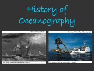
History of Oceanography. Brian Schuster. Polynesians. colonized islands in the Pacific Ocean (Hawaii, Tahiti, Easter Islands, etc.) navigated with stars sailed in large canoes made “stick charts” from bamboo and wood to diagram islands. Mediterranean Sea. first maps were made of this sea

E N D
History of Oceanography Brian Schuster
Polynesians • colonized islands in the Pacific Ocean (Hawaii, Tahiti, Easter Islands, etc.) • navigated with stars • sailed in large canoes • made “stick charts” from bamboo and wood to diagram islands
Mediterranean Sea • first maps were made of this sea • several civilizations navigated here • Greeks were the first to sail out of sea into ocean; they observed currents • Eratosthenes determined Earth’s circumference to be 25,000 miles • Phoenicians greatly improved navigation • Phoenicians circumnavigated Africa in 590 BC
Age of Discovery (1500s-1800s) • stimulated by the lust for resources and better trade routes • 1513 Balboa finds the Pacific Ocean • 1519 Victoria, led by Portuguese Ferdinand Magellan, circumnavigates the world; 3 of 5 ships are lost on voyage; Magellan is killed in Philippines, then del Cano takes over • 1768 English James Cook charts Australia region aboard Endeavor; prevents scurvy by getting sailors enough Vitamin C • 1772 Cook charts islands of Pacific with Resolution and Adventure; killed by natives of Hawaii
Age of Discovery (1500s-1800s) • 1728 John Harrison make a marine chronometer, which allowed navigators to determine longitude on ships • 1769 Ben Franklin and Tim Folger map the Gulf Stream • 1842 Matthew Fontaine Maury (“Father of Oceanography”) systematically collects wind and current data; charts North Atlantic • 1831 Charles Darwin sails aboard HMS Beagle as the naturalist; accurately describes atoll formation
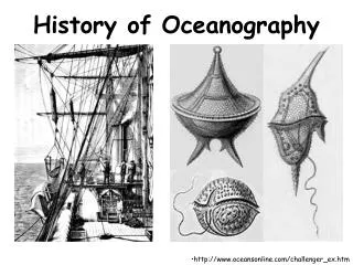
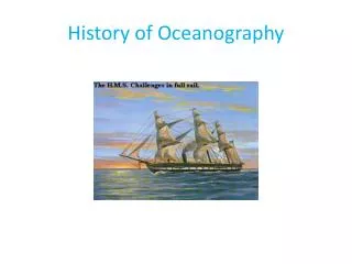
HMS Challenger(1872-1876) • first true oceanographic research expedition • renovated a British corvette, a small warship • led by Charles Wyville Thomson and his assistant, John Murray • discovered Mariana Trench; deepest spot was later given the name Challenger Deep • discovered mid-ocean ridge and collected water data
Oceanography Pioneers • Victor Hensen (1800s): plankton studies • Alexander Agassiz (1800s): studied corals aboard the Albatross • Fridjtof Nansen (1800s): drifted in ice with the Fram near the North Pole • Walfrid Ekman (1900s): Scandinavian who studied physical oceanography • 1909 Robert Peary reaches North Pole • 1911 Roald Amundsen reaches South Pole
Further Exploration (1900s+) • Ocean Drilling Program: collected data about sea floor; started with Glomar Challenger (1968), then JOIDES Resolution and Chikyu (“Planet Earth”) • Meteor: German ship; studied South Atlantic currents • FLIP (Floating Instrument Platform): sits still in the water • FAMOUS (French-American Mid-Ocean Undersea Study, 1974): studied Mid-Atlantic Ridge
Further Exploration (continued) • Trieste: bathyscaphe that still holds the deepest dive to 11000 m in Challenger Deep; designed by Auguste Piccard • SCUBA (self-contained underwater breathing apparatus, 1943): initially developed by Jacques-Yves Cousteau and Emile Gagnon • SEASAT (1978): short-lived satellite; pioneer in oceanography remote sensing • TOPEX/Poseidon (1992-2006): satellite that measured sea surface height to reveal info about circulation; successful mission
Modern Submersibles of Today • Alvin (max: 4000m): manned DSV; discovered hydrothermal vents, recovered missing bomb • Sea Cliff II (max: 6000m): went deeper than Alvin • Jason/Medea: pair of ROVs attached to each other