Download
1 / 32
320 likes | 437 Vues
Introduction to Geospatial Information Management and Spatial Databases. Lecture 4. Traditional (non-spatial) database management systems provide: Persistence across failures. Allows concurrent access to data.

E N D
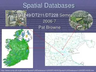
Introduction to Geospatial Information Management and Spatial Databases Lecture 4
Traditional (non-spatial) database management systems provide: • Persistence across failures. • Allows concurrent access to data. • Scalability to search queries on very large datasets which do not fit inside main memories of computers. • Efficient for non-spatial queries, but not for spatial queries. • Non-spatial queries: • List the names of all bookstore with more than ten thousand titles. • List the names of ten customers, in terms of sales, in the year 2001. • Spatial Queries: • List the names of all bookstores with 10 km of Chiayi city. • List all customers who live in Taipei city and its adjoining counties. Value of SDBMS
Examples of non-spatial data • Names, phone numbers, email addresses of people • Examples of Spatial data • Census data • NASA satellites imagery - terabytes of data per day • Weather and Climate Data • Rivers, farms, ecological impact Value of SDBMS – Spatial Data Examples
Many important application domains have spatial data and queries. • Army Field Commander: Has there been any significant enemy troop movement since last night? • Insurance Risk Manager: Which homes are most likely to be affected in the next great flood on the Changhua county? • Medical Doctor: Based on this patient's MRI, have we treated somebody with a similar condition ? • Molecular Biologist: Is the topology of the amino acid biosynthesis gene in the genome found in any other sequence feature map in the database ? • Astronomer: Find all blue galaxies within 2 arcmin of quasars. Value of SDBMS – Users, Application Domains
Various fields/applications require management of geometric, geographic or spatial data: • A geographic space: surface of the earth • Man-made space: layout of VLSI design • Model of a rat brain Value of SDBMS – Users, Application Domains
A SDBMS is a software module that • can work with an underlying DBMS(e.g., MySQL, GIS and Spatial Extentions) • supports spatial data models, spatial abstract data types (ADTs) and a query language from which these ADTs are callable • supports spatial indexing, efficient algorithms for processing spatial operations, and domain specific rules for query optimization • Example: Oracle Spatial data cartridge, ESRI SDE • can work with Oracle 8i DBMS • Has spatial data types (e.g. polygon), operations (e.g. overlap) callable from SQL3 query language • Has spatial indices, e.g. R-trees What is a SDBMS
Common challenge: dealing with large collections of relatively simple geometric objects. (e.g., rectangle, point, polygon) • Different from image and pictorial database systems: • Containing sets of objects in space rather than images or pictures of a space What is a SDBMS
Consider a spatial dataset with: • County boundary (dashed white line) • Census block - name, area, population, boundary (dark line) • Water bodies (dark polygons) • Satellite Imagery (gray scale pixels) • Storage in a SDBMS table: • create table census_blocks ( name string, • area float, • population number, • boundary polygon ); SDBMS Example
A row in the table census_blocks • Question: Is polyline datatype supported in DBMS? Modeling Spatial Data in Traditional DBMS
Traditional relational DBMS • Support simple data types, e.g. number, strings, date • Modeling spatial data types is tedious • Example: next slide shows modeling of polygon using (numbers) • Three new tables: polygon, edge, points. Note: Polygon is a polyline where last point and first point are same • A simple unit square represented as 16 rows across 3 tables • Simple spatial operators, e.g. area(), require joining tables • Tedious and computationally inefficient Spatial Data Types and Traditional Databases
Post-relational DBMS • Support user defined abstract data types • Spatial data types (e.g. polygon) can be added • Choice of post-relational DBMS • Object oriented (OO) DBMS • Object relational (OR) DBMS • A spatial database is a collection of (spatial data types), (operators), (indices), processing strategies, etc. and can work with many post-relational DBMS as well as programming languages like Java, Visual Basic etc. Spatial Data Types and Post-relational Databases
GIS is a (software ) to visualize and analyze spatial data using spatial analysis functions such as • Search Thematic search, search by region, (re-)classification • Location analysis Buffer, corridor, overlay • Terrain analysis Slope/aspect, catchment, drainage network • Flow analysis Connectivity, shortest path • Distribution Change detection, proximity, nearest neighbor • Spatial analysis/Statistics Pattern, centrality, autocorrelation, indices of similarity, topology: hole description • Measurements Distance, perimeter, shape, adjacency, direction • GIS uses SDBMS • to store, search, query, share large spatial data sets How is a SDBMS different from a GIS ?
SDBMS focuses on • (Efficient storage), (querying), sharing of large spatial datasets • Provides simpler set based query operations • Example operations: search by region, overlay, nearest neighbor, distance, adjacency, perimeter etc. • Uses (spatial indices) and (query optimization) to speedup queries over large spatial datasets. • SDBMS may be used by applications other than GIS • Astronomy, Genomics, Multimedia information systems, ... • Will one use a GIS or a SDBM to answer the following: • How many neighboring countries does USA have? • Which country has highest number of neighbors? How is a SDBMS different from a GIS ?
Geographic Information Services • Web-sites and service centers for casual users, e.g. travelers • Example: Service (e.g. AAA, mapquest) for route planning • Geographic Information Systems • Software for professional users, e.g. cartographers • Example: ESRI Arc/View software • Geographic Information Science • Concepts, frameworks, theories to formalize use and development of geographic information systems and services • Example: design spatial data types and operations for querying Three meanings of the acronym GIS
Recall: a SDBMS is a software module that • can work with an underlying DBMS • supports spatial data models, spatial ADTs and a query language from which these ADTs are callable • supports spatial indexing, algorithms for processing spatial operations, and domain specific rules for query optimization • Components include • spatial data model, query language, query processing, file organization and indices, query optimization, etc. Components of a SDBMS
Spatial Taxonomy: • multitude of descriptions available to organize space. • Topology models homeo-morphic relationships, e.g. overlap • Euclidean space models distance and direction in a plane • Graphs models connectivity, Shortest-Path • Spatial data models • rules to identify identifiable objects and properties of space • Object model helps manage identifiable things, e.g. mountains, cities, land-parcels etc. • Field model helps manage continuous and amorphous phenomenon, e.g. wetlands, satellite imagery, snowfall etc. Spatial Taxonomy, Data Models
Data Models • A collection of concepts to describe to describe: • structure of a database • data relationships • data semantics • data constraints • Data Model Operations: operations for specifying database retrievals and updates.
Without lose of generality, assume 2-D and GIS application, two basic things need to be represented: • Objects in space: cities, forests, or rivers modeling single objects • Space: say something about every point in space (e.g., partition of a country into districts) modeling spatially related collections of objects Modeling*
Fundamental abstractions for modeling single objects: • Point: object represented only by its location in space, e.g., center of a state • Line (actually a curve or ployline): representation of moving through or connections in space, e.g., road, river • Region: representation of an extent in 2-D space, e.g., lake, city Modeling*
Instances of spatially related collections of objects: • Partition: set of region objects that are required to be disjoint (adjacency or region objects with common boundaries), e.g., thematic maps • Networks: embedded graph in plane consisting of set of points(vertices) and lines (edges) objects, e.g. highways, power supply lines, rivers Modeling*
Spatial relationships • Topological relationships: e.g., adjacent, inside, disjoint. • Direction relationships: e.g., above, below, or north_of, southwest_of, … • Metric relationships: e.g., distance • There are 6 valid possible topological relationships between two simple regions (no holes, connected): • disjoint, in, touch, equal, cover, overlap Modeling* B A
SDBMS data model must be extended by ADTs at the level of atomic data types (such as integer, string), or better be open for user-defined types (OR-DBMS approach): • relation states (sname: STRING; area: REGION; spop: INTEGER) • relation cities (cname: STRING; center: POINT; ext: REGION; cpop: INTEGER); • relation rivers (rname: STRING; route: LINE) Modeling*
Spatial query language • Spatial data types, e.g. point, linestring, polygon, … • Spatial operations, e.g. overlap, distance, nearest neighbor, … • Callable from a query language (e.g. SQL3) of underlying DBMS • SELECT S.name • FROM Senator S • WHERE S.district.Area() < 300 Spatial Query Language
Efficient algorithms to answer spatial queries • Common Strategy – (filter) and (refine) • Filter Step:Query Region overlaps with MBRs of B,C and D • Refine Step: Query Region overlaps with B and C Query Processing
Fundamental spatial algebra operations: • Spatial selection: returning those objects satisfying a spatial predicate with the query object • “All cities in Taiwan” • SELECT sname FROM cities c WHERE c.center inside Taiwan.area • “All rivers intersecting a query window” • SELECT * FROM rivers r WHERE r.route intersects Window • “All big cities no more than 50 Kms from Taichung” • SELECT cname FROM cities c • WHERE dist(c.center,Taichung.center) < 100 • and c.pop > 500k • (conjunction with other predicates and query optimization) Querying* …
Spatial join: A join which compares any two joined objects based on a predicate on their spatial attribute values. • “For each river pass through Taichung, find all cities within less than 50 Kms.” • SELECT r.rname, c.cname, • FROM rivers r, cities c • WHERE r.route intersects Taichung.area and • dist(r.route,c.area) < 50 Km Querying* …
A difference between GIS and SDBMS assumptions • GIS algorithms: dataset is loaded in main memory (a) • SDBMS: dataset is on secondary storage e.g disk (b) • SDBMS uses space filling curves and spatial indices to efficiently search disk resident large spatial datasets File Organization and Indices
Issues: • Sorting is not naturally defined on spatial data • Many efficient search methods are based on sorting datasets • Space filling curves • Impose an ordering on the locations in a multi-dimensional space • Examples: row-order, z-order, Hilbert curve (higher spatial correlation) • Allow use of traditional efficient search methods on spatial data Organizing spatial data with space filling curves
To expedite spatial selection (as well as other operations such as spatial joins, …) • It organizes space and the objects in it in some way so that only parts of the space and a subset of the objects need to be considered to answer a query. • Two main approaches: • Dedicated spatial data structures (e.g., R-tree) • Spatial objects mapped to a 1-D space to utilize standard indexing techniques (e.g., B-tree) Spatial Indexing
SDBMS is valuable to many important applications • SDBMS is a software module • works with an underlying DBMS • provides spatial ADTs callable from a query language • provides methods for efficient processing of spatial queries • Components of SDBMS include • spatial data model, spatial data types and operators, • spatial query language, processing and optimization • spatial data mining • SDBMS is used to store, query and share spatial data for GIS as well as other applications Summary