Download
1 / 12
130 likes | 394 Vues
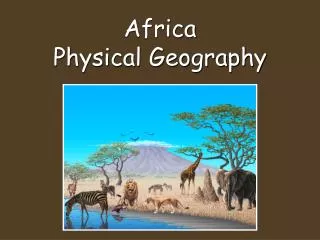
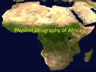
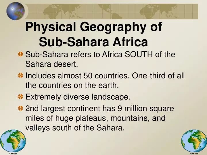
Physical Geography of Sub-Sahara Africa. Sub-Sahara refers to Africa SOUTH of the Sahara desert. Includes almost 50 countries. One-third of all the countries on the earth. Extremely diverse landscape.

E N D
Physical Geography of Sub-Sahara Africa • Sub-Sahara refers to Africa SOUTH of the Sahara desert. • Includes almost 50 countries. One-third of all the countries on the earth. • Extremely diverse landscape. • 2nd largest continent has 9 million square miles of huge plateaus, mountains, and valleys south of the Sahara.
Continent of Plateaus • “One big Plateau” • Coastal plains go 20 miles inland. • Plateau after plateau & in between there are escarpments. • Escarpments- steep cliffs or slopes. • South & East hold steepest escarpments. • B/C of plateau Africa has the highest overall elevation
Mountains • Atlas in Northwest. • Most mts. east side. • Drakensberg, Ruwenzori. • Volcanoes= Mount Kenya, Mount Kilimanjaro, Africa’s highest peak (19,340 feet)
Great Rift Valley • Stretches from Jordan river to Zambezi River in Mozambique. • Occurred when pangaea ripped apart creating mountains.
Water Systems • Largest lakes cut into Great Rift Valley. • Longest rivers all rise in plateaus. • Due to high escarpments, rapids and waterfalls are common on the edge of the continent.
Lakes • Lake Victoria in GRV, 2nd largest freshwater lake in the world, source of White Nile. • Lake Tanganyika (420 miles) 1st largest lake in world. • Lake Malawi in GRV • Outside GRV: Lake Volta, Lake Chad (no natural outlet-loses water through evaporation.
Rivers • 4 great rivers slice through Africa: • Nile • Congo (largest river system sub-Sahara) • Niger • Zambezi (plunges down a huge chasm known as Victoria Falls, which is twice the size of Niagara falls)
Natural Resources • Diamonds form the D.R.O.T. Congo. • Gold from South Africa & GRV. • Nigeria 3 % of world’s known oil. • Uranium, manganese, cobalt, zinc, copper.
Climate & Vegetation • Three tropical latitudes cross sub-Sahara Africa. • T of Cancer crosses south of Sahara Desert • T of Capricorn extends through southern tip. • Equator runs through center. (All Africa within 35 degrees of equator) • B/C sub-Sahara is all in the tropics makes for diverse climate and vegetation.
Deserts • Deserts cover a larger percentage of Africa than any other continent. • Sahara covers north. • Namib desert, coast of Namibia. • Kalahari desert most of Botswana.
The Sahel Looking south • Sahel means “border.” • Lies between the desert and fertile grassland to the south. • Long, dry seasons & wet seasons. • Drought has brought famine, misery, & hardship. • Countries: Senegal, Mauritania, Mali, Burkina Faso, Niger, • Nigeria, Chad, Sudan, and the “Horn.” • “Desertification” happening in the Sahel. Sahara taking over. Looking north
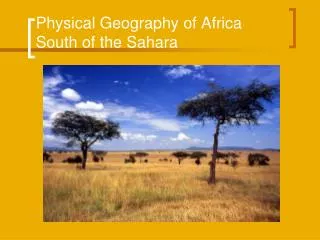
Tropical Savanna & Tropical Rain Forests • T.S. more rain than Sahel, supports livestock and game. • T.S. Holds the Serengeti plains and Nairobi national park. • T.R.F. covers only 8% of Africa, on the equator. • T.R.F. faces destruction from logging companies. • T.R.F. make poor farmland. • T.R.F. cocoa, rubber, palm-oil.