Download
1 / 15
150 likes | 162 Vues
Indian Sundarbans is tidal halophytic mangrove forest in the world. It is intersected by a complex network of tidal waterways, mudflats, and small islands of salt tolerant mangrove forests. A variety of habitats have developed to accommodate the wildlife, including beaches, estuaries, permanent and semi permanent swamps, tidal flats, tidal creeks, coastal dunes, back dunes and levees Shapiro and Ari 2016 . Besides a high number of mangrove tree species, additional plant species can be found here. The forest cover of the study area also provide a vital buffer against cyclones that are common in that part of the world and has been called a natural safeguard for people Wikipedia, the free encyclopedia 2017 . The lives of the study area residents are frequently affected by human animal conflicts a few tiger and crocodile attacks every year are common. Because of issues such as deaths and injuries due to human animal conflict, over fishing and deforestation, the state imposed several restrictions on livelihood strategies. The state forest department have tried to reduce the local peoples dependency on the forest for their livelihood by taking several management practices on infrastructure development projects such as building roads and jetties, excavating irrigation channels and ponds, providing solar lamps and establishing a few medical facilities Ghosh and Priyanka 2015 . Studies have shown that majority of population understand and support the conservation of mangroves and it ecosystems. However, perceived socio demographic factors such as severe poverty, lack of political commitment, and absence of community level institutions are often barriers to the successful implementation of conservation policies Das and Mandal 2016 . Dr. Sayantani Nath (Bhadra) "Mangroves of Indian Sunderbans Depleting Alarmingly Over the Past Few Decades" Published in International Journal of Trend in Scientific Research and Development (ijtsrd), ISSN: 2456-6470, Volume-2 | Issue-4 , June 2018, URL: https://www.ijtsrd.com/papers/ijtsrd14464.pdf Paper URL: http://www.ijtsrd.com/humanities-and-the-arts/environmental-science/14464/mangroves-of-indian-sunderbans-depleting-alarmingly-over-the-past-few-decades/dr-sayantani-nath-bhadra<br>

E N D
International Research Research and Development (IJTSRD) International Open Access Journal Mangroves of Indian Sunderbans Depleting Alarmingly Over the Past Few Decades Dr. Sayantani Nath (Bhadra) Faculty, Department of Geography, Haringhata Mahavidyalaya, Haringhata, Subarnapur, Nadia, West Bengal, India Keywords: deforestation, livelihood strategies, management practices International Journal of Trend in Sci Scientific (IJTSRD) International Open Access Journal ISSN No: 2456 ISSN No: 2456 - 6470 | www.ijtsrd.com | Volume 6470 | www.ijtsrd.com | Volume - 2 | Issue – 4 Mangroves o Alarmingly O f Indian Sunderbans Depleting Dr. Sayantani Nath (Bhadra) Faculty, Department Haringhata, Subarnapur, Nadia , halophytic halophytic ivelihood strategies, management mangrove mangrove forest, forest, ABSTRACT Indian Sundarbans is tidal halophytic mangrove forest in the world. It is intersected by a complex network of tidal waterways, mudflats, and small islands of salt tolerant mangrove forests. A variety of habitats have developed to accommodate the wildlife, including beaches, estuaries, permanent and semi swamps, tidal flats, tidal creeks, coastal dunes, back dunes and levees (Shapiro and Ari 2016). Besides a high number of mangrove tree species, additional plant species can be found here. The forest cover of the study area also provide a vital buffer against cyclones that are common in that part of the world and has been called "a natural safeguard for people (Wikipedia, the free encyclopedia 2017). The lives of the study area residents are frequently affected by human-animal conflicts; a few tiger and crocodile attacks every year are common. Because of issues such as deaths and injuries due to human conflict, over-fishing and deforestation, the state imposed several restrictions on livelihood strategies. The state forest department have tried to reduce the local people's dependency on the forest for their livelihood by taking several management practices on infrastructure development projects such as building roads and jetties, excavating irrigation channels and ponds, providing solar lamps and establishing a few medical facilities (Ghosh and Priyanka 2015). Studies have shown that majority of population understand and support the conservation of mangroves and it ecosystems. However, perceived socio factors such as severe poverty, lack of political commitment, and absence of community level institutions are often barriers to the successful implementation of conservation policies (Das and Mandal 2016). dal halophytic mangrove forest in the world. It is intersected by a complex network of tidal waterways, mudflats, and small islands of salt- tolerant mangrove forests. A variety of habitats have developed to accommodate the wildlife, including aries, permanent and semi-permanent swamps, tidal flats, tidal creeks, coastal dunes, back dunes and levees (Shapiro and Ari 2016). Besides a high number of mangrove tree species, additional plant species can be found here. The forest cover of ea also provide a vital buffer against cyclones that are common in that part of the world and has been called "a natural safeguard for people (Wikipedia, the free encyclopedia 2017). The lives of the study area residents are frequently affected by imal conflicts; a few tiger and crocodile attacks every year are common. Because of issues such as deaths and injuries due to human-animal fishing and deforestation, the state imposed several restrictions on livelihood strategies. forest department have tried to reduce the local people's dependency on the forest for their livelihood by taking several management practices on infrastructure development projects such as building roads and jetties, excavating irrigation channels and ds, providing solar lamps and establishing a few medical facilities (Ghosh and Priyanka 2015). Studies have shown that majority of population understand and support the conservation of mangroves and it ecosystems. However, perceived socio-demographic rs such as severe poverty, lack of political commitment, and absence of community level institutions are often barriers to the successful implementation of conservation policies (Das and 1.0INTRODUCTION The Indian Sundarbans, a world heritage site, consists of an area of about 6312.768 sq. km (2012) out of which 2122.421 sq. km is covered by mangrove forests. The total forest cover of the Indian Sundarban, as assessed by Remote Sensing studies for the year 1986, was about 2246.839 sq. km, which gradually declined to 2201.41 sq. km in 1996, to 2168.914 sq. km in 2001 and to 2122.421 sq. km in 2012 (Samanta and Hazra, 2017). There has been a loss of 124 sq. km of mangrove forest cover. Thus a study is undertaken in Indian Sundarbans to explore the feasibility of forest management with respect to prevailing forest conservation measures in order to provide opportunities for improvement of forest cover in a sustained way. The Indian Sundarbans, a world heritage site, consists of an area of about 6312.768 sq. km (2012) out of which 2122.421 sq. km is covered by mangrove forests. The total forest cover of the Indian arban, as assessed by Remote Sensing studies for the year 1986, was about 2246.839 sq. km, which gradually declined to 2201.41 sq. km in 1996, to 2168.914 sq. km in 2001 and to 2122.421 sq. km in 2012 (Samanta and Hazra, 2017). There has been a sq. km of mangrove forest cover. Thus a study is undertaken in Indian Sundarbans to explore the feasibility of forest management with respect to prevailing forest conservation measures in order to provide opportunities for improvement of forest cover 2.0. AIMS & OBJECTIVES To evaluate the existing vegetation cover of the 2.0. AIMS & OBJECTIVES To evaluate the existing vegetation cover of the study area To evaluate the causes of the shrinkage of forest cover of the study area To explore the mitigation strategies for mangrove forest maintenance 3.0. METHODOLOGY Reviewed and analyzed secondary data, information and literature that are available in the public domain, including information available on official websites of several Governmental agencies, scientific data and reports are used f purpose of writing this paper. To evaluate the causes of the shrinkage of forest To explore the mitigation strategies for mangrove Reviewed and analyzed secondary data, information and literature that are available in the public domain, including information available on official websites of several Governmental agencies, scientific data and reports are used for the and and Non Non-Governmental @ IJTSRD | Available Online @ www.ijtsrd.com @ www.ijtsrd.com | Volume – 2 | Issue – 4 | May-Jun 2018 Jun 2018 Page: 1936
International Journal of Trend in Scientific Research and Development (IJTSRD) ISSN: 2456-6470 deeper groups of aquifers occurring in the depths range 180-360 m contain fresh water. The ground water from deeper confined group is neutral to mildly alkaline with pH ranging from 7.4-8.1. The specific conductance ranges between 714-2692 mhos/cm at 250C and the chloride values range between 14-596 ppm. Concentration of magnesium and iron vary respectively from 207-598, 12-68, 11-50, and 0.01-2.01 ppm. Thus it is seen that the quality of ground water both from the unconfined aquifers and from deeper confined group of aquifers in the southern part of the study area is suitable for human consumption (C.G.W.B 2010). 4.7. Climate: The study area is under the typical tropical monsoonal maritime climate. Theclimate in Sunderbans is generally soothing and pleasant. Ordinarily, the climate in Sunderbans ranges from 34 °C and 20 °C, and the rainfall is extremely high. So the weather is almost always moist and with the humid air from Bay of Bengal blowing constantly carrying 80% humidity.From October to March the North Easterlies blow here. While from March to September, the Westerly prevails. Since the sea is nearby, there is a cool sea breeze during night and thus the temperature is favorable all along the day. During the high tides at sea, there is maximum possibility of Sunderbans Delta being over flooded. But at the same time the sea provides an excellent climatic condition for the vegetation and the animals. Thus the climate in Sunderbans is neither too hot nor too cold (Climates in Sunderbans - Indian Holiday 2018). 4.8. Soil: Soils of the Indian Sundarbans mangrove forest differ from other inland soils in thatthey are subjected to the effects of salinity and waterlogging, which naturally affect the vegetation. In places soils are semi-solid and poorly consolidated. pH ranges widely from 5.3 to 8.0. Soil is in general medium textured; sandy loam, silt loam or clay loam. The grain size distribution is highly variable. Silt loam is the dominant textural class. A 72-87% silt content in 0-60 cm depth for Indian part of Sundarbans (Ray et al. 2014). Porosity is 0.7 (Ray et al. 2014). Sodium and calcium contents of the soil vary from 5.7 to 29.8 meq/100g dry soil, respectively, and are generally low in the eastern region and higher towards the west. Available potassium (K) content of the soil is low, 0.3-1.3 meq/100g dry soil. Organic matter content 4.0. STUDY AREA 4.1. Location: Thestudy area lies between 21◦30'Nto 22◦38'N latitudes and 88◦05'E to88◦28'E longitudes and is bounded on the west from Bhagirathi or Hooghly to River Kalindi on the east and from Kalindi River to the confluence of River Meghna (Bangladesh), on the north by the Dampier Hodges Line to the south by Bay of Bengal. The study area covers 4264 sq. km (Bera et al. 2016) (Fig. 4.1). 4.2. Relief/Topography: The lands of the study area are plain with a network of canals,rivers and surrounded by estuaries. The process of land building through sedimentation by the Ganga and its distributaries is still active in this area. The average elevation of the lands in the study area is ~5m above mean sea level with a very gentle slope. 4.3. Geology: The area is the result of extensive fluvio-marine deposits of the river Gangesand the Bay of Bengal and the character of the sediment is silty clay. The dominant association of kaolinite with subordinate amount of quartz, illite and chlorite in the clay minerals in the Sundarban mangrove core sediment (Rajkumar et al. 2012). The adsorption capabilities result from a net negative charge on the structure of minerals, high surface area and high porosity (Alkan et al. 2004). 4.4. Geomorphology: The whole study area is under alluvial tract. Mainly seven gemorphicunits are considered in the study area namely creeks, river channel, mud flat, alluvial plain, sand flat, mangrove swamp and estuary (Ganguly et al. 2006). 4.5. Drainage: The study area is criss-crossed with the rivers; among them majors arenamely Matla, Ajmalmari, Kankalmari, Thakuran, Moni, Piyali, Raidighi, Mridangabhanga, Bidyadhari, Saptamukhi, Haribhanga, Kalindi etc. 4.6. Geohydrology: Generally aquifers occur in the confined condition in the depths range of76-360 m with numerous alterations of clay and sandy clay beds of varying thickness. Ground water from unconfined aquifer is generally neutral to mildly alkaline with pH ranging from 7.2-8.1. It has low electrical conductivity (523-1463 mhos/cm at 250C), low chloride 14-188 ppm, and concentration of calcium; magnesium bicarbonate and iron vary from 14-76, 11- 44, 281-640 and 0.01-3.4 ppm respectively. The bicarbonate, calcium, @ IJTSRD | Available Online @ www.ijtsrd.com | Volume – 2 | Issue – 4 | May-Jun 2018 Page: 1937
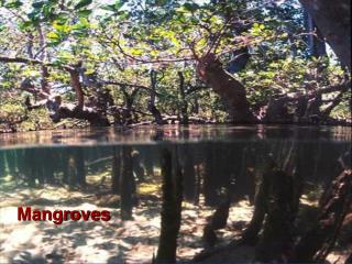
International Journal of Trend in Scientific Research and Development (IJTSRD) ISSN: 2456-6470 varies between 4% and 10% in dry soil. Soil salinity increases from 5 ppt in east (slight to moderate) to 30 ppt in west (highly saline), but the salinity is not uniform from north to south throughout the forest (Soils of Sundarban mangroves 2016). 4.9. Vegetation: Vegetation at the Indian Sunderbans consists mainly of dense mangroveforests. It is the primary vegetation in the Sunderbans Delta. It is a unique tree that can stand in inundated land for a long time. Spikes rise up from their roots and they help in respiration and overall support of the Mangrove Plants (Plate 4.1). In fact this vast delta is referred to as a tidal swamp forest. All the vegetation types at the Sunderbans are evenly distributed. Indian Sunderbans derived its name from the 'Sundari' trees that thrive in 5.0. RESULT & DISCUSSION 5.1. Existing Vegetation Cover in the Study Area The Indian Sundarbans flora is characterised by the abundance of Sundari (Heritiera fomes), Gewa (Excoecaria agallocha), Goran (Ceriops decandra) and Keora (Sonneratia apetala) all of which occur prominently throughout the area. New forest accretions are often conspicuously dominated by Keora (Sonneratia apetala) and tidal forests. It is an indicator species for newly accreted mud banks and is an important species for wildlife, especially spotted deer (Axis axis). There is abundance Dhundul or Passur (Xylocarpus granatum) and Kankra (Bruguiera gymnorhiza) distribution is discontinuous. Among palms, Poresia coaractata, Myriostachya wightiana and Golpata (Nypa fruticans), and among grasses spear grass (Imperata cylindrica) and Khagra (Phragmites karka) are well distributed. The varieties of the forests that exist in Sundarbans include mangrove scrub, littoral forest, saltwater mixed forest, brackish water mixed forest and swamp forest. Besides the forest, there are extensive areas of brackish water and freshwater marshes, intertidal mudflats, sand flats, sand dunes with typical dune vegetation, open grassland on sandy soils and raised areas supporting a variety of terrestrial shrubs and trees (Wikipedia, the free encyclopedia 2018). Except these mangrove vegetation (Plate 5.1), the varieties of trees are found in the homestead land, majors are Terminalia arjuna (Arjun), Acacia nilotica (Babla), Albizzia lebbeck (Shiris), Eucalyptus globulus (Eucalyptus), Lagerstroemia speciosa (Jarul), Swietenia mahagonij (Mahagoni), Shorea robusta (Sal), Tectona grandis (Segun), fruit trees like Mangifera indica (Aam), Syzygium cumini (Jamun), Artocarpus heterophyllus (Jackfruit), Psidium juajava (Guava), Carica papaya (Papaya), Cocos nucifera (Coconut), Areca catechu (Supari), Ficus glomerata (Jogya dumur), flower trees like Michelia champaca (Chanpa), Ixora coccinea (Rangan), Hibiscus rosa\ sinensis (Jaba) etc (Nath Bhadra and Khan 2015). great numbers in this region. These mangrove trees can grow very well in a combination of salt water and fresh water. More than 50 varieties of mangrove or sundari trees that grows wild as vegetation at the Indian Sunderbans region. In fact the Indian Sunderbans delta is one of the largest mangrove forests in the world. Mangrove plants thrive very well in muddy, wet soil and marshy areas in tropical tidal waters. The mangrove vegetation at the Indian Sunderbans can be categorized into shrubs, trees, ground ferns or palms depending upon the ratio of salt water and fresh water that the roots intake (Vegetation in Sunderbans 2018). of though @ IJTSRD | Available Online @ www.ijtsrd.com | Volume – 2 | Issue – 4 | May-Jun 2018 Page: 1938
International Journal of Trend in Scientific Research and Development (IJTSRD) ISSN: 2456-6470 A check list of some existing vegetation in the study area is given below (Nath Bhadra and Khan 2015) (Table 5.1 & 5.2). Table 5.1: Mangrove Forest Vegetation Sl. No. Scientific names Local names 1 Avicennia alba Paira Baen Blume 2 Avicennia marina Kala Baen (Forsk.) Vierh. 3 Avicennia Jat Baen officinalis L. 4 Aglaia domestica Amur Pellegrin. 5 Bruguiera Bakul cylindrical (L.) 6 Bruguiera Kankra gymnorrhiza (L.) Lam. 7 Bruguiera Kankra sexangula Poir. 8 Bruguiera Bakul parviflora (Roxb.) Wight and Arn. Ex Griff. 9 Cerbera manghas Dakor Geartn. 10 Ceriops tagal Math Goran (Perr.) C.B. Robins. 11 Cynometra iripa Singra Kostel. 12 Excoecaria Genwa agallocha L. 13 Heritiera fomes Sundari Buch.-Ham. 14 Hibiscus tiliaceus Bhola L. 15 Kandelia candel Garia (L.) Druce 16 Lumnitzera Kripe racemosa Willd. 17 Nypa fruticans Golpata Wurmb. 18 Phoenix paludosa Hental Roxb. 19 Pandanus Keya odoratissimus L. f. Types of plant Tree Tree Tree Tree Names of Families Avicenniaceae Avicenniaceae Avicenniaceae Meliaceae Rhizophoraceae Tree Rhizophoraceae Tree Rhizophoraceae Tree Rhizophoraceae Tree Apocynaceae Rhizophoraceae Tree Caesalpiniaceae Tree Euphorbiaceae Sterculiaceae Malvaceae Rhizophoraceae Tree Combretaceae Palmae Palmae Pandanaceae Tree Tree Tree Tree Tree Tree Tree Tree @ IJTSRD | Available Online @ www.ijtsrd.com | Volume – 2 | Issue – 4 | May-Jun 2018 Page: 1939
International Journal of Trend in Scientific Research and Development (IJTSRD) ISSN: 2456-6470 Garjan Garjan Rhizophoraceae Rhizophoraceae Sonneratiaceae Sonneratiaceae Sonneratiaceae Sonneratiaceae Malvaceae Tamaricaceae Tamaricaceae Meliaceae Meliaceae Avicenniaceae Avicenniaceae Avicenniaceae Cyperaceae Boraginaceae Chenopodiaceae Chenopodiaceae Ficoidae Cyperaceae 20 21 22 23 24 25 26 27 28 29 30 31 32 33 34 35 36 37 38 39 Rhizophora apiculata Blume Rhizophora mucronata Lam. Sonneratia apetala Keora Buch.-Ham. Sonneratia caseolaris (L.) Engl. Sonneratia griffithii Kurz. Sonneratia alba J. Smith Thespesia populnea (L.) Sol.ex. Cerrea Tamarix troupii Hole Tamarix dioica Roxb. Xylocarpus granatum Koenig Xylocarpus mekongensis Pierre. (Syn. Xylocarpus gangeticus Prain) Avicennia officinalis L. Avicennia alba Bl. Avicennia marine (Forsk.) Vierh. Fimbristylis ferruginea Heliotropium curassavicum L. Suaeda maritima (L.) Dum. Suaeda monoeca L. Sesuvium portulacastrum L. Scirpus s.l.ittoralis Schrad. Tree Tree Tree Ora Ora Ora Paras Nona Jhau Nona Jhau Dhundul Passur Jat Bani/Jat Baine Kalo Bani/ Kalo Baine Peyara Bani/ Peyara Baine Not Available Not Available Giria Shak Nonaguru Jadu Palang Chuchura Tree Tree Tree Tree Tree Tree Tree Tree Tree Tree Tree Herb Herb Herb Herb Herb Herb @ IJTSRD | Available Online @ www.ijtsrd.com | Volume – 2 | Issue – 4 | May-Jun 2018 Page: 1940
International Journal of Trend in Scientific Research and Development (IJTSRD) ISSN: 2456-6470 Acanthus ilicifolius Harguza L. Aegialitis rotundifolia Roxb. Acrostichum aureum L. Brownlowia tersa (L.) Koster. Clerodendron inerme L. Caesalpinia crista L. Ceriops decandra (Griff.) Ding Hou. Pluchea indica Less. Salacia chinensis L. Viscum orientale Willd. Salicornea brachiata Roxb. Aegiceras corniculatum (L.) Blanco Acanthus volubilis Wall. Dalbergia spinosa Roxb. Entada phaseoloides (L.) Merr. Nicker bean Finlaysonia obovata L. Mukuna gigantean DC Stichtocardia tidifolia Hallier F. Derris scandens (Roxb.) Benth. Derris D.fritoliata Lour. heterophylla (Willd.) Back. and Bakh. Hemithrea compressus L. Acanthaceae Plumbaginaceae Pteridaceae Tiliaceae Verbenaceac Caesalpiniaceae Rhizophoraceae Compositae Hippocrateaceae Viscaceae Chenopodiaceae Myrsinaceae Acanthaceae Papilionaceae Mimosaceae Asclepiadaceae Papilionaceae Manispemaceae Papilionaceae Papilionaceae Gramineae 40 41 42 43 44 45 46 47 48 49 50 51 52 53 54 55 56 57 58 59 60 Shrub Shrub Shrub Shrub Shrub Shrub Shrub Shrub Shrub Shrub Under-shrub Shrub to small tree Climber Climber Climber Climber Climber Climber Woody Climber Woody Climber Grass Tora Hodo Lata Sundari Banjai Nate Jhamti or Jele Goran Gagan Tulshi/ Bon Tulshi Dimal Banda Not Available Khalsi Lata harguza Chandi Gila Dudhilata Not Available Not Available Kalilata Kalilata Not Available @ IJTSRD | Available Online @ www.ijtsrd.com | Volume – 2 | Issue – 4 | May-Jun 2018 Page: 1941
International Journal of Trend in Scientific Research and Development (IJTSRD) ISSN: 2456-6470 Myriostachya wightiana (Nessex Steud.) Hook f. Porterasia coarctata (Roxb.) Tateoca. Saccharum cylindricum L. Stenochlaena palustris Bedd. Ghash Dhanighash Ulu Not Available Grass Grass Grass Fern 61 62 63 64 Gramineae Gramineae Gramineae Polypodiaceae Table 5.2: Vegetation in Settlement Sites Scientific names Local names Terminalia arjuna Arjun (Roxb.exDC.Wight &Arn.) Acacia nilotica (L.) Babla Delile Albizia lebbeck Shiris Benth. Eucalyptus Eucalyptus globules Labill. Lagerstroemia Jarul speciosa (L.) Pers Swietenia Mahagoni mahagoni Jacq. Shorea robusta Sal Roxb. Ex Gaertn.f. Tectona grandis Segun L.f. Mangifera indica Mango/ Aam L. Syzygium cuminii Blackberry/ (L.) Skeels Jam Artocarpus Jackfruit heterophyllus Lam. /Kanthal Psidium juajava L. Guava/Peyara Cocos nucifera L. Coconut/Narkel Palmae Areca catechu L. Betel nut/Supari Palmae Sl. No. Names of Families Combretaceae Mimosaceae Mimosaceae Myrtaceae Lythraceae Meliaceae Dipterocarpaceae Tree Verbenaceae Anacardiaceae Myrtaceae Moraceae Myrtaceae Habit of plants Tree (Indigenous) Tree (Indigenous) Tree (Indigenous) Tree (Introduced) Tree (Indigenous, Planted) Tree (Introduced) 1 2 3 4 5 6 7 8 9 10 11 12 13 14 (Indigenous, Planted) Tree (Indigenous, Planted) Tree (Indigenous) Tree (Indigenous) Tree (Indigenous) Tree (Indigenous) Tree (Indigenous, Planted) Tree (Indigenous Planted)) @ IJTSRD | Available Online @ www.ijtsrd.com | Volume – 2 | Issue – 4 | May-Jun 2018 Page: 1942
International Journal of Trend in Scientific Research and Development (IJTSRD) ISSN: 2456-6470 Ficus glomerata Jogya dumur Moraceae Tree 15 (Indigenous) Roxb. Michelia Magnoliaceae Tree 16 Chanpa champaca L. (Indigenous, Planted) Palita Mather, Tree 17 Erythrina Papilionaceae variegate L. Mandar (Indigenous) Typha elephantine Hogla Herb 18 Roxb. Typhaceae Ixora coccinea L. Rangan Rubiaceae 19 Shrub (Indigenous, Planted) Hibiscus rosa- 20 Hibiscus/ Jaba Malvaceae Shrub sinensis (Indigenous, Planted) Mussaenda Ruliaceae 21 Mussaenda Shrub frondosa L. (Indigenous, Planted) Jatropha Euphorpiaceae 22 Jatropha Shrub (Indigenous, panduraefolia L. Planted) Lantana amara L. 23 Putush Verbenaceae Shrub (Planted) Carica papaya L. Papaya Shrub to tree 24 Carieaceae (Introduced, Planted) Tabernaemontana Tagar Shrub to Tree 25 Apocynaceae coronaria R.Br. (Indigenous, Planted) @ IJTSRD | Available Online @ www.ijtsrd.com | Volume – 2 | Issue – 4 | May-Jun 2018 Page: 1943
International Journal of Trend in Scientific Research and Development (IJTSRD) ISSN: 2456-6470 Gloriosa superb L. Agnisikha Liliaceae 26 Climber (Indigenous) Clitoria ternatea L. Aparajita 27 Papilionaceae Climber (Indigenous, Planted) Scindapsus Araceae 28 Pothos or Climber officinales Schott (Planted) Money Plant Philodendron sp. Araceae 29 Philodendron Climber (Planted) Monstera deliciosa Monstera Araceae 30 Climber Liebm. (Planted) Ouisqualis indica Cornbretaceae Creeper 31 Malati lata Rangoon (Planted) L. Creeper Vernonia Vernonia Compositae Creeper 32 (Planted) elaeagnifolia Jue Creeper 33 Jasminum sp. Oleaceae (Planted) Ipomoea aquatic Forsk. Bougainvillea glabra Choisy Kalmi Bagan bilas Thrnner and (Indigenous) Scrambler (Planted) Conrolvulaceae Nyctaginaceae 34 35 Source: Compiled from secondary data sources 5.2. Significance of Mangrove Forest in the Study Area The mangrove forest provides benefits to the local communities in various ways (a) many mangrove trees are of great economic and use value as building materials for rural houses, furniture, making boats and as fuel wood (Government of India (1989), (b) many mangrove herbs have (Vannucci 2004), (c) mangrove functions as wind-breaking barrier, minimizing the intensity of cyclonic storms (Bandyopadhyay 1989, medicinal values @ IJTSRD | Available Online @ www.ijtsrd.com | Volume – 2 | Issue – 4 | May-Jun 2018 Page: 1944
International Journal of Trend in Scientific Research and Development (IJTSRD) ISSN: 2456-6470 Mastaller 1996) and (d) mangrove functions as natural sewage treatment plant and an important carbon dioxide sink. It absorbs pollutants from both air and water. The mangrove plants have high percentage of tannin present in their barks and leaves, which can neutralize some of the industrial pollutants and reduce their detrimental effect (Naskar and Guha Bakshi 1987, Mastaller 1996, Banerjee 1998, Government of West Bengal 2002, Vannucci 2004). The mangrove forest in the study area is an important nursery, breeding, feeding and spawning ground for many brackish water animal species especially fishes of great economic importance. From the beehives in the study area, people collect honey and wax on an average every year. It is the home of a number of endangered and globally threatened species. The mangrove ecosystem in the study area provides scope for interdisciplinary research programme involving natural and social sciences. Mangrove in the study area restoration offers good opportunities for ecotourism, biological research, conservation education and economic benefit to local communities (Nath Bhadra and Khan 2015). The mangroves of Sunderbans are mainly belonging from Abisiniya and Rizophora families. The breathing roots, stilt roots and tap roots of mangroves protect the inhabitants of Sunderbans from soil erosion, flood and coastal erosion. Actually the root systems of mangroves hold soil consistently during tidal effects. As a result the intensity of soil erosion is thus mitigated during tides. From the geographical perspective the mangroves situate towards the extreme southern part of West Bengal, as a consequence of such location they protect Kolkata with the important districts of south Bengal from destructive tropical cyclones being originated on the Bay of Bengal. Lots of honey is available in the Sunderban Mangrove jungles. Not only, this honey is sold in India and also exported for earning foreign currency, but also the poor people residing at Sunderbans economically depend on such forest products. But nowadays this type of forest dependency is strictly restricted by the Government. The natural vegetation found in the Sunderban jungles has a great economic value (Table 5.3). Except these, to maintain the balance of ecosystem, production of oxygen and also maintain the stability between food chain and food web, the mangroves of Sunderbans play a very vital role. This is why it is called the „Natural Museum‟. And at last but not the list to control environmental pollution, weather and climate, these mangroves play a very significant role (Bera et al. 2016). Table 5.3 Floral Diversity and its Importance in Indian Sunderbans About 33% tannin is found at the barks It is used for curing the diabetes disease Wood pieces are being made The wood of this tree is used to burn bricks and Charcoal is found (i) Garjan Rhizophora apiculata The chemicals from barks stop bleeding Use to join fractured soft muscles Use to cure diabetes (ii) Garjan (iii) Kankra R. murcronata Bruoguiera gymnorhiza 36% tannin is found Use to cure abdominal diseases and diabetes Fruits are used for making eye medicine (iv) Ban Bakul B. parviflora Fruits are used for making eye medicine (v) Bakul B. cylindrica @ IJTSRD | Available Online @ www.ijtsrd.com | Volume – 2 | Issue – 4 | May-Jun 2018 Page: 1945
International Journal of Trend in Scientific Research and Development (IJTSRD) ISSN: 2456-6470 Extract from barks stop bleeding and useful for diagnosis of Cancer (vi) Garan (vii) Jhampti Garan (viii) Gariya Ceriops tagal C. decandra Kandelia Candel Extract from barks stop bleeding Use to cure diabetes Expectorant medicines are made for removing cough from windpipe Medicine for curing dysentery Medicines for cough and fever are produced from leaf‟s extracts Use to build wooden plank Use to make match sticks Wooden pieces are made Use to construct wooden boat Use to make wooden plank Use to work in Lathe machine Use to construct boat Alcohols are produced from fruits i.e. (ix) Bani (x) Akash Bel (xi) Ban Jui (xii) Kaora (xiii) Ganoa (xiv) Sundari (xv) Pasur (xvi) Dhundul (xvii) Golpata Opuntia delenii Cassytha filiformis Clerodendrums inerme Sonreratia apetala Exceoecaria agallacha Heritiera minor Xylocarpus granatum Xylocarpus granatum Nipa fruticans Source: Gib Bhugol o Paribesh, Bera et al. 2016 5.3. Present/Current Status of the Shrinkage of Forest Cover in the Study Area: Table 5.4 Loss of Forest Cover over the Years Year 1986 1996 2004 2012 2122.421 506.69 163.47 64.24 Island Indian Sunderbans Gosaba Dulibhasani West Dalhousie 2246.839 517.47 180.03 76.60 Area in sq. km 2168.914 506.71 170.90 68.09 2201.41 517.44 174.78 72.39 @ IJTSRD | Available Online @ www.ijtsrd.com | Volume – 2 | Issue – 4 | May-Jun 2018 Page: 1946
International Journal of Trend in Scientific Research and Development (IJTSRD) ISSN: 2456-6470 Bhangaduni 40.44 6.09 35.15 29.55 5.68 24.91 5.003 5.91 Jambudwip Source: Mangrove Forest Cover Changes in Indian Sunderban (1986-2012) Using Remote Sensing and GIS, Samanta and Hazra 2017, School of Oceanographic Studies, Jadavpur University & Climate change impact: Sunderbans steadily losing its famed mangroves, Singh 2017 Table 5.5 Shrinkage of Forest Cover Year Indian Sunderbans Gosaba Dulibhasani West % of shrinkage of forest cover 1986 2.02 0.006 2.92 1996 1.48 2.07 2.22 2004 2.14 0.004 4.35 2012 5.54 2.08 9.20 Source: Formula of determining decreasing rate, i.e. Actual/Initial value – Decreasing Value x 100 Actual/Initial value The total forest cover of the Indian Sunderbans for the year 1986 was about 2,246.839 sq. km., which gradually declined by 2,201.41 sq. km. in 1996, then down to 2168.914 sq. km in 2004 and to 2122.421 sq. km in 2012. The loss in the mangrove forest in the Indian Sunderbans is about 5.54 %. The loss in mangrove cover at Gosaba has been about 2.08%, down from 517.47 sq. km in 1986 to 506.69 sq. km in 2012. In Dulibhasani West, the loss of mangrove cover has been about 9.20% from 180.03 sq. km. in 1986 to 163.47 sq. km. in 2012. The mangrove forest cover of Dalhousie, another island, has depleted by 16.14%, from 76.60 sq. km. in 1986 to 64.24 in 2012. Bhangaduni has mangrove forest land, from 40.44 sq. km. in 1986 to 24.91 sq. km in 2012, taking the loss to over 38.40%. Jambudwip, one of the smallest uninhabited islands at the mouth of the sea, also has reduced forest cover from 6.09 sq. km. in 1986 to 5.003 sq. km. in 2012, or about 17.85% (Table 5.4 & 5.5) (Fig. 5.1 & 5.2). Island Dalhousie Bhangaduni Jambudwip 2.96 3.89 11.92 17.85 5.50 5.94 5.65 16.14 13.08 15.93 15.70 38.40 @ IJTSRD | Available Online @ www.ijtsrd.com | Volume – 2 | Issue – 4 | May-Jun 2018 Page: 1947
International Journal of Trend in Scientific Research and Development (IJTSRD) ISSN: 2456-6470 erosion, coastal flooding, and an increase in the number of tidal creeks (Samanta & Hazra 2017, Singh 2017). The climate change and sea level rise has contributed to the phenomenon of losing land, including mangrove forests in the Indian Sundarbans, in the last part of the 21st century. This is because there is less fresh water flow and sediment supply in the western (Indian) part of the delta, so there is starvation of sediment and the rate of sea level rise is higher than sediment Sunderbans are losing land, including mangrove forest (Hazra, the Hindu). 5.4. Possible Causes of Deforestation in Indian Sunderbans over the Past Few Decades The balance is fragile between the people living in the study area with their surrounding mangrove forests, upon which they depend for subsistence and livelihood, because excessive exploitation due to lack of supplementary or alternative livelihood and income generation and prevailing poverty can undermine the resource availability. Some of the households directly extract forest resources for their livelihood and the remaining households depended partly on the forest resources, both earning money from either selling or processing these resources. Actually people living in the study area mostly depend on forest resources to satisfy many of their basic needs, such as food, fuel, construction materials for houses, boats, furniture and fishing implements, medicinal herbs and many other items for trade and commerce (Nath Bhadra & Khan 2015). supply. Hence Indian 5.5 Forestry Forest management in general sustainability of forests and forestry, ensuring adequate supplies of forest products, maintenance or expansion of forest cover and species composition, habitat and ecosystem conservation and improved quality of products and improved efficiency of production and distribution systems, as a basis for improved value of forests and forestry (including but not limited to economic revenue). Management of mangrove habitats and dependent communities has an even broader, multi-disciplinary scope. The following aspects have been identified as relevant for the study area, with the explicit aim of sustainable resource Management through Improvement of can aim at Moreover, the continuation of this process of depleting forest cover in response to climate change and sea level rise poses a serious threat to the carbon sequestration potential and other ecosystem services of this mangrove forest in future. The mean sea level rise at the Sagar Island Station, measured from 1985 onward till 2010, shows a rise by 2.6-4 mm a year, which can be considered a driving factor for coastal @ IJTSRD | Available Online @ www.ijtsrd.com | Volume – 2 | Issue – 4 | May-Jun 2018 Page: 1948
International Journal of Trend in Scientific Research and Development (IJTSRD) ISSN: 2456-6470 utilization, to the benefit of future generations as well as present ones. Sider were the most important source of fish and shrimps on the east Indian coast, They are an excellent example of the ecological processes of monsoon rain flooding, delta formation, tidal influence and plant colonization. The Indian Sundarbans lie within a WWF Global 200 Eco-region, and are contained by both a Ramsar Wetland and a UNESCO Biosphere Reserve which contains the Tiger Reserve, National Park and three wildlife sanctuaries. Moreover the people worked in the forest, of whom some collected timber and firewood, some collected honey and beeswax (The season for collecting honey and wax is limited to ten weeks from April 1st. Thousands of people, with permits from the Forest Department, enter the forest for nests) and some harvested the natural resources and hunted mainly deer, and some were fisherman and shrimp farmers. Today, the area provides a livelihood at some seasons of the year. Local people are also dependent on the forests for charcoal, timber for boats and furniture, poles for house-posts and rafters, nypa, palm thatch for roofing, grass for matting reeds for fencing, shells and reptile skins, with deer, fish, crabs and shrimps taken for food. Therefore, from these aforesaid significant values, the mangroves of Indian Sundarbans must be conserved through proper implementation of Government and Non-Government various initiatives considering the infrastructural development of the study area and people‟s cooperation and willingly participation. 5.5.1. Contribution of non-timber forest products (NTFPs) in the livelihood: The majorNTFPs that are found in the study area include honey, bee wax, tannin, bark and leave (Golpata) etc. It may become one of the essential components of the livelihood of the forest dependent population of the study area. The NTFPs being collected from the forests may contribute in the income generation of the local people. Actually NTFPs as a livelihood asset may help as a “safety net” against the livelihood vulnerability of the study area. Of course not every family of the villages go for NTFPs collection but if, they go for it on the basis of seasonality when there is a lean period in agriculture, high livelihood vulnerability may be reduced. 5.5.2. Work under NREGA: After reconstruction and repairing of the dykes, planting ofmangrove species may be a good option for providing work under NRGEA. „Dhani‟ grass and reeds can be grown on the slopes a fodder (Banerjee 2009). 5.5.3. Agro forestry or pisciculture: Agro forestry or pisciculture can also be tried in theforest. It is a practice to excavate channels in order to make inroads for the river water to enter the forest. Then they plugged the inlet point and used the water for growing fish. Thus, livelihood options for the people could be introduced without disturbing the forest cover in any way (Banerjee 2009). 7.0. REFERENCES 1.Alkan, M., Demirbas, O., Celikcapa, S., Dogan, M., 2004. Sorption of acid red 57 from aqueous solutions onto sepiolite. J. Hazard.Mater. 116, 135–145 5.5.4. Social forestry: Social forestry can be useful for eco-restoration of mangrovevegetation through creation of employment opportunities (Bose 2004). 2.Bandyopadhyay, K. K. 1989. Cyclone disaster management of West Bengal coastal zone: some aspects. Proc. Coast Zone Management of West Bengal. Sea Explorers‟ Institute. Kolkata. Proc. D 18-38 5.5.5. Mangroves and aquaculture: Action has to be taken for reforestation, restoration anddevelopment of the mangroves. Promotion conservation and management systems between mangroves and aquaculture is to be advocated. 6.0. CONCLUSION The Indian Sundarbans contain the world's largest halophytic mangrove forests and one of the most biologically productive of all natural ecosystems. The forests contain a rich biota which includes the Bengal tiger and many threatened reptiles. The mangrove jungles of Indian Sundarbans are also of great economic importance as a storm barrier, shore stabilizer, nutrient and sediment trap, a source of timber and natural resources, and before cyclone of integrated 3.Banerjee, A. 1998. Environment, population and human settlements of Sunderban Delta. 1st (ed.), Concept Publishing Company. New Delhi 4.Banerjee, A. K. 2009. Report of consultation for regeneration of agriculture and livelihood systems in Aila affected areas. Development Reaserch Communication and Service Centre supported by Christian Aid. Bosepukur, Kasba, Kolkata. Pp7 @ IJTSRD | Available Online @ www.ijtsrd.com | Volume – 2 | Issue – 4 | May-Jun 2018 Page: 1949
International Journal of Trend in Scientific Research and Development (IJTSRD) ISSN: 2456-6470 5.Bera. B, Bhattacherjee. S and Sengupta N. (2016). Gib Bhugol O Paribesh. Naboday Publication. Pp 272-274 ecological perspective. 1st Edition. Naya Prakash. Kolkata 16.Nath (Bhadra), S. and Khan, D.K. 2015. Alternative rural livelihood in Indian Sundarban. Lap Lambert Publishing House 6.Bose, S. 2004. The Sunderbans biosphere : A study on uncertainties and impacts in active delta region. Proc. 2nd. APHW Conference. Singapore. 1. 475-483 17.Rajkumar,K., 2012. Characterization of clay minerals in the Sundarban Mangrove SEM/EDS. J. Geol. Soc. India 80, 429–434 Ramanathan,A.L., Behera,P.N., 7.Central Ground Water Board [C.G.W.B] (2010). Geohydrology of South 24 Parganas River sediments by 8.Climates in Sunderbans - Indian Holiday 2018. Wildlife in India » Sundarbans » Climate in Sunderbans 18.Ray, R., Majumder, N., Das, S., Chowdhury, C., & Jana, T. K. (2014). Biogeochemical cycle of nitrogen in a tropical mangrove ecosystem, east coast of India. Marine Chemistry, 167, 33–43 9.Das, C. S., and R. N. Mandal (2016). "Coastal people and mangroves ecosystem resources vis-à- vis management strategies in Indian Sundarban". Ocean & Coastal Management. 134: 1–10. doi:10.1016/j.ocecoaman.2016.09.025 19.Samanta K., Hazra S. (2017) Mangrove Forest Cover Changes in Indian Sundarban (1986–2012) Using Remote Sensing and GIS. In: Hazra S., Mukhopadhyay A., Ghosh A., Mitra D., Dadhwal V. (eds) Environment and Earth Observation. Springer Remote Springer, Cham 10.Ganguly, D., Mukhopadhyay, A., Pandey, R. K. and Mitra, D. 2006. Geomorphological study of Sundarban deltaic estuary. Journal of the Indian Society of Remote Sensing. 34 (4). 431-435 Sensing/Photogrammetry. 20.Shapiro, Ari (May 20, 2016). "Rising Tides Force Thousands to Leave Islands of Eastern India"". NPR 11.Ghosh, Priyanka (2015). "Conservation and conflicts in the Sundarban biosphere reserve, India". Geographical Review. 105: 429–440. doi:10.1111/j.1931-0846.2015.12101.x 21.Singh, S.S. 2017. Climate change impact: Sunderbans steadily losing its famed mangroves. Environment 12.Govt. of India. 1989. Sunderban Biosphere Reserves. Ministry of Environment and Forests. Project Document- 10. New Delhi 22.Soils of Sundarban mangroves, 2016. Sunderban Mangroves, Scientific Sunderbans 2018. Research Initiatives 13.Govt. of West Bengal, 2002. Dept. of Sunderbans Forest. Banabibi Utsab 23.Wikipedia, the free encyclopedia 14.Mastaller, M. 1996. Destruction of mangrove wetlands – causes and consequences. A Biannual Collection Titled Natural Development– Focus: Mangrove Forests. Institute for Scientific Cooperation. Tubingen. 43/44 24.Vannucci, M. (edited by). 2004. Mangrove management and conservation – Present and future. U.N. University Press. Tokyo Resources and 25.Vegetation in Sunderbans 2018. National Park, India Wildlife Tours, online guide for tours to India 15.Naskar, K. R. and Guha Bakshi, D. N. 1987. Mangrove swamps of the Sunderbans – an @ IJTSRD | Available Online @ www.ijtsrd.com | Volume – 2 | Issue – 4 | May-Jun 2018 Page: 1950