Download
1 / 57
570 likes | 686 Vues
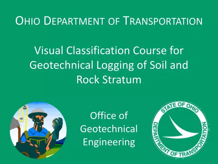
Ohio Department of Transportation. Visual Classification Course for Geotechnical Logging of Soil and Rock Stratum. Office of Geotechnical Engineering. Visual Classification Course for Geotechnical Logging of Soil and Rock Stratum. Purpose :

E N D
Ohio Department of Transportation Visual Classification Course for Geotechnical Logging of Soil and Rock Stratum Office of Geotechnical Engineering
Visual Classification Course for Geotechnical Logging of Soil and Rock Stratum Purpose: • To inform and train all field persons who visually classify borehole samples (soil and rock). • Developed to ensure high quality and consistency in the field classification of samples during subsurface explorations . • Follows the Ohio Department of Transportation’s (ODOT) Specifications for Subsurface Explorations (SGE) - 2011. http://www.dot.state.oh.us/Divisions/Engineering/Geotechnical/Pages/SGE.aspx
Visual Classification Course for Geotechnical Logging of Soil and Rock Stratum Rock Mass Classification has been attempted for over 100 years • Ritter (1879) – Tunnel Design • Terzaghi (1946) – Tunnel Design • Lauffer (1958) – Tunnel Design (modified into New Austrian Tunnelling Method) • Deere et al (1967) – Rock Quality Designation Index (RQD) • Wickham et al (1972) – Rock Structure Rating (RSR) • Bieniawski (1976) – GeomechanicsClassification -or-Rock Mass Rating (RMR) • Cummings et al (1982) – Modified Basic RMR (MBR) • Barton et al (1974) – Rock Tunnelling Quality Index (Q system) • Hoek (1995) – Geologic Strength Index (GSI)
Visual Classification Course for Geotechnical Logging of Soil and Rock Stratum • ODOT Utilizes a modified RMR/GSI system for rock classification ODOT looks at Rock Classification as a Tiered process with the level of detail within the description relative to the type of project for which the boring is being drilled. • Why is the boring being drilled?
Visual Classification Course for Geotechnical Logging of Soil and Rock Stratum ODOT Rock Sample Description • Lithology • Color • Degree of Weathering • Strength • Texture • Bedding • Other Descriptors • Type and Condition of Discontinuities • Unit RQD & Loss (Recovery)
Visual Classification Course for Geotechnical Logging of Soil and Rock Stratum Lithology: Determine the type of in-place bedrock based upon its physical characteristics. Try to determine a Bedrock Unit versus possibly individual lithological units. The primary bedrock types encountered in Ohio are: • Claystone(Mudstone), • Coal, • Dolomite, • Limestone, • Sandstone, • Shale, • Siltstone, • Underclay
Visual Classification Course for Geotechnical Logging of Soil and Rock Stratum If repeating lithologies in thin units use the term “Interbedded” and describe each lithologic unit. Interbedded Shale (70%) and Limestone (30%), Unit RQD 50%, Unit Loss 10%; Shale, gray, moderately weathered, weak, laminated, calcareous; ranges in thickness from 3” to 26” Limestone, light gray, slightly weathered, moderately hard, thin bedded, fossiliferous; ranges in thickness from 2” to 8”
Visual Classification Course for Geotechnical Logging of Soil and Rock Stratum Note: Remember this is for an Engineering Design not a Geological research project.
Visual Classification Course for Geotechnical Logging of Soil and Rock Stratum Color: important property in identifying organic soils, and it may also be useful in identifying materials of similar geologic origin within a given locality Variegated: Contains two distinct colors intermingled or “swirled” together.
Visual Classification Course for Geotechnical Logging of Soil and Rock Stratum
Visual Classification Course for Geotechnical Logging of Soil and Rock Stratum
Visual Classification Course for Geotechnical Logging of Soil and Rock Stratum
Visual Classification Course for Geotechnical Logging of Soil and Rock Stratum Descriptors: Use terms to describe secondary characteristics of bedrock as necessary. Use no more than three characteristics in the description.
Visual Classification Course for Geotechnical Logging of Soil and Rock Stratum
Visual Classification Course for Geotechnical Logging of Soil and Rock Stratum
Visual Classification Course for Geotechnical Logging of Soil and Rock Stratum
Visual Classification Course for Geotechnical Logging of Soil and Rock Stratum Note: to describe the bedrock as Unfractured more than one core run is necessary.
Visual Classification Course for Geotechnical Logging of Soil and Rock Stratum
Visual Classification Course for Geotechnical Logging of Soil and Rock Stratum • Aperture/Openness - Perpendicular distance separating adjacent rock walls of an open discontinuity - It is unlikely that an actual aperture can be observed and measured in core • Filling Thickness - Perpendicular distance separating adjacent rock walls of a filled discontinuity
Visual Classification Course for Geotechnical Logging of Soil and Rock Stratum Terminology: • Slickensided (polished): Extremely smooth and shiny • Slightly Rough: Small asperities are visible and can be felt, most extend < 0.5 mm • Very Rough: Large, angular asperities can be seen, most extend > 2 mm
Visual Classification Course for Geotechnical Logging of Soil and Rock Stratum Rock Quality Designation (RQD): The Rock Quality Designation, RQD, is an index of fracture frequency. Determine the RQD value for each core run (Run RQD) and for the total length of each bedrock unit encountered by a boring (Unit RQD). The RQD value is calculated by adding up the total length of each rock core piece which is 4 inches (100 millimeters), or longer, and dividing by the total length of the core run or total rock unit thickness. The value is expressed as a percentage. Take measurements along the centerline axis of the core. Consider only natural fractures for the RQD determination, discounting mechanical breaks resulting from the drilling operations or transport of the core. Consider fractures that cannot be determined to be either mechanical or natural to be natural. Applies to NQ, NX and PQ holes (1.87”, 2.16”, and 3.35”)
Visual Classification Course for Geotechnical Logging of Soil and Rock Stratum
Visual Classification Course for Geotechnical Logging of Soil and Rock Stratum Mechanical Breakage: • Fresh, rough, unweathered surface • Very good fit between core pieces • No staining • “Spin” marks where the core was staying stationary while barrel was still rotating • “Hackel Plum” fracturing • If you break it to fit in the core box it is mechanical
Visual Classification Course for Geotechnical Logging of Soil and Rock Stratum • Measure during the drilling operations as soon as possible after core run. • RQD can change over time due to: • Poor curatorial handling • Slaking • Dessication • Stress Relief • Swelling
Visual Classification Course for Geotechnical Logging of Soil and Rock Stratum
Visual Classification Course for Geotechnical Logging of Soil and Rock Stratum
Visual Classification Course for Geotechnical Logging of Soil and Rock Stratum Review of Soil Properties • Particle Sizes • Plasticity • Dilatency
Visual Classification Course for Geotechnical Logging of Soil and Rock Stratum Based on AASHTO
Visual Classification Course for Geotechnical Logging of Soil and Rock Stratum Gravel and Sand– Visible to the naked eye and can be visually estimated. Silt - When subjected to shaking in the palm of the hand, a pat of saturated inorganic silt expels enough water to give a glossy appearance to the surface and, when bent or slightly squeezed between the fingers, the surface of the pat will become dull. The pat, upon working in the hand, loses moisture, becomes brittle, and breaks easily into very fine particles. Clay - Clay is sticky at high water contents, plastic over a wide range of water contents, and can be rolled into a fine thread without breaking. Upon drying it becomes hard and will not break into fine particles.
Visual Classification Course for Geotechnical Logging of Soil and Rock Stratum Plasticity of Cohesive Soils • Plasticity determined through Atterburg Limits: • Liquid Limit Test (LL) • Plastic Limit Test (PL)
Visual Classification Course for Geotechnical Logging of Soil and Rock Stratum Plasticity Index (PI) = LL – PL PI is the basic measure of the nature of a fine-grained soil. Four (4) states of fine-grained soil relative to PI and moisture content: • Solid • Semi-solid • Plastic • Liquid
Visual Classification Course for Geotechnical Logging of Soil and Rock Stratum Plastic Limit Moisture content (%) at which the soil can be rolled into 1/8 in diameter thread, or the boundary between non-plastic and plastic state.
Visual Classification Course for Geotechnical Logging of Soil and Rock Stratum Field Plastic Limit • Select test soil at natural moisture • Remove any non-soil materials (i.e. rock, roots, etc.) • Roll sample between palms • Does it reach a uniform 1/8 inch diameter thread • Yes – above plastic limit • No – below plastic limit
Visual Classification Course for Geotechnical Logging of Soil and Rock Stratum Liquid Limit Moisture content (%) at which the soil crosses the boundary from a plastic state to a liquid state.
Visual Classification Course for Geotechnical Logging of Soil and Rock Stratum Field Liquid Limit As a soil is wetted from either a dry or natural moisture content the stickiness will indicate it’s relative plasticity. Stickiness estimates the soil’s capacity to adhere to other objects. Try to utilize a moisture content that displays the maximum adherence of the soil between the thumb and fore finger after it is squeezed together.
Visual Classification Course for Geotechnical Logging of Soil and Rock Stratum
Visual Classification Course for Geotechnical Logging of Soil and Rock Stratum Non-Sticky Slightly Sticky Very Sticky
Visual Classification Course for Geotechnical Logging of Soil and Rock Stratum ODOT Soil Sample Description • Consistency or Compactness • Color • Primary Component (Classification) • Modifiers of Components • Supplementary Descriptive Terms • Water Content
Visual Classification Course for Geotechnical Logging of Soil and Rock Stratum Consistency or Compactness Cohesive Soils are Described by Consistency Granular Soils are Described by Compactness
Visual Classification Course for Geotechnical Logging of Soil and Rock Stratum
Visual Classification Course for Geotechnical Logging of Soil and Rock Stratum Pocket Penetrometer Torvane
Visual Classification Course for Geotechnical Logging of Soil and Rock Stratum • N60=Nmeasuredx (ERi/60) • ERi= Hammer energy ratio
Visual Classification Course for Geotechnical Logging of Soil and Rock Stratum Color • Important property in identifying organic soils, and it may also be useful in identifying materials of similar geologic origin within a given locality. • Soil Color will change with moisture conditions. • Primary Color should be used (brown, gray, black, red...). • Soils with different shades or tints of basic colors are described using two basic colors (grayish brown, brownish gray, etc...). • Non-organic soil colors are associated with the presence, absence, or oxygenation of iron minerals. • Gray soil indicate that the surface particles have not reacted with oxygen. • Yellow and brown soils will become gray over time in anaerobic conditions.
Visual Classification Course for Geotechnical Logging of Soil and Rock Stratum • The soil color of the upper aerated profile will typically be brown to yellowish brown. • The soil color below the groundwater table will be typically more grayish. • A profile of clay soils typically go from brown near the surface and fade to gray with depth due to the lack of oxygen. • Sand colors are not typically affect by moisture.
Visual Classification Course for Geotechnical Logging of Soil and Rock Stratum Primary Component • Primary material encountered. • Given a letter-number code designation example Gravel (A-1-a) Silt (A-4b) Clay (A-7-6)
Visual Classification Course for Geotechnical Logging of Soil and Rock Stratum Organics in Soils Except Peat: Describe organics by characteristics such as smell, texture, staining, color, or presence of organic material. Peat Soils: Describe soils composed primarily of plant tissue in various stages of decomposition and having a fibrous to amorphous texture, a dark brown to black color, and an organic odor as a peat. Distinguish among various peat soils according to its composition, for example, woody peat, fibrous peat, sedimentary peat, fine textured peat, loamy peat, marly peat, marls, or various combinations thereof. Gravel and Rock Fragments: Differentiate between gravel and rock fragments as follows: Gravel is rounded or sub-rounded pieces of rock exposed to either stream or glacial abrasion. Rock fragments are angular pieces of rock subjected to little or no abrasive action.
Visual Classification Course for Geotechnical Logging of Soil and Rock Stratum