Download
1 / 9
110 likes | 271 Vues
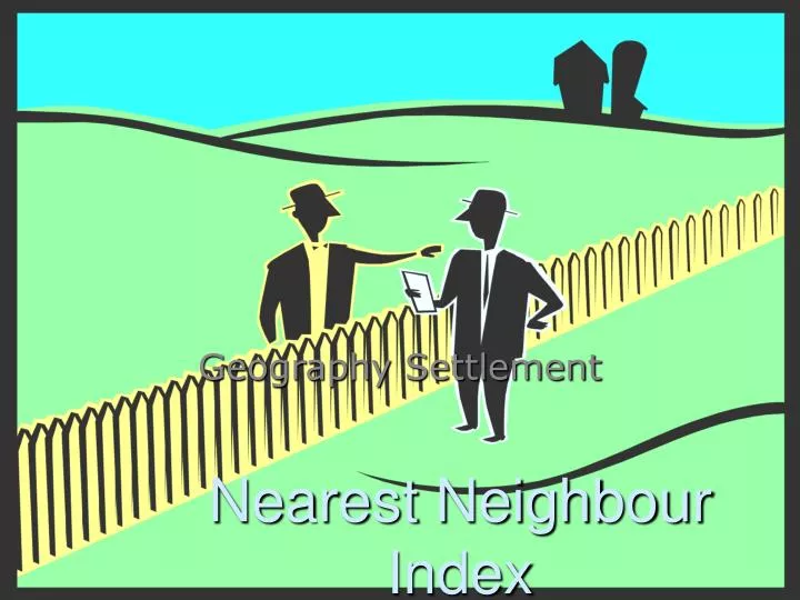
Nearest Neighbour Index. Geography Settlement. What is it?. X. X. X. X. X. X. X. X. X. X. X. X. X. X. X. X. X. Rn=2.15. Rn=0.0. Rn=1.0. X. X. X. X. X. Linear Clustering (nucleated) random regluar-uniform

E N D
Nearest Neighbour Index Geography Settlement
What is it? X X X X X X X X X X X X X X X X X Rn=2.15 Rn=0.0 Rn=1.0 X X X X X Linear Clustering (nucleated) random regluar-uniform ______________________________________________ tendency towards clustering tendency towards regularirty Rn=0.0 Rn=1.0 Rn=2.15 Indicates spatial distribution of area-from average distance between each point and nearest neighbour 3 types of pattern: Regular Clustered Random
Formula _ _ • Rn=2D (N) A • D: average distance between each point & its nearest neighbour [d=each individual distance] (take all the distances between the points and find the mean) • N: number of studied points • A: size of the studied area (total area)
Example 1-flat land _ Total distance=25.7 Area= 100km2 # of villages=12 Rn=2D (N/A) 2D :25.7/12=2.14*2=4.28 Rn=4.28(12/100) =1.48 regular A lot of free land on flat plains
Example 2-hilly land Total distance(average)= Area= 100km2 # of villages=23 Rn=0.536
Drawbacks ‘straight line assumption’: on a map the distances through mountains not considered Where do you measure from? How do you determine the centre of the settlement exactly? Measure distance by road/straight line? What settlements to include? Size limit? Controlling factors e.g. Soil type, relief
Practical use? Comparison of distributions-quantifiable measure of a distribution pattern