Download
1 / 1
10 likes | 208 Vues
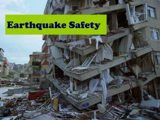
EGU2014-12984. Bignami C. 1 , Stramondo S. 1 , Pierdicca N. 2 and the APhoRISM partners. 1 Istituto Nazionale di Geofisica e Vulcanologia, Rome, Italy 2 Sapienza University of Rome. INTRODUCTION

E N D
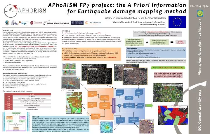
EGU2014-12984 Bignami C.1, StramondoS.1, Pierdicca N.2 and the APhoRISM partners 1 Istituto Nazionale di Geofisica e Vulcanologia, Rome, Italy 2 Sapienza University of Rome INTRODUCTION The APhoRISM – Advanced PRocedure for volcanIc and Seismic Monitoring - project is an FP7 funded project, which aims at developing and testing two new methods to combine Earth Observation satellite data from different sensors, and ground data for seismic and volcanic risk management. The objective is to demonstrate that this two types of data, appropriately managed and integrated, can provide new improved products useful for seismic and volcanic crisis management. One of the two methods deals with earthquakes, and it concerns the generation of maps to address the detection and estimate of damage caused by a seism. The method is named APE – A Priori information for Earthquake damage mapping. The use of satellite data to investigate earthquake damages is not an innovative issue. Indeed, a wide literature and projects have addressed and focused such issue, but usually the proposed approaches are only based on change detection techniques and/or classifications algorithms. The novelty of APhoRISM-APE relies on the exploitation of a priori information derived by: - InSAR time series to measure surface movements - shakemaps obtained from seismological data - vulnerability information. This a priori information is then integrated with change detection map from earth observation satellite sensors (either Optical or Synthetic Aperture Radar) to improve accuracy and to limit false alarms. • APE METHOD • The A Priori information for Earthquake damage product: APE • is a new procedure providing maps of damage occurred during earthquakes • to address the detection, analysis and estimate of changes to buildings and infrastructures • APE aims at reducing false alarms on satellite change detection maps, which originate from different factors (e.g. shadows and sun illumination in optical images, changes in looking angle, and speckle in SAR images) Core of the method: integration of a-priori information and change detection by satellite images (optical and/or SAR) The buildings vulnerability can be accounted in the APE method SAR time series and geological maps to derive the soil vulnerability of the exposed areas shakemaps and ground accelerations from seismological analysis a-priori information APhoRISM FP7 project: the A Priori information for Earthquake damage mapping method • The crises phase • In the crises phase, i.e., soon after the seismic event, change detection maps are calculated by exploiting satellite images • SAR and/or Very High Resolution optical data • and • Shakemaps complete the a priori information layer • The preparedness phase • APE method defines a pre-earthquake scenario (preparedness phase ): • InSAR velocity map is generated by means of Persistent Scatterers Interferometry (PSI), coupled with geological information to obtain the soil vulnerability • In addition, building vulnerabilitycan be used to the finalization of the Vulnerability Scenario • Change detection maps and a-priori information are fused. A dedicated algorithm will be developed during project lifetime Pre-seismic image Pre-seismic image Outcome: LIDaM – Likelihood Index Damage Map Post-seismic image Post-seismic image EGU General Assembly 2014 Vienna, Austria, 27 April – 02 May 2014 • City blocks scale map or single building scale map can be provided depending on the resolution of available satellite images. APhoRISM consortium and structures The project consortium is composed by 7 partners from 5 European Countries IstitutoNazionale di Geofisica e Vulcanologia, Project Leader, Italy Centre Tecnològic de Telecomunicacions de Catalunya, Spain Bureau de Recherches Géologiques et Minières, France Sapienza University of Rome, Italy Gamma Remote Sensing Research and Consulting AG, Switzerland Univerisy OF Oxford, United Kingdom ALMA Sistemi, Italy The projects is structured in 8 Work Packages: Example of single building scale damage map Example of city blocks scale damage map TEST CASE The APE methods will be tested on L’Aquila 2009 earthquake. It has been selected because of the very large number of available data: SAR data have been acquired covering the time span 1992-2011; Very High Resolution optical images from Ikonos and Quickbird satellites are available all over the epicentral region; ground measurements, seismological and geodetic data from national seismic and GPS networks can be considered; site effects campaigns and microzonationdata have been acquired during recent years. Once the procedure has been properly developed and applied to the L’Aquila test site, it is expected to perform a further validation test in a second site