Download

1 / 49
490 likes | 580 Vues
Soil-choked Riprap covered with Erosion Control Blanket (ECB), & planted with native trees & shrubs through the ECB.

E N D
Soil-choked Riprap covered with Erosion Control Blanket (ECB), & planted with native trees & shrubs through the ECB
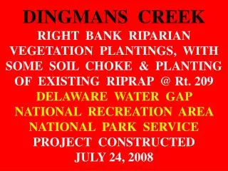
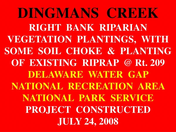
Riprap to top bank was soil-choked, seeded, covered with a 100% coir 700 grams/ sq. meter series Erosion Control Blanket (ECB), & five species of container native trees & shrubs planted through the ECB. Toe protection was LPSTP and Single Stone Bendway Weirs.
Cutting coir blanket to length plus close-up. This is a 700 series (700 grams per sq. meter blanket. Heavy& tough. Traps soil & seed well, sticks in dirt when wet, open weave, can be reseeded if needed CONSTRUCTION DELAWARE RIVER-SITE 6-PIX BY DERRICK 9-12-2009
SITE 2-B: BANK STABILIZATION TO PROTECT A COUNTY OWNED HIGHWAY, BUSHKILL, PA.DELAWARE WATER GAP NATIONAL RECREATION AREA NATIONAL PARK SERVICE PROJECT CONSTRUCTED SEPTEMBER 19-22, 2009
PROBLEMS • A severe attack angle caused by planform geometry & a transverse bar that directs the flow of Bushkill Creek into the left descending bank just downstream of Site 2-A had eroded the left descending bank dangerously close to a county-maintained two lane highway. The project is 255 ft long. In places the stream was within 15 ft of the road. The bank was steep in this area with the high velocity thalweg immediately at the toe. In some areas a single row of mature trees attempted to hold the bank together, in other areas trees were absence or dead.
Aerial view of project area with work limits delineated. Courtesy of Ecological Restoration, Inc
PRE-PROJECT PHOTOS by Dave Derrick Dec. 16, 2008(HIGH WATER) & Sept 9, 2009
HIGH WATER-Looking DS @ flow attack into Site 2-B. PRE-PROJECT BUSHKILL CR-SITE 2-B PIX BY DERRICK 12-16-2008
Looking DS @ left bank (entire length of project) PRE-PROJECT BUSHKILL CR-SITE 2-B PIX BY DERRICK 9-9-2009
Looking DS @ left bank. Flow into upper end of project PRE-PROJECT BUSHKILL CR-SITE 2-B PIX BY DERRICK 9-9-2009
SOLUTIONS (THE PLAN) • The upstream section has 210 ft of Longitudinal Peaked Stone Toe Protection (LPSTP), applied at a rate of 2 tons/ft as a resistive toe protection. Vines were planted to cover the LPSTP stone. Keyed into the LPSTP are 9 Single or Double Stone Bendway Weirs, spaced approx. 30 ft apart. The downstream 45 ft of the project has two Bendway Weirs & 7 Traffic Control Stones. Four keys anchor the entire project, with two keys designed as stairs for fisherman access. Above the entire length of LPSTP is a row of willow & dogwood poles (brush layer). The upstream 85 ft has riprap applied up to top bank, then soil-choked & encapsulated with a 100% coir, 700 grams/sq. meter Erosion Control Blanket (ECB). Five species of trees and shrubs were planted through the ECB. The downstream 125 ft of LPSTP has the single brush layer & about 2 ft of ECB encapsulated earth, with the mid & upper bank sloped & planted with dozens of rooted-stock trees & shrubs.
Soil-choked & planted riprap to top bank in pink area-85 ft wide Courtesy of Ecological Restoration, Inc.
This is typical protection US & DS of the Soil-choked Riprap protection Courtesy of Ecological Restoration, Inc.
PLANTS PLANTED Common Name # Size • Cottonwood 30 in tree bands (small pots) • Sycamore 10 2 gallon fiber pots • Silver Maple 10 2 gallon pots • Red Oak 10 3 gallon pots • Silky Dogwood 500 bare root • Black Willow 250 bare root • Ninebark 233 bare root • Virginia Creeper 52 cuttings • Rhododendron 25 3 gallon pots
Looking US @ large stone for Single & Double Stone Bendway Weirs. No room for construction! CONSTRUCTION BUSHKILL CR-SITE 2-B PIX BY DERRICK 9-22-2009
Looking US @ completed LPSTP toe protection near DS end. Valuable trees untouched. Single Stone Bendway Weir CONSTRUCTION BUSHKILL CR-SITE 2-B PIX BY DERRICK 9-22-2009
Looking US @ thalweg controlled by Bendway Weirs, note dead water near bank. CONSTRUCTION BUSHKILL CR-SITE 2-B PIX BY DERRICK 9-22-2009
The local county road supervisor was worried that the section of bank that was impacted the most by flow would erode (upper section of project), so in response to his concerns, a blanket of riprap 85 ft wide was applied up to top bank (riprap applied above the LPSTP). Riprap was soil-choked, covered with a 100% coir 700 grams/ sq. meter series Erosion Control Blanket (ECB), & five species of container native trees & shrubs planted through the ECB
Bushkill Creek, Delaware Water Gap, PA Slope bank. A balanced cut/fill in all sections. Backfill anchors the ECB at toe. CUT Erosion Control Blanket FILL Live Siltation Bendway Weir LPSTP
Bushkill Creek, Delaware Water Gap, PA 85 ft wide blanket of riprap applied from LPSTP & Live Siltation up to top of bank.
Bushkill Creek, Delaware Water Gap, PA Soil-choke riprap to top of bank.
Bushkill Creek, Delaware Water Gap, PA Seed all soil-choke soil.
Riprap to top bank, then soil-choked. Leah is spreading grass seed. The local road super was worried about the impact zone eroding, so riprap to top bank. CONSTRUCTION BUSHKILL CR-SITE 2-B PIX BY DERRICK 9-22-2009
Bushkill Creek, Delaware Water Gap, PA Install Erosion Control Blanket, dig key at top bank to anchor ECB
Looking US. Upper end of ECB tucked into key trench. CONSTRUCTION BUSHKILL CR-SITE 2-B PIX BY DERRICK 9-22-2009
Looking US. Backfilling the uphill ECB anchor trench CONSTRUCTION BUSHKILL CR-SITE 2-B PIX BY DERRICK 9-22-2009
Looking US. Backfilling the uphill ECB anchor trench CONSTRUCTION BUSHKILL CR-SITE 2-B PIX BY DERRICK 9-22-2009
Bushkill Creek, Delaware Water Gap, PA Install rooted stock plants through ECB as appropriate
CONSTRUCTION COMPLETE-Looking downhill @ the soil-choked riprap with Erosion Control Blanket cover & rooted plants CONSTRUCTION BUSHKILL CR-SITE 2-B PIX BY DERRICK 9-25-2009
CONSTRUCTION COMPLETE-Looking at the ECB uphill key. ECB was trenched in, then backfilled with soil & stone. CONSTRUCTION BUSHKILL CR-SITE 2-B PIX BY DERRICK 9-25-2009
CONSTRUCTION COMPLETE-Looking DS @ flow into Site 2-B. Upstream key & US end of project. Riprap area is covered by the tan Erosion Control Blanket. CONSTRUCTION BUSHKILL CR-SITE 2-B PIX BY DERRICK 9-25-2009
CONSTRUCTION COMPLETE-LPSTP with Live Siltation, Single-Stone Bendway Weirs, ECB with riprap to top bank with soil-choke & tree & shrub rooted-stock plantings CONSTRUCTION BUSHKILL CR-SITE 2-B PIX BY DERRICK 9-25-2009
CONSTRUCTION COMPLETE-LPSTP with Live Siltation, Single-Stone Bendway Weirs, ECB with riprap to top bank with soil-choke & tree & shrub rooted-stock plantings. Note dead water near bank due to Bendway Weirs Soil-Choked Riprap CONSTRUCTION BUSHKILL CR-SITE 2-B PIX BY DERRICK 9-25-2009
CONSTRUCTION COMPLETE-Looking @ the DS half of the project Soil-Choked Riprap CONSTRUCTION BUSHKILL CR-SITE 2-B PIX BY DERRICK 9-25-2009
1 YEAR AFTER PROJECT COMPLETION Photos by Dave DerrickSEPT. 12, 2010
1 YEAR LATER-Looking DS @ mid-project area. LPSTP, Bendway Weirs, Soil-Choked Riprap & many plantings Soil-Choked Riprap 1 YEAR LATER-BUSHKILL CR-SITE 2-B - DERRICK 9-12-2010
1 YEAR LATER-Looking US @ the transverse bar directing flow into the formerly eroding bank. Riprap with soil choke encapsulated with ECB with plantings. 1 YEAR LATER-BUSHKILL CR-SITE 2-B - DERRICK 9-12-2010
1 YEAR LATER-Looking @ section covered by full bank riprap, then soiled, seeded, & covered by Erosion Control Blanket (ECB) 1 YEAR LATER-BUSHKILL CR-SITE 2-B - DERRICK 9-12-2010
14 MONTHS AFTER PROJECT COMPLETIONHIGH WATERPhotos by Derrick Nov. 4, 2010
HIGH WATER-Looking @ the US end of Site 2-B. Soil-choked riprap. Water is redirected by the transverse bar toward the project (US arrows), but then redirected again by the Bendway Weirs (SSBW), DS arrow. 14 MONTHS LATER-BUSHKILL CR-SITE 2-B - DERRICK 11-4-2010
HIGH WATER-All of the bank in this picture is rip rapped to top bank, soil-choked, seeded, & covered with a 700 series, 100% coir, 100% degradable, Erosion Control Blanket then container plants were installed. 14 MONTHS LATER-BUSHKILL CR-SITE 2-B - DERRICK 11-4-2010
HIGH WATER-Close-up looking @ soil-choked riprap with Erosion Control Blanket & plantings. 14 MONTHS LATER-BUSHKILL CR-SITE 2-B - DERRICK 11-4-2010
HIGH WATER-Close-up looking @ soil-choked riprap with Erosion Control Blanket & plantings. 14 MONTHS LATER-BUSHKILL CR-SITE 2-B - DERRICK 11-4-2010