Download
1 / 9
90 likes | 167 Vues
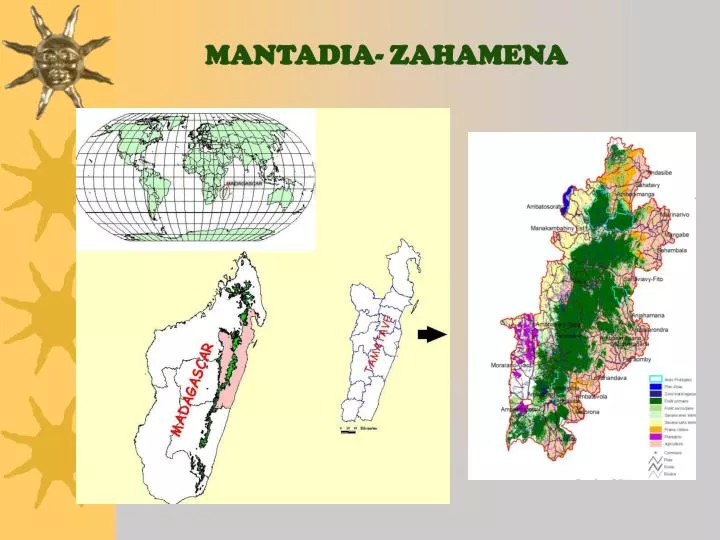
MANTADIA- ZAHAMENA. Deforestation across elevation Between 1974 and 1994: around 90% of forest <800 m are lost Between 1990-2000: 0-800 m – 17.8% of the remaining forest are lost 800-1200 m – 5% 1200-1600 m - <1%. Forest logging Few direct impact of forest extraction on biodiversity

E N D
Deforestation across elevation • Between 1974 and 1994: around 90% of forest <800 m are lost • Between 1990-2000: • 0-800 m – 17.8% of the remaining forest are lost • 800-1200 m – 5% • 1200-1600 m - <1% • Forest logging • Few direct impact of forest extraction on biodiversity • Major impacts in the short and medium term • Open up deforestation by local people • Rapid expansion of invasive plant species impeding regeneration of high economic valued species • Mining:small illegal mining activities and 4 companies • Hunting:very few data, but in reserves Indri and Varecia populations are abundant compared to other sites CONTEXT OF ZAHAMENA-MANTADIA Corridor area: 540,000 ha No. Population: ~800,000 Population density: 46 inhabitants/ km2
CONTEXT ANALYSIS IN ZAHAMENA-MANTADIA • Durban Vision implementation- Conservation Sites • Design the logical framework to understand links between socio-economic factors and deforestation: issue, factors, changes, data requirement. • Collection and compilation of existing biological and socio-economic data with partners • Identification of gaps of information: RAP • Gap analysis, spatial analysis, participatory appraisal • Combine biological, geographic and economic data layers • Assess the landscape scenarios with associated biodiversity and economic values
CONTEXT ANALYSIS PRODUCTS • Priority zones for conservation are identified, with management rules and options for each zone to achieve conservation goals • Deforestation trends are projected in the future • Opportunity costs and benefits of conservation alternatives are assessed • Landscape scenarios with associated biodiversity and economic values are evaluated
KEY QUESTIONS • Where should the core conservation zone be? => value of biodiversity and ecological services • Where the deforestation rate is the highest in Zahamena-Mantadia ? => vulnerable sites • What and where do ecological function benefits come from, and who received them? => cost-benefit analysis • What management scenarios and rules do we need in order to conserve biodiversity of the highest value across the corridor? => biological and economic criteria
DATA LAYERS Land use and forest cover Population density Roads Watersheds DEM Protected areas Mining Vulnerable sites Core Conservation sites MCE Analysis
DATA CONSOLIDATION • Business-As-Usual : Cellular Automata Algorithm projects forest cover in 30 years • MCE: Integrate and correlate socioeconomic variables affecting deforestation and agricultural activities • Economic analysis of hydrological benefits of watersheds • Cost-benefit analysis of forest management transfer to communities • Evaluation of economic impacts from community-based ecotourism • Development of sustainable and cost-effective management scenarios
HURDLES AND AH-HAS • Difficulties: • Lack of data at communal and village level to refine planning process: need for RAP and RACE • Tamarin modeling needs to be adapted to the current Site de Conservation establishment process • Mechanism for transferring conservation benefits to downstream populations should be designed and implemented • Innovative and helpful analysis: • Analysis of risks of erosion • Contribution to the refining of preliminary forest zoning maps
Chefs de Region Decision-making Platform of coordination Corridor Management Consolidation Regional Planning Communal Planning USAID Alliance Local Communities and village Associations Information- concertation ENGAGEMENT of STAKEHOLDERS Regional Development Committees • Authorities at provincial, regional and local level • Environment, Water and Forest departments • Local NGOs • Private sectors