Download
1 / 24
240 likes | 407 Vues
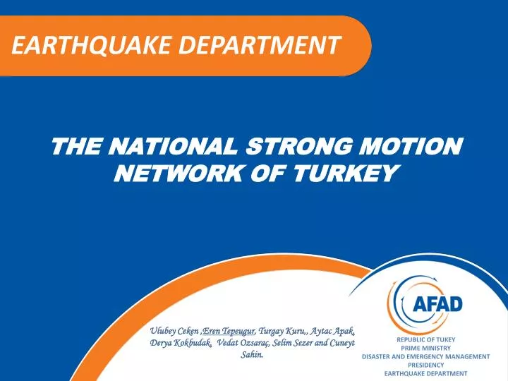
EARTHQUAKE DEPARTMENT. THE NATIONAL STRONG MOT I ON NETWORK OF TURKEY. Ulubey Ceken , Eren Tepeugur , Turgay Kuru,, Aytac Apak, Derya Kokbudak , Vedat Ozsaraç , Selim Sezer and Cuneyt Sahin. REPUBLIC OF TUKEY PRIME MINISTRY DISASTER AND EMERGENCY MANAGEMENT PRESIDENCY

E N D
EARTHQUAKE DEPARTMENT THE NATIONAL STRONG MOTION NETWORK OF TURKEY Ulubey Ceken ,Eren Tepeugur, Turgay Kuru,, Aytac Apak, Derya Kokbudak, Vedat Ozsaraç, Selim Sezer andCuneytSahin. REPUBLIC OF TUKEY PRIME MINISTRY DISASTER AND EMERGENCY MANAGEMENT PRESIDENCY EARTHQUAKE DEPARTMENT
HISTORY OF STRONG MOTION NETWORK The National Strong Motion Network of Turkey was established in 1973. Once, all stations were analog as the then-available technology. After 1993, digital accelerometers were added to the Network. Today, thanks to the technology, data has been achieved real time and high quality due to increasing number of stations rapidly. SM Network in Turkeyhas been operated by «The Republic of Turkey, Prime Ministry, Disaster Emergency Management Presidency, Earthquake Department» . REPUBLIC OF TURKEY PRIME MINISTRY DISASTER AND EMERGENCY MANAGEMENT PRESIDENCY EARTHQUAKE DEPARTMENT
MAIN GOALS OF STRONG MOTION NETWORK REPUBLIC OF TURKEY PRIME MINISTRY DISASTER AND EMERGENCY MANAGEMENT PRESIDENCY EARTHQUAKE DEPARTMENT
OVERVİEW • The SM Networkconsist of387 strong-motion observation stations with spacing of 50 km. • There are 5 different model digital accelerometers in the network. REPUBLIC OF TURKEY PRIME MINISTRY DISASTER AND EMERGENCY MANAGEMENT PRESIDENCY EARTHQUAKE DEPARTMENT
OVERVİEW The accelerometers are generally installed on the North Anatolian Fault System (NAFS), East Anatolian Fault System (EAFS) and Aegean Graben System where the big earthquakes occurred or the expected active areas. REPUBLIC OF TURKEY PRIME MINISTRY DISASTER AND EMERGENCY MANAGEMENT PRESIDENCY EARTHQUAKE DEPARTMENT
LOCAL NETWORKS Local networks are established with specific geometrical arrays on active fault systems in order to observe seismic activity closely. REPUBLIC OF TURKEY PRIME MINISTRY DISASTER AND EMERGENCY MANAGEMENT PRESIDENCY EARTHQUAKE DEPARTMENT
LOCAL NETWORKS An Example of local networks: IZMIR-NET established by the context of “Modelling Of Seismic Site Response For Earthquake Resistant Structural Design in İzmir Metropolitan Area and Aliağa-Menemen Districts” Project REPUBLIC OF TURKEY PRIME MINISTRY DISASTER AND EMERGENCY MANAGEMENT PRESIDENCY EARTHQUAKE DEPARTMENT
ACCELEROMETER STATIONS The instruments are located in governmental buildings area owing to being safety and ease of maintenance. These instruments are installed in the containers as free fields. • While installing, • Active tectonic lines, • Population of cities and the density of building, • Different geological structures, • Energy lines, • Communication, • Security, • Environmental noise, • Transportation etc. • conditions are considered. REPUBLIC OF TURKEY PRIME MINISTRY DISASTER AND EMERGENCY MANAGEMENT PRESIDENCY EARTHQUAKE DEPARTMENT
Base-concrete of containers is (220cmx220cmx30cm) • The middle-concrete thataccelerometersaremounted is (40cmx40cm x60cm) • Half of middle-concrete is on the ground and the other half is under the ground. • There is 20cm space between base and the middle- concrete. Space between them is full of mixture of sand-grovel. REPUBLIC OF TURKEY PRIME MINISTRY DISASTER AND EMERGENCY MANAGEMENT PRESIDENCY EARTHQUAKE DEPARTMENT
SITE INVESTIGETIONS The local site conditions of stations were obtained by in-situ geotechnical and geophysical surveys. VS30 measurementswith MASW profile (100 m) Borehole (30m) REPUBLIC OF TURKEY PRIME MINISTRY DISASTER AND EMERGENCY MANAGEMENT PRESIDENCY EARTHQUAKE DEPARTMENT
The average of shear-wave velocity for upper 30m soil layer (VS30) is obtained at the each strong-motion site thanks to multi-channel analysis of surface waves (MASW),which is used for defining of soil classification. REPUBLIC OF TURKEY PRIME MINISTRY DISASTER AND EMERGENCY MANAGEMENT PRESIDENCY EARTHQUAKE DEPARTMENT
Concerned researcher can provide « Station Information Form» over the Internet through this search engine . REPUBLIC OF TURKEY PRIME MINISTRY DISASTER AND EMERGENCY MANAGEMENT PRESIDENCY EARTHQUAKE DEPARTMENT
COMMUNICATION • Data is transmited to the central office as continuous or trigger mode with communication instruments (Dial-up, Internet, ADSL, GPRS/EDGE). • Data is submitted to users through main server after process. REPUBLIC OF TURKEY PRIME MINISTRY DISASTER AND EMERGENCY MANAGEMENT PRESIDENCY EARTHQUAKE DEPARTMENT
TYPES of ACCELEROMETER There are 5 digital different type of accelerometers in the network. All of them have three component acceleration sensors . QDR, modified from SMA-1, has 12 bits resolution. SMACH has 72 dB sensitivity and 12 bits digital converter. REPUBLIC OF TURKEY PRIME MINISTRY DISASTER AND EMERGENCY MANAGEMENT PRESIDENCY EARTHQUAKE DEPARTMENT
TYPES of ACCELEROMETER GSR type accelerometers have 16 and 18 bits digital converter. ETNA type records have 18 bits resolution. CMG-5TD is an integrated DM-24 high resolution digitizer. REPUBLIC OF TURKEY PRIME MINISTRY DISASTER AND EMERGENCY MANAGEMENT PRESIDENCY EARTHQUAKE DEPARTMENT
DATA CENTER The data management center is located in Ankara. MAIN SERVER DATA CENTER REPUBLIC OF TURKEY PRIME MINISTRY DISASTER AND EMERGENCY MANAGEMENT PRESIDENCY EARTHQUAKE DEPARTMENT
DATA PROCESS Windows-based software (USDP) wasdevelopedduringtheprojectforthefilterprocess (AkkarandBommer, 2006) of records in thedatabase. Withintheframework of theprojectentitled “Compilation of The National Strong Motion Network Database According to International Standart“, 3000 eventsand 4600 rawaccelerometric data (between1976 and 2007) is prosesseduniformlywith a consistentmethodologythroughthe software called USDP (Utility Software for Data Processing) . Elasticspectralparameters of allrecordswasalsodeterminedforresearchersbyusingthesamefiltermethod. REPUBLIC OF TURKEY PRIME MINISTRY DISASTER AND EMERGENCY MANAGEMENT PRESIDENCY EARTHQUAKE DEPARTMENT
DATA FORMAT Itis possible to be reached to all of accelerograms for researcher since the establishment of Turkish National Strong Motion (1973). An example of file names is Date(yyyymmdd)+time(hhmmss)+abbreviation of the station (1201)(ex.20030501002704_1201). All data are ASCII format as seen figure. REPUBLIC OF TURKEY PRIME MINISTRY DISASTER AND EMERGENCY MANAGEMENT PRESIDENCY EARTHQUAKE DEPARTMENT All data are ASCII format as seen figure.
DATA FORMAT • In the header information there are three components of acceleration data like; N-S(North-South), E-W(East-West) and U-D(up-down). • Sample intervals foreach records can be found beneath the header "SAMPLE INTERVAL". • Set-off correction process is applied for untreated data . Unit of all acceleration data iscm/sn2 (gal). • Untilnow, Therehavebeenabout7600 acceleration records, which are presented via Internet to all researchers and scientific areas. REPUBLIC OF TURKEY PRIME MINISTRY DISASTER AND EMERGENCY MANAGEMENT PRESIDENCY EARTHQUAKE DEPARTMENT
PROJECTS REPUBLIC OF TURKEY PRIME MINISTRY DISASTER AND EMERGENCY MANAGEMENT PRESIDENCY EARTHQUAKE DEPARTMENT
User Interfaces WEB PAGE Web Page of our system is http://kyh.deprem.gov.tr Daily strong motion records, Earthquake Reports ( M4), Station Information and their maps are always up to date. Ifearthquakepoint on themap is clicked, event page opens Detailed Special Reports are also published after the destructive earthquake occurred. REPUBLIC OF TURKEY PRIME MINISTRY DISASTER AND EMERGENCY MANAGEMENT PRESIDENCY EARTHQUAKE DEPARTMENT
WEB PAGE Users can provide byusing search engine about the station or earthquake information and then they can download the Raw Data. Users can find data from a particular station by going to the station pages Users can download all data easly REPUBLIC OF TURKEY PRIME MINISTRY DISASTER AND EMERGENCY MANAGEMENT PRESIDENCY EARTHQUAKE DEPARTMENT
TARGETS • At the beginning of 2013, it is aimed to have 450 stations in the network. Furthermore, total station number will be 1000 until 2023. • To increase the number of local or regional array, • To implement shake and intensity maps, • Strong-motion indexes such as real-time intensity, acceleration, velocity, displacement, and response spectra are continuouslyand automaticallyto be calculated to utilize for seismic hazard analysis • To review processed accelerograms in order to produce data beinguniform and NGA standards • To develop attenuation relationships at theregional and country scale, • Local geology and Vs profile of all stations will be completed. REPUBLIC OF TURKEY PRIME MINISTRY DISASTER AND EMERGENCY MANAGEMENT PRESIDENCY EARTHQUAKE DEPARTMENT
Thank You ! A view of İstanbul