Download
1 / 52
530 likes | 1.02k Vues
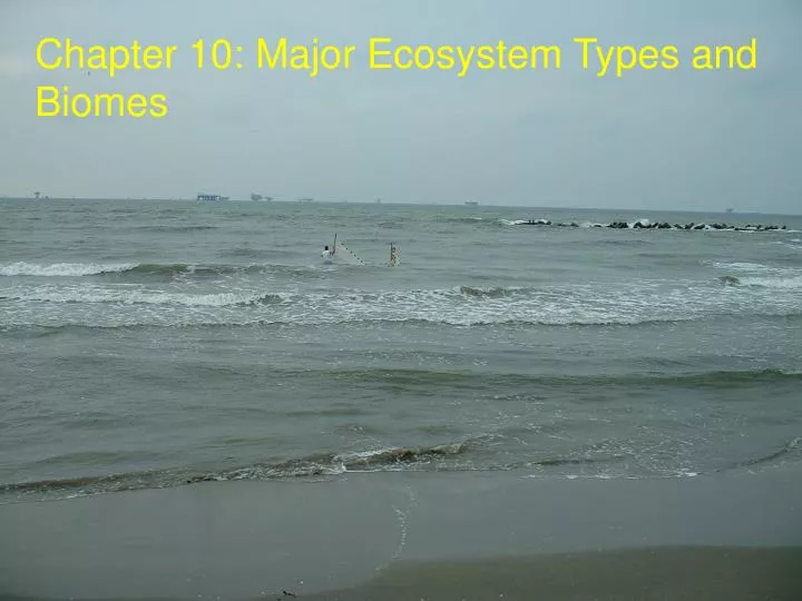
Chapter 10: Major Ecosystem Types and Biomes. Marine Open Ocean (pelagic) Continental Shelf (Inshore Waters) Upwelling regions Deep sea hydrothermal vents Estuaries Fresh Water Lakes and Ponds ( Lentic ; standing water) Rivers and Streams ( Lotic ; flowing water)

E N D
Marine Open Ocean (pelagic) Continental Shelf (Inshore Waters) Upwelling regions Deep sea hydrothermal vents Estuaries Fresh Water Lakes and Ponds (Lentic; standing water) Rivers and Streams (Lotic; flowing water) Wetlands (Seasonally inundated) Aquatic Biomes
Continental Shelf – the portion of the continental plate that lies submerged under the ocean. • Usually has a gentle slope • Width can vary from a few to ten kilometers • Continental Slope – that area that drops from the continental shelf to the full depth of the ocean floor. Oceans
Oceans Oceanic zone – any portion of the ocean beyond the continental shelf. Neritic zone – section of ocean that lies over the continental shelf. Littoral zone – shoreline between the high and low tide marks.
Oceans Photic Zone – area of water that sunlight penetrates Aphotic zone – area of water that sunlight does not penetrate
Oceans Thermocline – vertical area where temperature abruptly changes; restricts the mixing of upper and lower water masses.
Open Ocean • Salinity averages 35 ppt (full strength sea water). • Due to high concentrations of sodium and chloride • Ocean is more than NaCl and water, but most ocean waters are very poor in nutrients • Phosphate, nitrate, ammonium, iron • Oceans cover ~71% of Earth, but only account for 50% of the Earth’s primary production. • Biological deserts not limited by water, but by nutrients • Unlike terrestrial biomes, production is not higher at equator and lower at the tropics –respond to nutrient concentrations like upwellings.
Upwelling Productivity • Primary production dependent on nutrients brought from the ocean depths. • This is a function of ocean currents driven by wind pattern and the Earth’s rotation • A disturbance to wind patterns can affect the primary production of upwellings, which can have an effect ‘up the food chain.’
Oceans: Coastal regions • Coastal regions are much more productive than non-coastal areas. • Rich nutrient input from coastal rivers • Most of the worlds great fisheries come from the continental shelf • Too many nutrients can lead to algal blooms, which may deoxygenate the water (eutrophication) Dead zones
Chemoautotrophic Organisms • Photosynthetic organisms are labeled as autotrophs, specifically phototrophs. • Organisms that are able to harvest energy from inorganic compounds without photosynthesis are called chemoautotrophs. • Usually sulfur-oxidizing (harvesting energy rich electrons from sulfur compounds) organisms
Colorful crab perched on top of a large tubeworm cluster at GC 354, depth 532 m. This community was first discovered on this MMS/LSU subdive, August 24, 2000 Chemosynthetic Communities Organisms use organic material seeping from the ocean floor as an energy source http://www.gomr.mms.gov/homepg/regulate/environ/chemo/chemo.html
Symbiotic Relationships • Consumer organisms found in chemosynthetic communities rely on a symbiotic relationship with chemoautotrophic bacteria. • Consumer organisms must take up inorganic carbon (CO2) and sulfides and get rid of the bacterial waste. • The bacteria are able to capture energy (oxidize) from the sulfides to reduce carbon dioxide (primary production). • Consumers then absorb nutrients from the bacteria! • Consumer organisms do not have a mouth or gut!
Estuaries • Where the river meets the sea • Sometimes classified freshwater, sometimes classified marine • Most productive biome on Earth • Support a diverse fauna • Serve as nursery habitat for many organisms.
Marsh Types • Fresh water marsh salinity < 1.0 ppt. • Plants are not salt tolerant and include maidencane, bulltongue, alligatorweed, cattails, and spikerush • Intermediate marsh salinity averages 3.3 ppt. • Plants are slightly salt tolerant and include spikerush, three-corner grass, arrowhead, cordgrass, wiregrass, roseau cane, and deer pea • Brackish marsh salinity averages about 8 ppt. • typically dominated by cordgrass or wiregrass • Salt marsh salinity averages about 16 ppt. • oyster grass is common, but few other plant species can survive
Lake / Pond Spatial Zones • Littoral – Edge area • Limnetic – Open area • Profundal – deep water (heterotrophs) • Benthic - bottom
Lake/Pond Temperature Zones Warmer Cooler
Rivers and Streams • Generally represent the excess of precipitation on land areas over evaporation from them. • Precipitation that falls is either evaporated, transpirated, enters the ground water supply, or flows down rivers • Flow is down-hill and varies seasonally • Related to rainfall and ice/snow melt • Beginning of a river = the source and the end of a river = the mouth • Discharge - volume of water passing a given point during a period of time • Channel Width X Depth X Velocity
Rivers and Streams • Flow velocity is important in determining abiotic and biotic components. • Flow related to slope and precipitation • Sediment type, current strength • Only certain organisms can withstand strong flow • The faster the flow, the more material can be transported in the water • Materials are transported by running water in three principal states • Dissolved matter • Suspended solids • Bed load
1 1 1 1 2 2 1 2 3 Stream Order – Strahler Method Stream Order Used to classify a stream in relation to tributaries, drainage area, total length, and age of water. 1 1 = 2 1 2 = 2 2 2 = 3 1 3 = 3 2 3 = 3 3 3 = 4 Mississippi River is classified as a 10th or 12th order stream. Headwater stream classification matters
Tundra • Windswept expanses where nothing stands taller than grasses and sedges. • Average temperature is -5°C. • Water is held as ice for most of the year; growing season is from May to August • Plant growth is inhibited • Decomposition and nutrient cycling is very slow; soils are rich in organic matter • Each year, only the top meter defrosts, below that the ground remains frozen year round - Permafrost
Tundra • The organic rich soil in the tundra called peat. • Due to the short growing season, all growth and reproduction must happen in a short period. • Young shoots are thus loaded with nutrients • Makes good grazing • Food is so abundant at this time that wading birds, ducks, geese and swans commonly migrate to the tundra; herds of caribou and reindeer arrive and support biting flies, midges, and mosquitoes. • Insects spend the winter as eggs, larvae or pupae. • Birds usually feast on the abundant newly-hatched insects
Tundra • Although there are a lot of individual birds, mammals, and insects, there are not many types of species. • Few plant species have evolved to withstand the harsh tundra climate. • Tundra has a low species diversity (# of species) • Naturally low diversity does not mean unimportant. • Tundra is essential to the well-being of animals such as ducks, geese, seals, polar bears, and caribou • Recovery from disturbance takes a long time • Tracks from vehicles are visible for several months
Boreal Forest (Taiga) • Great fir forest of Canada and northern Eurasia. • Vegetation type is defined by seasonal expansion and contraction of the Arctic and continental polar air masses. • Polar air in the winter, continental air in the summer • Very cold winters, relatively warm summers so trees can survive
Boreal Forest (Taiga) • Many trees look like Christmas trees, not oak trees • Shape of tree is related to the ability to shed snow • Broken trees are not good competitors • Leaf morphology is important • Needles are more durable, can photosynthesize year round • conserve heat more efficiently • Boreal forests are low in species diversity, but not as low as tundra
Temperate Forest • Can be divide into evergreen and deciduous forest types. • Generally have a moist cool climate. • Sometimes referred to as temperate rain forests • Evergreen: Contain giant redwoods and Douglas fir • Redwoods can reach 120 m (~360 ft) in height. • High-quality wood makes these forests a valuable timber resource • Old Growth Forest
Temperate Forest (Deciduous) • Hot summers, cool winters (minimum temp rarely < -12C). • Rain is plentiful (75 – 200 cm / yr), long growing season, fertile soil, moderate diversity. • Species include oak, beech and maple. • Produce a new batch of leaves each year • Not as expensive as ‘freeze-proofing’ them • Early spring, a lot of light hits the forest floor and spring ephemerals take advantage of this. • Soils make good farmland and supports good lumber
Prairies and Grasslands • Climatically similar to temperate forests but are dryer. • Precipitation ranges from a low 40 mm (plants seldom grow taller than 0.5m) to a high of 80 cm (plants can grow more than 2 m – tall grass prairie). • Home to numerous herbivores • Grazing is an important ecological factor in these areas • Heat and aridity become important evolutionary factors • Panting, sweating, large ears, evapotranspiration
Prairies and Grasslands • Native grazers prevented any single plant from out competing the others. • Introduced domestic grazers (cattle or sheep for example) have different grazing patterns and the floristic composition has been resorted. • Soils are very rich – America’s bread basket. • Fire is an important component of grasslands. • Some areas may burn every three to five years (lightning) • Keeps trees from becoming established • Stopping these fires can alter the community, allowing trees to grow.
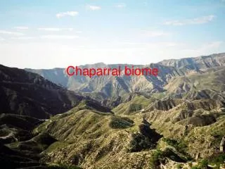
Chaparral • Wet and mild winter climate, dry and mild summer • Found in coastal California, Israel, parts of South America and Australia • Mediterranean climate • The summer drought is what drives this biomes ecology • Plants either limit the water they lose, or gain as much water as possible
Chaparral • Plants can limit water loss by producing small hard green leaves • Hardness due to a waxy outer covering used to prevent water loss • Most of these plants are evergreen, so they can photosynthesize during the wet part of the year • By retaining leaves year round – they are able to take advantage of all rainfall • Plants can gain as much water as possible • Deep tap roots • Extensive root system (bare ground between plants)
Chaparral • Eradication of top predators when these areas are settled leads to a proliferation of herbivores. • Sometimes, native herbivores have been replaced with goats • Goats are indiscriminate browsers and kill many of the plants they eat • Overgrazing has reduced many Mediterranean hillsides to bare rock with very few patches of vegetation • Urbanization in California
Desert • Dry air descends usually at Latitudes 20 – 30 North and 20 – 30 South. • Too dry to support most life forms • Cloudless skies permit wide temperature fluctuations • 50 C during the day, near 0 C at night.
Desert Rainshadow
Desert • Desert animals usually hide from the full strength sun and come out when the temp is lower. • Top predators are usually snakes and lizards – need less water than mammals • Camels have a highly developed nasal structure that prevents water loss and its hair is efficient at reflecting the sun’s heat. • Desert plants can not escape the sun. • Evolution has shaped them to minimize exposure to the sun
Desert • Desert plants are also designed to retain as much water as possible. • Stem and leaves appear to be thick and fleshy, skin very leathery. • Needles create microclimate in still air. • Extensive root network; leaves are recycled
Tropical Forest • Key feature is constant temperature • Average temperature from one month to the other is usually within ± 2C • However, daytime temp may be 34 C during the day and 20 C at night. • Much rain: annual rainfall ranges from 2,000 mm to 15,000 mm (79 – 591 inches; 1.6 inches per day). • Wet and dry seasons • Length of dry season determines the areas ecology
Tropical Forest • Long Dry Season • Dry season = 6-8 months • Many trees drop their leaves during the dry season not to escape cold, but to prevent overheating • Short Dry Season • Dry season < 3 months • Tropical rain forest: 2,300 – 5,000 mm of rain per year (extreme years some places may get 15,000 mm = 50 feet).
Tropical Forest (Rain) • Huge diversity • Perhaps 50 - 75% of all organisms on Earth inhabit theses forests. • Temperate forest may have 20 - 30 tree species per hectare (2.47 acres); rain forests can support more than 350 – 450 tree species per hectare • To fit that many tress each species may only be represented once or twice • Most productive terrestrial biome • High temp, moisture, uninterrupted growing season • Decomposers / nutrient cycling