Download
1 / 22
250 likes | 495 Vues
Groundwater area protection plans in water management. Groundwater areas Groundwater protection methods Protection plans GroPro - Groundwater Protection Plans and Implementation in a North European Perspective Korsør, Denmark 15-17 September 2008

E N D
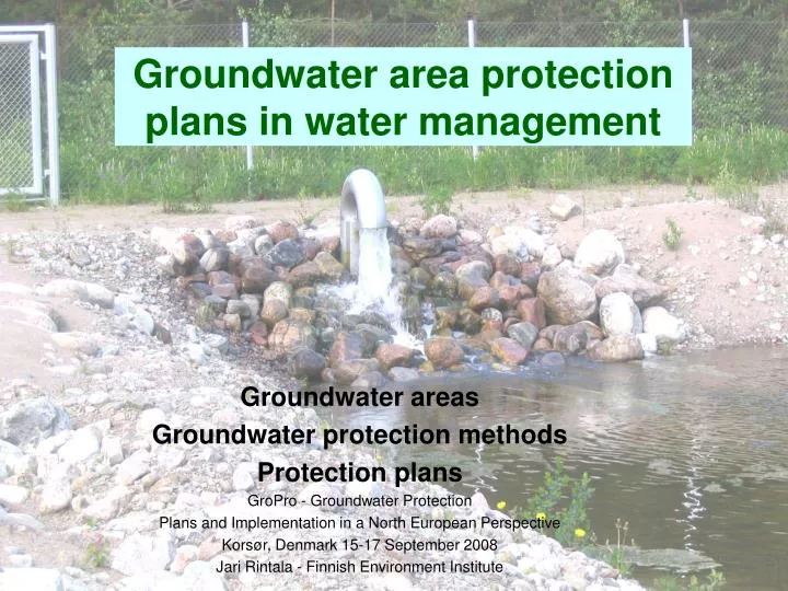
Groundwater area protection plans in water management Groundwater areas Groundwater protection methods Protection plans GroPro - Groundwater Protection Plans and Implementation in a North European Perspective Korsør, Denmark 15-17 September 2008 Jari Rintala - Finnish Environment Institute
Land area 304,000 km2, 6th largest in Europa Population 5.3 milj In the capital city area (incl. suburbs) 1.0 milj Precambrian crystalline bedrock covered with thin layers of quaternary deposit Glaciofluvial sand and gravel formations host the most important aquifers; cover 4 % of total land area Finland
Groundwater accounts for 60% of the water distributed by waterworks The share of groundwater is 100% in a great part of the country Surface water is used as raw water in the biggest cities. E.g. the raw water in Helsinki is led via a 120-kilometer-long rock tunnel from Lake Päijänne 12% is artificially recharged groundwater Around 2000 groundwater intakes Ca. 10 % of the population get their water from their own wells or bedrock boreholes Groundwater supply and utilisation
Groundwater areas have been divided into three classes: Definitions: Class I: groundwater area important for water supply is an aquifer from which 10 or more dwellings obtain their water Class II: groundwater area suitable for water supply areas are suitable for water supply, but for now, these areas are not needed by communities or they are located in sparsely populated areas Class III: other groundwater area more hydrogeological information is needed turn to class I or II or unsuitable for water supply Groundwater areas mapping and classification
Purpose to identify priority areas for groundwater utilization and improve the management of groundwater Information about groundwater area boundaries groundwater divides groundwater volumes in sand and gravel layers estimate direction of groundwater flow Main phase completed in 1995; the classification is still being continously revised as water supply investigations are undertaken Groundwater areas mapping and classification Total number of groundwater areas ca. 6300 2,250 in Class I (area 6,200 km2) 1,500 in Class II (area 3,500 km2) 2,600 in Class III (area 3,600 km2)
Groundwater database • A Nationwide GIS-database system is maintained by the Finnish environmental administration • Information on • groundwater areas: location, capacity, potential threats, land use • groundwater quality • groundwater level etc. • Mainly carried out scale on the of 1 to 20,000 • Public use via internet (limited data content)
The average groundwater area size 1-2 km2 Aquifer thickness ca. 10 m Groundwater level 3-5 m below the surface, in eskers up to 50 m Sensitive to the contamination Groundwater areas
Groundwater contamination • During the last decades dozens of contamination cases of groundwater • Wood preserving with chlorophenols • Laundries with solvents • Fur farming with nitrogen compounds • De-icing with chlorides • Service station with petroleum products
Groundwater Protection Regulations • Is principally provided for in the Water Act (in 1961) and the Environmental Protection Act (in 2000) • Aim to preventthe pollution and alteration of aquifers • A good chemical state of groundwater is safeguarded by means of the prohibition against groundwater pollution • The prohibition on altering groundwater refers to maintaining a good quantitative state of groundwater
Groundwater protection methods • Intake protection area around an active groundwater abstraction site • Protection plan for groundwater area
Intake protection area • Based on the Water Act • Area around a groundwater abstraction site • Usually consists of a small part of the total groundwater area • Legally-based land use restrictions • More than 200 intake protection areas since 1961
The number of intake protection areas and groundwater areas protection plans annually
Groundwater area and intake protection area map(scale ca 1:20 000)
Protection plan for groundwater area • To ensure the availability and quality of groundwater • To take into account entire groundwater area instead of the immediate vicinity of a groundwater intake • Procedure of establishing is based on voluntary action and co-operation • Principal responsibility for local authorities and waterworks • For approx. 1000 groundwater areas
A protection plan for groundwater area Includes: • Hydrogeological characteristics • The inventory of potential threats to groundwater • Risk assessment • The recommended measures to minimize the groundwater contamination risks • Operating instructions for occurrence of damage The information in the protection plan can be applied to the planning and monitoring of land use as well as in the handling of permit applications
Risk assessment • Location risk The factors affecting groundwater vulnerability • Soil structure • Depth to water table • Groundvater flow direction and flow rate • Distance to water intakes • Discharge risk Possible discharges into the soil and into the groundwater • Use and storage of hazardous chemicals in the groundwater-area • The likelihood of damage occurrence
The recommended protection measures for the threats • Essential part of protection plan • The measures includes: • Threats identification • Preventive and remedial measures to minimise contamination risk (inc. timetable, Institutional arrangements, supervisory authorities, legal obligation, estimated costs) • Monitoring of groundwater quality and groundwater level • Implementation of measures is followed periodically by co-operative follow-up group • As a rule, new potential contamination threats (e.g. service stations) will be located outside of groundwater area
Future challenges for protection plans in Finland • Protect the most important groundwater areas • More than 1,500 I-class groundwater areas have no protection plan • Significant updates to several protection plans • More hydrogeological information on aquifers is needed • More geophysical surveying techniques and groundwater models should be applied • Responsible for establishing and financing the protection plans needs clarification
Summary • Groundwater areas and groundwater utilisation • Groundwater accounts for 60% of the water distributed by waterworks • More than 6000 groundwater areas • The groundwater aquifers are generally shallow and small and therefore vulnerable to contamination • Goundwater protection methods • A protection area around an intake • A Protection plan for groundwater area • Protection plan for groundwater area • Based on voluntary action and co-operation • Take into account entire groundwater area • The most important method for groundwater protection in Finland • More information: www.environment.fi