Download
1 / 24
350 likes | 1.04k Vues
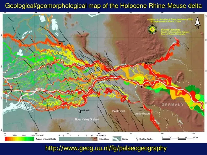
Geological/geomorphological map of the Holocene Rhine-Meuse delta http://www.geog.uu.nl/fg/palaeogeography 10000 BP 7000 BP 6500 BP 6000 BP 5500 BP 5000 BP 4500 BP 4000 BP 3500 BP 3000 BP 2500 BP 2000 BP 1500 BP 1000 BP 500 BP Present Holocene thickness delta 10 km 13 m 0 m

E N D
Geological/geomorphological map of the Holocene Rhine-Meuse delta http://www.geog.uu.nl/fg/palaeogeography
Holocene thickness delta 10 km 13 m 0 m
E N S Late Weichselian subsurface 3D high vertical exaggeration
E N S Present delta surface Late Weichselian subsurface 3D high vertical exaggeration
E N Late Weichselian subsurface 3D high vertical exaggeration S
E N Holocene channel belt Late Weichselian subsurface 3D high vertical exaggeration S
N 10 km