Download

1 / 37
370 likes | 517 Vues
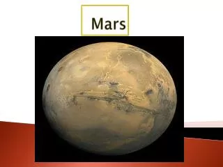
NASA's new Mars picture. www.powerpointpresentationon.blogspot.com. A full-circle scene combining 817 images taken by the panoramic camera ( Pancam ) on NASA's Mars Exploration Rover Opportunity. The US space agency NASA is calling it the "next best thing to being" on the Red Planet. .

E N D
NASA's new Mars picture www.powerpointpresentationon.blogspot.com
A full-circle scene combining 817 images taken by the panoramic camera (Pancam) on NASA's Mars Exploration Rover Opportunity. The US space agency NASA is calling it the "next best thing to being" on the Red Planet.
In this undated image provided by NASA, Mars Rover Opportunity catches its own late-afternoon shadow in a view eastward across Endeavour Crater on Mars. The rover used a panoramic camera between about 4:30 and 5:00 p.m. local Mars time to record images taken through different filters and combined into this mosaic view. Most of the component images were recorded during the 2,888th Martian day, or sol, of Opportunity's work on Mars, which corresponds to March 9, 2012 on Earth. The view is presented in false color to make some differences between materials easier to see, such as the dark sandy ripples and dunes on the crater's distant floor. Opportunity has been studying the western rim of Endeavour Crater since arriving there in August 2011.
This image provided by NASA on Thursday, April 26, 2012 shows lava flows in the shape of coils located near the equatorial region of Mars. Analyzing high-resolution images of the region, researchers have determined the area was sculpted by volcanic activity in the recent geologic past. This is the first time such geologic features have been discovered outside of Earth.
A Martian dust devil roughly 12 miles (20 kilometers) high was captured winding its way along the AmazonisPlanitia region of northern Mars on March 14, 2012 by NASA's Mars Reconnaissance Orbiter.
This image mosaic taken by the Mars Exploration Rover Spirit's panoramic camera shows a new slice of martian real estate southwest of the rover's landing site. The landscape shows little variation in local topography, though a narrow peak only seven to eight kilometres away is visible on the horizon. A circular depression, similar to the one dubbed Sleepy Hollow, can be seen in the foreground. Compared to the Viking and Pathfinder landing sites, the terrain at Gusev Crater, Spirit's landing site, is flat and speckled with a sparse array of rocks. The picture was released by the Jet Propulsion Laboratory in Pasadena, California Janaury 10, 2004. EDITORIAL USE ONLY
A view of Eberswalde crater containing a rare case of a martian delta, with well preserved channels which fed the lake in the crater, located in the southern highlands of Mars, seen in this handout photograph acquired by Mars Express at approximately 25S / 326E during orbit 7208 on August 15, 2009 and released September 2, 2011. The delta deposits and channels together provide a clear indication of liquid surface water during the early history of Mars. The images have a ground resolution of about 22 m per pixel. Reuters
A close-up of the sunset on Sol 24 as seen by the Imager for Mars Pathfinder was released by the Jet Propulsion Labratory August 27. The red sky in the background and the blue around the Sun are approximately as they would appear to the human eye but the color of the Sun itself is not correct -- the Sun was overexposed in each of the 3 color images that were used to make the picture. The true color of the Sun itself may be near white or slightly bluish.
Mars' Victoria Crater at MeridianiPlanum is seen in this image taken by NASA's High Resolution Imaging Science Experiment (HiRISE) camera in this picture released October 6, 2006. NASA officials gave conflicting views during a meeting of space scientists on December 13, 2006, on whether the construction of a moon base will mark a great leap in planning for a manned mission to Mars or prove a wasteful diversion of funds.
A portion of the west rim of Endeavour crater sweeps southward in this color view from NASA's Mars Exploration Rover Opportunity released by NASA August 10, 2011. This crater has a diameter of about 14 miles (22 km). This view combines exposures taken by Opportunity's panoramic camera (Pancam) of the rover's work on Mars August 6, 2011. Opportunity arrived at the rim during its next drive on August 9, 2011. Endeavour crater has been the rover team's destination for Opportunity since the rover finished exploring Victoria crater in August 2008. Endeavour offers access to older geological deposits than any Opportunity has seen before. The lighter-toned rocks closer to the rover in this view are similar to the rocks Opportunity has driven over for most of the mission. However, the darker-toned and rougher rocks just beyond that might be a different type for Opportunity to investigate. The ground in the foreground is covered with iron-rich spherules, nicknamed "blueberries," which Opportunity has observed frequently since the first days after landing. They are about 0.2 inch (5 millimeters) or more in diameter.
A handout of the European Space Agency ESA shows a visualisation of Mars, created from spacecraft imagery. ESA's first mission to the Red Planet is Mars Express. It comprises an orbiter carrying seven scientific instruments to probe the planet's atmosphere, structure and geology, including a search for evidence of hidden water. The main spacecraft will also release the UK's small Beagle 2 lander to gather and test rock and soil samples on the surface. British space probe Beagle 2 failed to broadcast a signal on December 25, 2003, to confirm it had landed on Mars, but scientists said they were waiting for a second contact opportunity later on Thursday.
In this image released January 19, 2005, NASA's Mars Exploration Rover "Opportunity": has found an iron meteorite on Mars, the first meteorite of any type ever identified on another planet. The pitted, basketball-size object is mostly made of iron and nickel. This composite combines images taken through the panoramic camera's 600-nanometer (red), 530-nanometer (green), and 480-nanometer (blue)
NASA's Phoenix Mars Lander's Surface Stereo Imager shows two trenches dug by Phoenix's Robotic Arm in this image taken June 8, 2008, the 14th Martian day after landing. Soil from the right trench, informally called "Baby Bear," was delivered to Phoenix's Thermal and Evolved-Gas Analyzer, or TEGA, on June 6, 2008.
A cliff, up to 4,000 m high, located in the eastern part of EchusChasma, one of the largest water source regions on Mars, is seen in this image taken by the High-Resolution Stereo Camera (HRSC) on board ESAís Mars Express and made available July 14, 2008. EchusChasma is the source region of Kasei Valles which extends 3,000 km to the north. The dark regions
The High-Resolution Stereo Camera (HRSC) on board ESA?s Mars Express has returned images of EchusChasma in this image made available on July 14, 2008. EchusChasma is an approximately 100 km long and 10 km wide incision in the LunaePlanum high plateau north of VallesMarineris, the ?Grand Canyon? of Mars.
One of the first colour images from the Phoenix Mars Lander shows the surface of Mars after the Phoenix Mars Lander spacecraft landed successfully in the first-ever touchdown near Mars' north pole May 25, 2008.
An artist's conception shows what NASA's Mars Reconnaissance Orbiter has revealed, vast Martian glaciers of water ice under protective blankets of rocky debris at much lower latitudes than any ice previously identified on the Red Planet. Scientists analyzed data from the spacecraft's ground-penetrating radar and report in the November 21, 2008 issue of the journal Science that buried glaciers extend for dozens of miles from edges of mountains or cliffs.
This magnified look at the martian soil near the Mars Exploration Rover Opportunity's landing site, MeridianiPlanum, shows coarse grains sprinkled over a fine layer of sand, in this image released by NASA's Jet Propulsion Laboratory in Pasadena, California, February 4, 2004. The image was captured on the 10th day of the rover's mission by its microscopic imager and roughly approximates the color a human eye would see. Opportunity, NASA's second of two roving Mars probes, rolled ten feet off its lander onto Mars on January 31.