Download
1 / 1
10 likes | 79 Vues
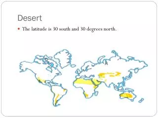
Basic SMA Eqn. RSMA Eqn. Disturbance. Recruitment. Total Soil Organic Nitrogen. VNIR. Senesce/Mortality. Plant Nitrogen by Functional Type. SWIR. Plant uptake/Growth. Climate. Mineralization. Land cover Classification in Desert Environments Desert Vegetation

E N D
Basic SMA Eqn. RSMA Eqn. Disturbance Recruitment Total Soil Organic Nitrogen VNIR Senesce/Mortality Plant Nitrogen by Functional Type SWIR Plant uptake/Growth Climate Mineralization • Land cover Classification in Desert Environments • Desert Vegetation • Often bright mineral soil background • weaker “red edge” • Reduced absorption in the visible • Wax absorptions ~1720 nm • Spectral variability within shrub species • Rapid movement of desert shrubs through • phenological stages in response to spatially • discontinuous precipitation • Open canopies--> poor correlations with LAI • Relative Multiple Endmember Spectral Mixture Analysis (RMESMA): new multitemporal SMA technique designed for use with coarse resolution (e.g. MODIS) satellite data (Okin, In Press) • Design of RMESMA: • apparent sfc. Refl. For a pixel at a reference time in a timeseries of collocated images is defined as the “baseline” spectra of that pixel • Spectral components can be added or subtracted from the baseline spectrum, which allows RSMA to provide information about changes in NPV/litter without having to separate NPV/litter from soil (e.g., soil is never used explicitly as an endmember) Climate Current Plant Biomass Plant Attributes Plant-Available Nitrogen Study Sites: Iranian and Tibetan Plateaus Plant Biomass by FunctionalType Gregory S. Okin,RelativeSpectral Mixture Analysis-Amultitemporalindex of total vegetation cover, RSE (In Press) Epstein et al. (2000) Okin et al., 2001, RSE Remote Analysis of Asian Cold Desert Ecosystems Cheney M. Shreve & Gregory S. Okin: Univ. of Virginia and Univ. of California, Los Angeles • Evaluating appropriate scale for quantifying patches of vegetation and snow cover • Linear spectral mixture analysis (SMA) techniques are commonly used for remote land cover classification and the high temporal resolution and global coverage of the MODIS sensor make it amenable for monitoring Asian cold deserts, however it is necessary to verify that MODIS derived SMA classifications are representative of the actual percentage of vegetation and snow cover in a pixel. • Methods: • Top-Down variability analysis • Classify 1 km MODIS reflectance data using eCognition and/or k-means algorithm into natural land-cover classes • Transfer class to collocated contemporaneous multispectral data, calculate semi-variogram for different classes and entire image • Repeat the first two steps using multispectral reflectance data and transferring classes to collocated contemporaneous hyperspectral reflectance data, calculate semi-variograms for individual classes and entire image • Compare (nugget: sill) N:S of classes with N:S ratio of entire image (at 2.5 m) using kriging leave-one-out cross validation. • Methods: • Bottom-Up variability analysis • Calculate semi-variogram for multispectral reflectance equivalent band in high resolution hyperspectral data • Calculate vegetation (VI) and snow indices (NDSI) for multispectral equivalent band in high resolution hyperspectral data • Block-krig multispectral equivalent bands, VIs and NDSI in high resolution hyperspectral data to 30 m resolution. • Calculate VIs, NDSI, and MESMA snow fractional cover of ETM+ data • Compare co-located ETM+ pixels with block-kriged 30-m ETM+ prediction using paired difference between means t-test, or equivalent randomization test. • Repeat for multispectral to coarse resolution (30 m to 1 km) • Optical Snow Products • May be better for sensing snow in cold deserts because traditional microwave based products have difficulty sensing snow with thin, discontinuous spatial patterns as often occurs in cold desert environments • Methods for comparing optical snow products: • Randomization tests • Multiple linear regressions • Methods for quantifying spatial patterns of snowfall: • Data Stratification using Envi Decision Tree Classifier • Spatial: aspect, slope, elevation • Temporal: annual, seasonal, during snow disaster events • Connectivity • Preliminary Results: Tibet • Good agreement (> 80%, p=0.05) between regressions of optical snow cover products (2 SMA based products and Normalized Difference Snow Index (NDSI)) • Aspect has greatest effect on agreement • North facing slopes show poorest agreement • Spatial distribution of snowfall changes seasonally • K-means clustering of green vegetation and snow timeseries (separately) followed by extraction and comparison of mean annual signatures from each class suggests spatiotemporal distribution of snowfall has strong effect on type and spatial distribution of green vegetation. Introduction Asian cold desert ecosystems are understudied, poorly understood and sensitive to the effects of climate change (Miehe, 1995). The geographical remoteness of these regions coupled with a lack of in situ data makes remotely derived satellite datasets the most practical means for studying these ecosystems. In North American cold deserts precipitation and temperature are the primary controlling factors on vegetation productivity (Comstock & Ehleringer, 1992) and in Arctic environments it has been hypothesized that nutrients may be the most limiting factor (Tissue & Oechel, 1987; Chapin, 1991). To investigate the role of climatic variables on vegetation productivity in Asian cold deserts, specifically portions of the Iranian and Tibetan Plateaus, and to predict how these dynamics might change in response to changing climate, it is necessary to assess the limitations of a remote analysis and to model climate change scenarios. Snow disasters are also common in the Tibetan Plateau and pose a threat to humans, livestock and the economy. Optical snow products have the potential to outperform microwave based products due to the spatial distribution (e.g., thin, discontinuous sheets) of snow in cold deserts. Several optical snow products will be compared and used to assess snow disasters. Cold deserts also have the potential for producing large quantities of dust (aka mineral aerosols), which can potentially affect the apparent surface reflectance due to additional scattering of light by dust particles suspended in the atmosphere. Practical limits on linear spectral mixture modeling in turbid atmospheric conditions using radiative transfer models (MODTRAN4), a method for spectral simulation after Okin et al. (2001), and SMA indices will be used for the evaluation. Modeling Potential Impact of Climate Change using a Transient-Nutrient Based Model (ArcVeg) Higher than expected shrub biomass in Northern Tibet, where rainfall is scarce, suggests that snowfall may be an important source of water/ insulation for vegetation. Studies in North American cold deserts suggest temperature and precipitation are the primary controls on primary productivity (Comstock & Ehleringer, 1992). Changing climate will alter the equilibrium between these variables and thus it is necessary to model how these changes will affect primary productivity. ArcVeg model will be modified to reflect the climate and vegetation characteristic of Northern Tibet, water availability and insulation from snowfall. Fieldwork will be conducted to provide information on plant functional type, soil nitrogen and mineralization rates for use in model input and validation purposes. • Objectives • Investigate the role of climatic variables on vegetation productivity in Asian cold deserts and to predict how these dynamics might change in response to changing climate. • evaluate a new multi-temporal linear spectral mixture algorithm, Relative Multiple Endmember Spectral Mixture Analysis (RMESMA) designed for use with coarse resolution satellite data (e.g., MODIS) for land cover classification • compare optical snow cover products and assess snow disasters • evaluate inter-annual vegetation dynamics • determine how much dust impedes retrieval of surface characteristics in arid environments • examine how vegetation in the cold desert ecosystem might respond to changing climate using a model to simulate climate change ArcVeg Diagram