Download
1 / 41
410 likes | 590 Vues
West Virginia Mine Drainage Task Force Symposium. CREATING NATIONAL COAL MINING GEOSPATIAL DATA STANDARDS. By The National Coal Mine Geospatial Committee April 10, 2007. Topics to be covered. Geospatial What does it mean? Why does it matter?

E N D
West Virginia Mine Drainage Task Force Symposium CREATING NATIONAL COAL MINING GEOSPATIALDATA STANDARDS By The National Coal Mine Geospatial Committee April 10, 2007
Topics to be covered • Geospatial • What does it mean? • Why does it matter? • Why create unified national coal mining geospatial datasets? • Mining accidents/disasters • Recent • Future • Public’s right to know • Recent technology improvements making this vision possible • Recent • Future
Topics to be covered (2) • Voluntary Participation • Introduction to the National Coal Mining Geospatial Committee (NCMGC) • Background information about NCMGC • FY 2006 Significant Activities • Highlights of Geospatial Questionnaire Results • Sharing Coal Mining Data
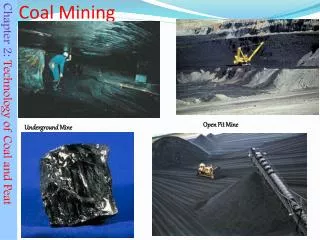
What is Geospatial? • Geospatial “pertain[s] to the geographic location and characteristics of natural or constructed features and boundaries on, above, or below the earth’s surface” … term refers especially to data that are geographic and spatial in nature. • Coal mining geospatial data describes the geographic location and characteristics of the features and boundaries of coal mining operations on or below the earth’s surface.
Why create unified national coal mining geospatial datasets? • Mining accidents & disasters • Recent • Inez, KY. slurry impoundment failure Oct. 11, 2000 the nation's largest coal slurry spill occurred at the Martin County Coal Co., Inez, Ky. Far greaterin damagethan the 1989 Exxon Valdez spill, this event dumped an estimated 306 million gallons of toxic sludge down 100 miles of waterways. The 10/17/’01 MHSA reportpoints toinaccurate mapping as the principal cause.
Mining accidents & disasters Recent Martin County slurry impoundment failure Quecreek Why create unified national coal mining geospatial datasets? MHSA's Quecreek accident report, July 24th., cited faulty maps as a cause for the Quecreek Mine disaster in June 2002, where nine miners were trapped for 4 days. According to the report, "The primary cause of the water inundation was the use of an undated and uncertified mine map of the Harrison No.2 mine.“
Mining accidents & disasters Recent Martin County slurry impoundment failure Quecreek Sago Why create unified national coal mining geospatial datasets? Local Trimble geodetic survey expert called in to survey spot to drill. Hours later drilling begins. The delay … establishing survey control required creating a link to a rover setting on a known point outside the permit boundary
Mining accidents & disasters Recent Martin County slurry impoundment failure Quecreek Sago Aracoma Why create unified national coal mining geospatial datasets? “Timmy Paul Morgan, who died Apr 9, ‘06 of a heart attack, gave a statement to an attorney representing the widow of Mr. Hatfield. In that statement, Mr. Morgansaidrescue team members complained that the map of Aracomathey were given to search for the missing men was inaccurate, showing doors and stoppings in places that did not exist.”
Mining accidents & disasters Recent Martin County slurry impoundment failure Quecreek Sago Aracoma Black Castle fatality Why create unified national coal mining geospatial datasets? On Feb. 1, ‘06, a dozer operatoratBlack Castle strip mine in Drawdy, WV was fatally injured due to ignition of natural gas. As the operator with 15 years experiencewas developing a drill bench, the blade ruptured a 16” low-pressure, high-volume gas line. The MHSA's report stated that “Vira told Moss to stay 100 feet away from the gas line. Neither Vira nor Moss knew the exact location of the gas line.”
Mining accidents & disasters Recent Martin County Quecreek Sago Aracoma Black Castle A Google search for "mining accident" + mapyields54,100 hits Why create unified national coal mining geospatial datasets? Unfortunately the importance of accurate maps wasn’t even on the radar!!! Miner’s Act signing ceremony
Why create unified national coal mining geospatial datasets? • Mining disasters • Recent • Possible future mining emergencies may extending across state boundaries • A common national data structure and map accuracy standard will …………. • save time trying to combine dissimilar dataset from adjoining states and • eliminate future poor spatial accuracy problems.
Why create unified national coal mining geospatial datasets (2)? • Could allow MANY additional users of this new national information asset • Federal DOE, BLM, MSHA, etc. • State Emergency response entities • Local County, municipal. • Others interested in sharing geospatial data assets.
Why create unified national coal mining geospatial datasets (3)? • Could substantially enhance OSM’s e-Permitting initiative. • Public’s right to know • Speed up the permit review process • Allow check for mining below properties changing hands (VA House Bill 1562) Subsidence • Proximity of impoundments and valley fills • Proximity to abandoned portals • Mining discharges
Technology improvements making this vision possible • Recent • ArcGIS software accommodates data with different projections and/or datums in the same desktop session that allows each state to keep data in the projection/datum already decided on. • ALL mining data can share a core set of tabular attributes of national interest and still have unique tables containing all existing State/Tribe attributes.
Technology improvements making this vision possible (2) • Future • ArcGIS 9.2 & Enterprise IT features • Database synchronization NCMG Data State Data
Technology improvements making this vision possible (3) • Future • ArcGIS 9.2 & enterprise IT features • Database synchronization • Versioned data replication In 9.2 for the 1st time a single logical database can be spread over several network nodes … allows a version of a geodatabase to be replicated to another geodatabase.
Technology improvements making this vision possible (4) • Future • ArcGIS 9.2 enterprise features • Database synchronization • Versioned data replication • Nonversioned editing At ArcGIS 9.2, multiuser editing is possible for the first time without versioning.
Technology improvements making this vision possible (5) • Future • ArcGIS 9.2 enterprise features • Database synchronization • Versioned data replication • Nonversioned editing • Web-based services In version 9.2 ArcGIS Server can provide “services” integrating geodata, globe (3-D), map (2-D), geoprocessing and locator functions.
NCMGC Startup History roots are OSM’s TIPS Program • Previous OSM Director, Jeff Jarrett, and the Technical Innovation & Professional Services (TIPS) Steering Committee formed the NCMGC May 3-5, 2005 at the St. Louis committee meeting. • Setting members selected late FY 2005. • Supported by TIPS and operates as a partnership between OSM and the states. • Members represent the geospatial technology interests of the states, tribes, and OSM offices. • Representation includes the Interstate Mining Compact Commission (IMCC), National Association of Abandoned Mine Lands Programs (NAAMLP), and the Western Interstate Energy Board (WIEB).
Purpose of NCMGC • Promote development of geospatial technology to support SMCRA • National forum to identify geospatial needs of SMCRA organizations • Discover best practices • Help implement change • Help migration to enterprise GIS • Improve business processes
NCMGC’s Charter • Deliberative, advisory body • Subject matter experts • Represent SMCRA community • Identify geospatial technology issues • Facilitate sharing of geospatial technology • Technical support personnel used to create technical support groups (TSGs) • Supported by TIPS • Report to Chief, TMD WR
NCMGC’s Technical Support Groups (TSGs) • Subject matter experts • Extension of committee • Advise committee on technical matters • Short term tasking • Cooperation among TSG members promotes sharing of technology
NCMGC Accomplishments FY 06 • Held first meeting to plan work activities • Determined geospatial technology development status of all SMCRA organizations via questionnaire • Identified the Geospatial Data Steward (GDS) within each SMCRA organization • Held the first National Meeting of SMCRA Geospatial Data Stewards • Identified geospatial technology development needs of SMCRA organizations for FY 2007
NCMGC Accomplishments FY 06 (2) • Established a Standards Task Group from the Geospatial Data Stewards (GDSs) that volunteered to help develop national standards • Obtained SDE and/or Relational Database Management System (RDBMS) training for a few qualified GDSs to facilitate their moving data to an enterprise environment. • Successfully completed a "proof of concept" project demonstrating exchange of selected coal mining spatial datasets between two networked servers inside OSM's Wide Area Network (WAN)
Highlights of Questionnaire Results • 42 responses from SMCRA organizations • 38 GSDs identified • 38 SMCRA organizations use GIS • 13 do not use MS SQL Server or Oracle • 28 do not use ArcSDE • 29 do not share spatial data by Internet • 33 do not have a written GIS implementation plan
Coal Mining Spatial Data Standards ASTM Task Group • Held the first meeting at ASTM International headquarters September 20-21, 2006 • Will hold 3 meetings in FY 07 to develop voluntary spatial data standards for the first 2 coal mining spatial data sets of national interest: surface coal mining boundaries and underground coal mining boundaries • Standards for additional data sets to be determined later • Press release on group and tasks in late 2006
Initial (’07) Coal Mining Datasets • Datasets common to SMCRA workers • Surface mining boundaries • Underground mining boundaries • Quick index to location of other coal mining data • Geographic locator of potential impacts
Surface Mining Boundaries Surface mining boundaries are polygons representing the boundary of the permitted area of a surface coal mining operation as described on the most recent mining operations map contained in a coal mining permit approved by the regulatory authority. Each approved permit has a single record in a spatial database of surface mining boundaries. Each record in the spatial database identifies the permit number of the surface coal mining operation and contains one or more polygons identifying the areas for conducting surface coal mining operations approved by the regulatory authority.
Underground Mining Boundary Underground mining boundaries are polygons representing the boundary of the underground mine workings of an underground coal mining operation as described on the best available mine workings maps. Each mine has a single record in a spatial database of underground mining extents. Each record in the spatial database identifies the underground coal mining operation and contains one or more polygons identifying the areas of underground mine workings.
Coal Mining Data is a National Information Asset • Executive Order 12906 • Public access to geospatial data Sec. 3(c) • OMB Circular No. A-16 • Themes of national significance Sec 2.b.(1) and Appendix E • Applies to all agencies using spatial data Sec 5. • Applies to all spatial activities funded with federal funds Sec 6. • Agency responsibilities and reporting requirements Sec 8.a. • Spatial data are subject to Exhibit 300 Sec 8.b.
Applicable Requirements • Surface Mining Control and Reclamation Act of 1977 (SMCRA) • Executive Order 12906, Coordinating Geographic Data Acquisition and Access: The National Spatial Data Infrastructure • OMB Circular No. A-16, Coordination of Geographic Information and Related Spatial Data Activities • OMB Circular No. A-130, Management of Federal Information Resources • Clinger-Cohen Act of 1996, formerly the Information Technology Management Reform Act • E-Government Act of 2002, Section 216, Common Protocols for Geographic Information Systems • Paperwork Reduction Act (P.L. 104-13) • Government Performance and Results Act (GPRA) • President’s Management Agenda • Expanded e-Government • Government reuse of data • Sharing information among government agencies • Automate internal processes to reduce cost
NCMGC Plans FY 07 • Hold a meeting to review and implement recommendations from the first National Meeting of SMCRA Geospatial Data Stewards • Provide briefings to OSM management and SMCRA organizations on the accomplishments and progress of the NCMGC in its activities • Send additional qualified personnel to attend vendor software training in managing coal mining geospatial data in an enterprise environment • Establish a planning sub-committee to begin preparations for an FY 08 National Meeting of SMCRA Geospatial Data Stewards with a theme of “Integrating GIS into SMCRA Business Processes” • Continue development work on a geospatial infrastructure to exchange selected coal mining spatial datasets among networked servers outside OSM's WAN • Recruit state regulatory programs to participate in this geospatial infrastructure • Conduct an outreach program by giving presentations about NCMGC activities at national meetings of SMCRA organizations; • Explore participation with MSHA
Outcomes of the Geospatial Initiative SAVE LIVES! • Improved regulation of active coal mines • Reduced random oversight inspections • Accurate bond release determinations • Better reclamation of abandoned mines • Improved subsidence investigations • Slower growth of AML Inventory • Fewer cases of CO2 gas buildup in homes • Reduced offsite impacts • Verifiable annual reports for both states and OSM