Download
1 / 12
130 likes | 363 Vues
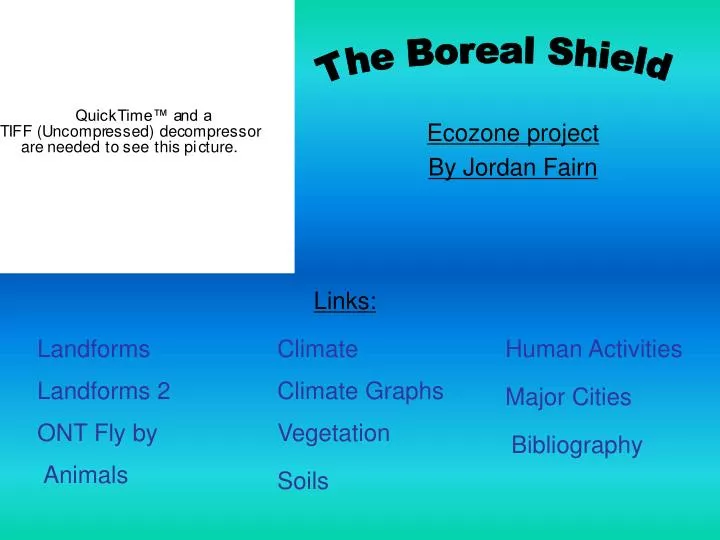
The Boreal Shield. Links:. Ecozone project By Jordan Fairn. Landforms. Climate. Human Activities. Landforms 2. Climate Graphs. Major Cities. ONT Fly by. Vegetation. Bibliography. Animals. Soils. Landforms.

E N D
The Boreal Shield Links: Ecozone project By Jordan Fairn Landforms Climate Human Activities Landforms 2 Climate Graphs Major Cities ONT Fly by Vegetation Bibliography Animals Soils
Landforms • The area of the Boreal shield is 1 774 000 km2 and it has plains and the low hills of the Canadian Shield. The Boreal Shield is the largest of Canada’s terrestrial ecozones. This natural region - popularly known as “shield country” - extends 3,800 kilometers from Saskatchewan to Newfoundland and Labrador. It covers 1.8 million square km’s and surrounds almost 20 percent of Canada’s landmass; its countless rivers and lakes account for 22 percent of Canada’s freshwater surface area. The Boreal Shield has a rich supply of minerals and lumber plays a major role in fueling the economy of the “heartland” of southern Ontario and Quebec. Back Home
Types of Land • Legend • 1. Canadian Shield Rock • 2. Quartz vein • 3. Glacial striations • 4. Erratic • 5. Fen-bog complex • 6. Rocky hills and morainal debris Back Home
Ontario Fly By Back Home
Animals • White-tailed deer, black bear, wolves, raccoons, and bobcats are some of the mammals associated with the Boreal Shield. The freshwater lakes attract lots of animals each spring, including buffleheads and ring-necked ducks. Other local birds include great horned owls, evening grosbeaks, and white-throated sparrows. Ring-necked Ducks White-tailed deer White-throated sparrows Black Bear Back Home
Climate • The Boreal Shield provides the images of exposed bedrock, endless forests, and rushing rivers that make the image that much of the world has of Canada. The short summers have roughly the same average temperature throughout the area, about 13˚C. The maritime influence in the east gives it a milder winter, with a mean temperature of about -1˚C, while the western edge suffers through average winter temperatures of -20˚C. Precipitation in the west is low, about 400mm a year, but it can be a high as 1600mm a year in some areas of Newfoundland, largely due to its position in the Atlantic. I have two climate graphs and an interpretation of both. They are from two different locations in the Boreal shield because it is so big. Back Home
Timmins, ONT Climate Graph Goose Bay, NFL Climate Graph Interpretation: 1.Average temp: 69.283333 2.Temperature range: 34.9 3.Total precipitation: 16.3 4.Season of maximum precipitation: Summer Interpretation: 1.Average temp: -0.54166666667 2.Temperature range: -2.7 3.Total precipitation: 949.5 4.Season of maximum precipitation: Summer Back Home
Vegetation • Forest fires create a patchy forest types in different stages of recovery from the fire. Trees in the north are coniferous, but broadleaf trees appear further south and trees normally found in much warmer climates, such as the yellow birch and sugar maple, can be found in the south of the Boreal Shield. Bogs and other wetlands, some of the most diverse and productive areas in the Boreal Shield, cover one-fifth of the land. Tree species that can be found here include the white spruce, black spruce, balsam fir, tamarack, trembling aspen, balsam poplar, white pine, red pine, jack pine, eastern white pine, red maple, mountain maple, eastern red cedar, eastern hemlock, black ash, speckled alder, pin cherry, paper birch, and white birch. Some of the other plants that grow here are ericaceous shrubs, sphagnum moss, willow, alder, Labrador tea, blueberry, bog rosemary, feathermoss, cottongrass, sedges, kalmia heath, high bush cranberry, baneberry, wild sarsaparilla, bunchberry, shield fern, goldenrod, water lilies and cattails. Back Home
Soils Vegetation can be found in many areas through out the boreal shield ecozone because of the soils. Many urban centers have been created near the boreal shield’s resource bases. Although patches of fertile soil can only be found in few areas which also have a suitable climate (leading to limited agriculture), this does not prevent beef cattle farming which is predominate in this ecozone. Dairy production is also important in this area. There are two different types of soil, which dominate this ecozone, Luvisolic and Brunisolic. Luvisolic soil is made up of mostly silicate clay and develops under deciduous, mixed forest or forest-grassland transitions in a moderate to cool climate. Brunisolic soil is usually found under forest, tundra and alpine vegetation and is usually an immature soil. Overall, the boreal shield ecozone isn’t extremely fertile and has only about 10, 900 farms which is tiny for its size. • 1- Orthic • 2- Orthic Humo-Ferric • 3- Eluviated Dystric • 4- Orthic Gleysol • 5- Typic Fibrisol Back Home
Human Activities • The big water areas in the Boreal Shield were the roads of the fur trade. More recently, some rivers have been altered and degraded by mining, hydroelectric development, and logging practices, though many are still relatively unaffected. Insect control, monoculture tree plantings, control of natural forest fires and acidification of the lakes and soil all affect the natural system, but in many cases the long-term effects are unknown. The current population is approximately three million. Most of the population lives along the St. Lawrence River and the Great Lakes and in areas where economic activities are based on the exploitation of natural resources (mining, forestry, recreation, hunting and fishing). Farming is limited to a few areas where the soil quality and microclimate are suitable. Back Home
Major Cities • The major in cities and towns are Flin Flon, Thunder Bay, Sault Ste. Marie, Rouyn-Noranda, and St. John's. While agriculture is limited, there are lots of natural resources and they help create employment in mining, forestry, hydropower, and tourism. Most of the people work in the urban centers: in public administration, and in the service and retail industries. Back Home
Bibliography • http://ernestchi.tripod.com/id5.html • http://canadianbiodiversity.mcgill.ca/ • http://english/ecozones/borealshield/borealshield.htm • http://www.ec.gc.ca/soer-ree/English/ • http://vignettes/Terrestrial/bs/default.cf • http://ecosys.cfl.scf.rncan.gc.ca/classif/classif03_e.htm • http://www.canadiangeographic.ca/atlas/themes.aspx?id=shield&lang=En • http://www.heritage.nf.ca/environment/boreal_shield.htm Back Home