Download
1 / 22
230 likes | 452 Vues
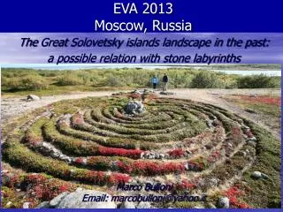
You had to be there: Landscape archaeology using GIS and VR. L. Jesse Rouse Dept of Geology and Geography West Virginia University. Introduction. “Being in the moment”, to take in one’s surroundings Objective goals of science? Subjective approaches more representative? Phenomenology

E N D
You had to be there: Landscape archaeology using GIS and VR L. Jesse Rouse Dept of Geology and Geography West Virginia University
Introduction • “Being in the moment”, to take in one’s surroundings • Objective goals of science? • Subjective approaches more representative? • Phenomenology • Husserl, early 1900s • Monte-Perleau, Heidegger
Phenomenology • Understanding based on individual experience • Change in understanding as experience grows • Move beyond an impartial observer to an active participant (emic vs etic)
GIS • Shift back towards objective, empirical • Mostly due to underlying framework and methodology • GIScience pushes for a more critical approach
Phenomenology, GIS, and VR • Attempts to join in landscape research • Mostly implicit • Difficult to ‘experience’ through 2D/Static • Extend GIS interface through Virtual Reality • Immersive and dynamic interface • Heidegger’s “Being-in-the-world”
Gillings and Goodrick, 1996 “Sensuous and Reflexive GIS” • Use GIS to understand place and contextualization of data • Use the senses to better interpret information • Visualization • Audio, Haptics, Smell, Taste • Linked issues • Multiple realities • Link qualitative and quantitative information • Retain reflexivity based on senses
Experiential • Reconstruction/recreation of ‘life-like’ virtual world • Create a prehistoric setting to view a relict landscape • React and interact with virtual landscape • View different perspectives/change perspectives
Immersive • VR can place the user “in” the landscape • Can step ‘through the looking glass’ • Offers the opportunity to experience and move through the landscape • Individual can control navigation, just as in ‘real’ world
Conclusion • Integration of GIS and VR to support subjective research • Phenomenology offers a subjective approach • Less detached, experiential • Immersive technologies can insinuate the researchers within the research • “Being-in-the-world”
Thanks go to: • WV Tech Center Staff • Dept of Geology and Geography • Eberly College of Arts & Science • WVView.org • Laboratory of Geographic Information Science • Natural Resource Analysis Center
Special thanks go to: • Dr. Keith Clarke • Dr. Duane Nellis • Dr. Greg Elmes • Nichole Edwards
Tuesday’s events will begin at 8:15AM in Room G21, White Hall • Free parking on Tuesday only in Lot 1 • Directly across the street from White Hall • Please take a moment to fill out the survey located in your folder • Thank you all for coming! We hope you enjoyed today’s sessions.