Download
1 / 21
230 likes | 716 Vues
Rocks, Weathering, Erosion, Deposition, Rock Cycle, and Watersheds. Rocks – Types and Characteristics. Igneous Rocks: Origin Texture Characteristics Mineral composition. State whether each is a characteristic of a plutonic or volcanic rock: Large crystal size

E N D
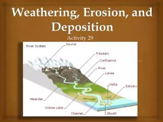
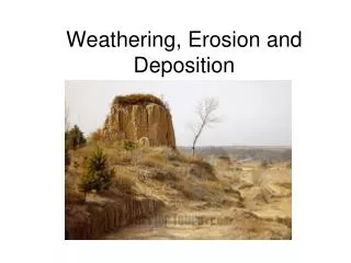
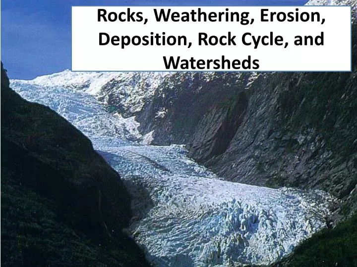
Rocks, Weathering, Erosion, Deposition, Rock Cycle, and Watersheds
Rocks – Types and Characteristics Igneous Rocks: Origin Texture Characteristics Mineral composition • State whether each is a characteristic • of a plutonic or volcanic rock: • Large crystal size • Vesicular • Small crystal size • Batholith • Pumice • Solidified lava • Solidified magma
Which graph best represents the textures of granite, pegmatite, and rhyolite? A B C D
Rocks – Types and Characteristics Sedimentary: Types: Clastic, chemical, organic Environment of formation
Environment of Formation • Sediments accumulate in streams, lakes, and oceans. Sediments deposit based upon water velocity.
Which graph best represents the correct relationship between the discharge of a river and the particle size that can be transported by that river?
Rocks – Types and Characteristics • Metamorphic Rocks: • Parent rocks • Heat and pressure • More dense; less porous • types of metamorphism • regional • contact/local • Texture • foliated vs. nonfoliated
Weathering • Types: • Mechanical • Chemical
Measuring Weathering • Mechanical: • Lab----Sugar Cubes: • 1. Solving for changes in mass and volume • 2. Calculating Rate of Change (ESRT Page 1) • Chemical: • Lab----Acid Rain and Rock Types • 1. Solving for mass loss • 2. Calculating Rate of Change Be able to predict future changes based on observations and measurements.
Rates of Weathering Calculate the rate of change for each rock type and predict the mass for each rock type if exposed for additional 52 hours.
Erosion = Transport Agents of erosion Wind Water Ice Describe the agent of erosion in the picture.
Particle Size and Water Velocity Sediments were analyzed near the shore of a nearby stream. The sediments were mostly between 0.2 – 1.2 cm in diameter. 1.Which sediment particle type has that diameter? 2. What velocity (cm/s) is required to move the sediment particle? 3.If the sediment was compacted and cemented together, what type of sedimentary rock will it form? 4. The velocity of a stream was measured to be 75 cm/s. What sediments could be transported at that velocity?
Characteristics of Sediments • Porosity • Permeability • Water retention • Saturation Describe the relationship between porosity and permeability Describe the relationship between water retention and particle size Describe the relationship between Particle size and porosity/permeability
The diagram below shows columns A, B, C, and D that contain different sediments. Equal volumes of water were poured through each column. • Which column of sediment retained the most water? • Which retained the least? • Which is most permeable? • Which is least permeable?
Stream and Meander Dynamics • The greatest stream velocities are found closest to points: • A and B • B and C • C and D • D and A • Erosion will occur at points: • A and B • B and C • C and D • D and A • Deposition will occur at points: • A and B • B and C • C and D • D and A • Which sediments will deposit first upon entering the lake?
The diagram below shows several different landscape features. Point X and Y indicate locations on the stream bank. • Identify which point, X or Y, has more stream erosion and explain why the amounts of erosion are different. • Explain why the stream meanders on the floodplain, but not in the mountains. • The beach consists of particles with diameters from 0.01 cm to 0.1 cm. Identify the sedimentary rock that will form when burial and cementation of these sediments occur. • Identify the feature at A. A
ResistanceA cross-section of Niagara Falls • Which TWO rock units appear to be most resistant to weathering and erosion? • Lockport dolostone and Whirlpool sandstone • Rochester shale and Albion sandstone and shale • Clinton limestone and shale and Queenston shale • Thorold sandstone and Queenston shale
The block diagram shows a volcano Which map shows the stream drainage pattern that most likely formed on the surface of this volcano?
Watersheds Watershed boundaries, or divides, are typically defined by the highest elevation that drains a stream.
Stream Order Identify the correct Stream Order for each of the following locations.
Rock Cycle Page 6 of ESRT