Download
1 / 27
280 likes | 820 Vues
CENS - UCLA July 25, 2003 Earthquake Sensation: integrating GPS and inertial sensors Kenneth W. Hudnut, Ph.D. Chief, So. Calif. Earthquake Hazard Assessment Project Earthquake Hazards Team U. S. Geological Survey

E N D
CENS - UCLA July 25, 2003 Earthquake Sensation:integrating GPS and inertial sensors Kenneth W. Hudnut, Ph.D. Chief, So. Calif. Earthquake Hazard Assessment Project Earthquake Hazards Team U. S. Geological Survey
Southern California is the nation’s most dangerous place for earthquakes - why? Silver linings: State-of-the-art earthquake monitoring arrays Many of the world’s best researchers work within this natural laboratory
San Andreas fault • 35 mm/yr slip rate; • >70% of total plate boundary motion • 1685, 1812, 1857 eq’s • Big Bend compression • 1971 Sylmar (M 6.7) • 1994 Northridge (M 6.7) • SoCal is now heavily ‘wired’ (much like Japan & Taiwan) • 150+ BB CISN stations • 250+ SCIGN stations • Catalog; SCEC CMM3
Improving hazard assessment • Temporal variations do occur: • Clustering (e.g., Basin & Range, ECSZ, Asia) • Discrepant geological and geodetic rates • Sequences involving fault interaction (e.g., Joshua Tree - Landers - Big Bear - Hector Mine; Anatolian system, etc.) • Implement robust research findings into hazard assessment • “Variability does not mean predictability” Courtesy Anke Friedrich
SCIGN Data Products • 1st Year • Combined time • series (1996-2002) • 3rd Year • Real-time earth- • quake response • 5th Year • Resolve rates on • primary LA basin • faults (and others)
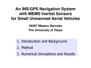
New methods and data integration • Precise topographic mapping of surface ruptures and active fault scarps • slip models for prehistoric events • rapid assessment of surface slip and damage patterns after large events • Requires precise integration of GPS & INS for flight navigation 1957 Gobi-Altai earthquake surface rupture
High resolution topography along surface rupture of the October 16, 1999 Hector Mine, California Earthquake (Mw7.1) from Airborne Laser Swath Mapping Hudnut, K. W. (USGS), A. Borsa (UCSD), C. Glennie (Aerotec, LLC) and J.-B. Minster (UCSD) Bulletin of the Seismological Society of America Special Issue on the Hector Mine earthquake (2002) http://pasadena.wr.usgs.gov/office/hudnut/docs/
Airborne laser swath mapping (ALSM) • precise topographic mapping of surface ruptures and active fault scarps Airborne platform navigation must be highly precise and requires high-rate GPS data • representation of actual fault ruptures recorded and preserved in unprecedented detail
R v v r r R Geolocation Vectors and Error Sources Vector from CMearth to GPS phase center Magnitude & directional errors both are stochastic, time and location variant. Vector from GPS phase center to laser Magnitude error is constant if no airframe flexing. Directional error due to constant and time-varying biases in INS. Vector from laser to ground footprint Magnitude error due to timing, instrument and atmospheric delays. Directional error from constant mirror mounting offsets and time-varying biases in reporting of scan angles (both pitch and roll). Note: additional errors due to imperfect synchronization of GPS, INS, mirror scan and laser firing times must be modeled and removed as well.
Exploded ordnance (crater) Lavic Lake Roll & Pitch Maneuvers pitch maneuvers
Maximum slip section of the 1999 Hector Mine eq. surface rupture Photo by Keith Stark (SCIGN)
Laser Scanof the San Andreas Proposal to the NSF EarthScope Science RFP: Prof. Mike Bevis, PI (OSU) Requires high-rate (1 Hz) GPS data from SCIGN sites along fhe fault & special care with IMU-INS
GPS Fault Slip Sensor APEC symposium Proc. Paper, Fall AGU poster, and paper in preparation for Bulletin of the Seismological Society of America http://pasadena.wr.usgs.gov/office/hudnut/slipsensor/ K. Hudnut, G. Anderson, A. Aspiotes, N. King, R. Moffitt, & K. Stark (all at USGS-SCIGN, Pasadena CA)
Central Computers Early Warning The speed of light >> the speed of sound EmergencyResponse Seismic and GPS Stations Utilities Transport- ation (e.g; Wu & Teng, BSSA, 2002; Allen & Kanamori, Science, 2003)
Real-Time GPS Network - Enhancing SCIGN • On 15 November 2002, first-ever GPS fault slip sensor deployed across San Andreas fault at Gorman, Calif. • Augments seismic early warning system - resolves the observational deficiency inherent with inertial sensors that cannot discern tilt from acceleration • Upgrade SCIGN telemetry • DSL, frame relay • Radio repeaters, WiGate and dedicated links • Data buffering • Augment SCIGN real-time acquisition and processing system • Implemented sub-daily processing (4 hr) for ~100 SCIGN stations (down from 24 hr) • Implementing multiple real-time streaming GPS processors (commercial software)
Lone Juniper Ranch and Frazier Park High School First prototype GPS fault slip sensor Spans the San Andreas fault near Gorman, California
Cleaned-up test results Why is real-time GPS processing noisy and less robust than post-processing? Ambiguity resolution, multipath, atmosphere and clock errors - what can be done?
Upgrading SCIGN telemetry Low cost options such as frequent FTS dial-up, radio nets, and DSL Development & testing of near real-time GPS precise processing, etc.
Conclusions: • GPS and inertial sensor integration for high-accuracy applications is practical in SoCal because SCIGN can be readily upgraded to support centimeter-level accuracy in real-time • Earthquake applications of GPS/INS integration are: • societally relevant - significant economic impact and consequences would result from technological innovations • scientifically exciting for the very dynamic SCEC research community - major breakthroughs in earthquake source physics are likely to result from collaborations