Download
1 / 34
400 likes | 778 Vues
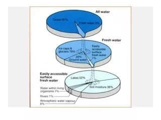
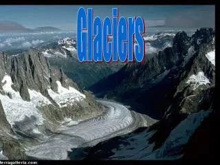
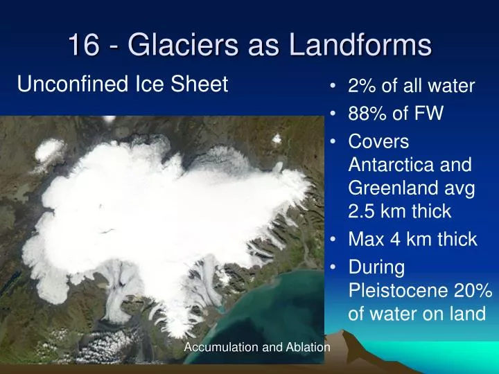
16 - Glaciers as Landforms. Unconfined Ice Sheet. 2% of all water 88% of FW Covers Antarctica and Greenland avg 2.5 km thick Max 4 km thick During Pleistocene 20% of water on land. Accumulation and Ablation. Geomorphology of Alpine Glaciers. Valley Glaciers.

E N D
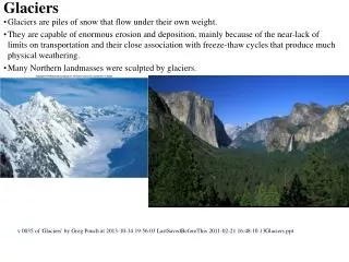
16 - Glaciers as Landforms Unconfined Ice Sheet • 2% of all water • 88% of FW • Covers Antarctica and Greenland avg 2.5 km thick • Max 4 km thick • During Pleistocene 20% of water on land Accumulation and Ablation
Geomorphology of Alpine Glaciers Valley Glaciers • http://www2.wwnorton.com/college/geo/egeo/animations/ch18.htm Equilibrium line ~snow line, maximum flow in x-sec. Glaciers much higher average surface gradient than streams
Importance of glaciers • Influence earth’s energy balance - albedo • Major component of (fresh) water storage – affects sea level • Important agent of landform evolution Center moves faster than margins. Note ogives, annual waves
Obstacles • Upglacier, the movement of ice closes joints in the rock. Only abrasion occurs. • Downglacier, over the crest of the bedrock, ice flow opens joints. Meltwater gets into cracks and freezes, enlarging cracks. Plucking removes rock.
Davidson Glacier near Haines, AlaskaAn Alpine glacier system Ledges (obstacles) beneath ice reflected by Crevasse Fields and Ice Pinnacles (Seracs) Accumulation zone extending, ablation zone and buried obstacle compressing Terminus
Ice Caps and Continental Ice Sheets http://www.nmm.ac.uk/server/show/conWebDoc.1221 White, reflective, high latitude, positive feedback Nunatak Sentinal Range, Antarctica • Antarctica is the broadest high place on Earth, the ice cap is up to 4km thick • and covers the continent • Antarctica is a desert, with only 15 cm (6 inches) of snowfall a year around • the South Pole • The lowest recorded temperature is -89.2 °C. • There is no life in Antarctica except near the coast
Ablation Vatnajokull http://pubs.usgs.gov/fs/2005/3056/ Zone of Accumulation Equilibrium Line Ablation Outlet Glaciers
Formation of Glacier Ice Firn BTW: note leading edges thrust over terminal debris
Ice Deformation Accelerating slowing
Wet Glaciers • Warm = wet-based • Cold = dry-based • ρice < ρwater, therefore Pressure increase on ice increases density to that of liquid water. • Causes "melting point decrease“. Ice than would normally melt at 0oC = 32 o F now melts at a cooler temp. High pressure melting point called PMP - pressure melting point • 0.7°C/ km of ice above you • “Warm” ice = thick, fast • Moves mostly by basal sliding on wet base Pressure Melting Point
Cold, High Polar, Dry Based Base ice is frozen These glaciers do not slide, they only move by internal deformation Plucking
Temperate, Wet Bed Striations, transport by subice flows
Observed Ice Core Temps • Greenland • Tbed < 0°C • Antarctica • Tbed ≈ 0°C
Pressure Melting and Regelation melt melt • For ice near Pressure Melting Point: • Movement increases pressure, thus melting, on the up-ice side of an obstruction • Movement away from the obstruction releases pressure - causes freezing on the down-ice side – “regelation”
Effects of Pressure Melting • High pressure is experienced on the up-ice side of an obstruction. • Pressure melt results • Water migrates around obstacle • Regelation occurs in low pressure zone MELT REFREEZE = "Regelation"
Erosion by Plucking • Melt then regelation mix loose bed material and refreezing ice at base – gets into rock cracks, expands w/ freeze and pushes: “plucking”
Abrasion • Plucked material is available to wear away the bed – “abrasion”
Polish • Typical of similar hardness (bed vs. tool) and fine load (~ sandpaper)
Glacial Abrasion in Bedrock Source:Tom Bean
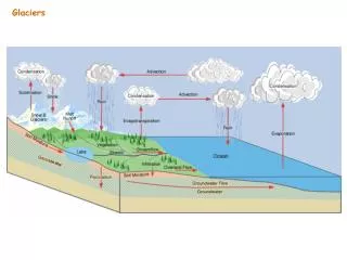
Glacier Hydrology Liquid water flows on, within, and beneath glaciers
Subglacial Channels • Eroded into bedrock • Polar Glaciers • Pressure • Tools
Subglacial - Ice Caves Ice Cave Mendenhall Glacier, AK Photographer: John Bortniak, 1991 NOAA Corps Note Ice contact debris
To be continued terminus outwash