Download
1 / 27
340 likes | 770 Vues
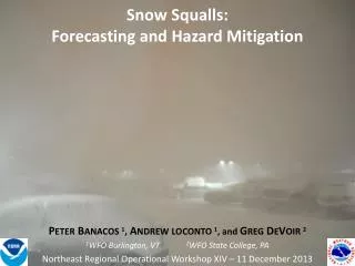
A Quick Review Of Snow Microphysics And Its Relation to Heavy Snow Forecasting. Greg DeVoir NWS CTP Winter Weather Workshop November 7, 2002. Forecasting Snow Amounts. Forecasters generally employ the following formula for predicting snowfall totals: (Intensity) * (Duration) = Snow Amount

E N D
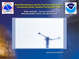
A Quick Review Of Snow Microphysics And Its Relation to Heavy Snow Forecasting Greg DeVoir NWS CTP Winter Weather Workshop November 7, 2002
Forecasting Snow Amounts • Forecasters generally employ the following formula for predicting snowfall totals: (Intensity) * (Duration) = Snow Amount • Dynamical processes which lead to the production of precipitation are generally well- resolved by numerical models, therefore we usually have a good idea of Durationfor a given event. • Intensity is a different story!
Why is Determining Snow Intensity so Difficult? • Many factors influence the amount/distribution of snow over a given area. • Snow-to-water ratio (density), precipitation phases, terrain/orographic effects, convective stability, and surface temperatures are commonly considered by forecasters. • But the character (type, size, shape) of snowflakes themselves, determined by the intensity of lift, variations in moisture, and snow microphysics (vertical thermal profile), can play a crucial role in the resulting accumulations.
Why is Determining Snow Intensity so Difficult? • Snow-to-water ratios (i.e. snow density) vary GREATLY. • The standard 10:1 ratio commonly used in operations is only correct 25.8% of the time. • From observational studies, snow ratios of freshly fallen snow vary from 3:1 to 100:1!!!
Distribution of Snow Ratios*1973-1994 *Source: Roebber et al., 26 March 2002, “Improving Snowfall Forecasting by Diagnosing Snow Density.”
In a Nutshell… • Even with accurate and precise QPF forecasts, large errors in snowfall forecasts will still occur (by factors of 2 to 10!) unless we do a better job at diagnosing and anticipating snow density/ ratios. • Can we do this and how? Examining snow microphysics operationally may help us improve snow density/ratio assessments, leading to more accurate forecasts of snow amounts.
References • Dan Baumgardt - ARX SOO Wintertime Cloud Microphysics Review www.crh.noaa.gov/arx/micrope.html • Jeff Waldstreicher –former BGM SOO – now at ER SSD The Importance of Snow Microphysics for Large Snowfalls www.erh.noaa.gov/er/hq/ssd/snowmicro/sld001.html • Roebber, Schultz et al. – (Collaboration - UW Milwaukee and NSSL) Improving Snowfall Forecasting by Diagnosing Snow Density www.nssl.noaa.gov/~schultz/snowdensity/paper.shtml
Snow Microphysics • Top-down approach (Steve D. talk) • Ice crystals form by heterogeneous nucleation, and grow by deposition • These ice crystals can then grow into larger snowflakes by aggregation and riming. • The temperatures at which these processes occur determine not only precipitation type, but snowflake type, and resulting snow density.
Snow Microphysics • Heterogeneous Nucleation • Cloud droplets commonly exist in super-cooled state. • Nucleation of ice occurs when water molecules collect and freeze onto a foreign particle (dust, clay, existing ice crystal). • For most particles, temperatures of less than -10C are required for heterogeneous nucleation of ice to occur. • ICE MUST BE IN THE CLOUD FOR SNOW TO BE IN THE FORECAST!
Got Ice? • Baumgardt (1999) found: • -4°C……NO ICE in clouds • -10°C….60% chance ice is in the cloud (Warm cutoff) • -12°C….70% chance ICE is in the cloud – a good operational discriminator • -15°C….90% chance ICE is in the cloud • -20°C….ICE is in there! *Temperatures at top portion of cloud
Ice Crystal (Snow) Growth • Occurs in Three Ways: • Accretion: Growth of an ice particle when it captures super-cooled liquid droplets • *Deposition: Growth by water vapor depositing on the ice particle in a liquid form and immediately freezing, or directly depositing as a solid • Aggregation: Merging of multiple ice particles to form one main snowflake…i.e. snowflakes sticking together. Surfaces of ice crystals become sticky at temperatures above -5° C. Aggregation maximizes near 0° C. *Deposition is the dominant snow growth process
Deposition • The change from water in the vapor form to water in the solid form. • Growth by deposition is greater at colder temperatures. • Deposition growth is also dependent on pressure.
Ice Crystal Growth as a Function of Temperature and Pressure
Snow Crystal Growth - Dendrites • Crystal growth maximizes around -15oC with dendrites the preferred crystal type. • Dendrites are “efficient” accumulators of snow because of the extra “space” within each crystal.
Can We Use This Operationally? • Waldstreicher (2002) – Assessed the viability of using NWP to forecast periods of efficient (rapid) snow accumulation. • Ice crystals maximize near the greatest rising motion (if air mass saturated). • Dendrites will be favored where omega maximums intersect dendrite-favored temperatures (-12° to -18° C).
Omega/Dendrite Intersection:Waldstreicher Study • Question Is the intersection of model omega and dendrite temperatures a consistent signature for heavy snowbursts and/or large snowfall accumulations?
Waldstreicher Study • Days where snowfall exceeded warning and advisory criteria were identified. • Eta and MesoEta hourly forecast soundings were examined, using Bufkit, for the presence of the omega/dendrite intersection zone.
Waldstreicher Study • Omega Maximum of at least -10 µbs-1… arbitrary value sufficient to assume moderate lift…will vary by model and resolution. • Temperatures favorable for dendrite formation (-12° to -18° C). • Coincident signatures needed to be present in 2 of 3 successive model runs.
Waldstreicher Study • Results • 76.4% of the Warning Events exhibited the cross-hair signature. • ONLY 9.4% of Advisory Events had the cross-hair signature. This signature may have utility distinguishing Warning vs. Advisory Events!
Waldstreicher Study • Omega max below the dendrite zone: • “Warm” atmospheric environment. • Indicative of shallow lift. • Snow is more likely to have low snow:water ratio. • These events are not likely to produce warning criteria.
Waldstreicher Study • Omega max above the dendrite zone: • “Cold” Atmospheric environment. • Snow more likely to have higher snow:water ratios. • Major Virga Potential (look for lower layer subsidence or dry layers). • Could be a sign of sloped lift in the model if upstream locations depict omega maximum at lower elevations. This could give a good estimate of the north/west extent of heavy snowfall.
CTP Variation on Waldstreicher Cross-Hair Study • Will examine this year’s snowfalls, and write routine summaries with regards to the snow microsphysics associated with each event to help us learn and improve. • Will further attempt to classify false alarm cases, and cross reference with quantifiable parameters such as precipitable water (false alarms were not considered in the Waldstreicher study).
Latest Directions in Snow Microphysics Research – The future of Snow Forecasting? • Roebber, Schultz et al. have created an Artificial Neural Network (ANN) for predicting snow densities. • Currently, their ANN correctly diagnoses better than 60% of cases (vs. only 25% using the standard 10:1 ratio typically used in operations). This should only improve in time.
Summary • Things to remember • Need ice! -12°C Cloud Top Temp is a good operational discriminator • Check location of favored dendritic snow growth zones with regard to max model omega. Look for at least moderate lift maximum. • Consider potential for aggregation (snowflakes sticking together to form bigger flakes) • Size matters!