Download
1 / 33
400 likes | 876 Vues
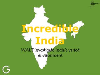
Incredible India. WALT investigate India’s varied environment. India is among the world's biggest countries, covering more than 3.1m sq km. This amounts to 12 times the size of the UK. Its size means there are tremendous variations in its landscape and climate.

E N D
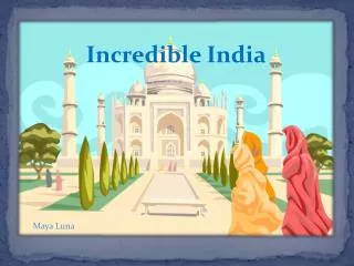
Incredible India WALT investigate India’s varied environment
India is among the world's biggest countries, covering more than 3.1m sq km. This amounts to 12 times the size of the UK. Its size means there are tremendous variations in its landscape and climate. You’re a journalist and you’ve been commissioned to write an article about ‘New India’ for a British newspaper You’re finally en route to Bangalore. The flight takes ten hours, three of which are in Indian air space.
Make sure your map has BOLTS! BorderOrientationLegend / KeyTitleShading
Map showing the relief of India N River Ganges This map has BOLTS!
Map showing the relief of India N River Ganges On your map label: New Delhi (the capital city) Bangalore Mumbai (Previously Bombay) Kolkata (Previously Calcutta)
Watch the three in-flight films about India’s diverse landscapes. • How many different landscapes and climate conditions did you notice? • What were the similarities and differences to the UK?
Incredible India WALT investigate India’s varied environment
Key questions:What is India’s landscape and climate like?Where do people live in India?
India’s main physical features are the ancient Deccan plateau encompassing most of Southern India and flanked by the Western Ghats and Eastern Ghats, the vast alluvial plain of the River Ganges, the Himalaya mountains stretching for 2,400 km across the north of India, and the Thar desert which lies mostly in the state of Rajasthan.
The least populated areas are in the inhospitable mountain regions of the Western and Eastern Ghats and the Himalayas
Because of India’s size its climate depends not only on the time of year but also the location. It ranges from tropical in the south to temperate and alpine in the Himalayas.
Most of India has three seasons – summer, rainy or monsoon, and winter. South-west monsoon causes rain over most of the country from June to September. The north-east monsoon hits the east coast between October and February mostly as cyclones. The north-east of India receives rain from both monsoons.
India’s main cities are New Delhi (capital), Mumbai (Bombay), Kolkata (Calcutta), Chennai (Madras), Bangalore, Cochin, Jaipur, Shimla, Varanasi. Mumbai is the most populated city with a population of over 18 million. About 13 million people live in New Delhi The average density of population in India is 319 per sq km.
73% of Indian’s population live in more than 500,000 villages while 27% of Indians live in towns and cities. The Ganges Plain is one of the most populated areas in the world being home to nearly 900 million people (over 1/8th of the world’s population).
The town of Cherrapunjee is famous for being the wettest place on earth. It has 12 metres of rain a year – 15 times the amount of the UK. The total average rainfall for London is 752.1 mm for Bangalore it is 859.6 mm.
The highest mountain in India is Mount Kanchenjunga at 8,598 metres.
The main rivers are the Ganges, the Brahmaputra, the Yamuna, the Godavari, the Kaveri, the Narmada and the Krishna.
India is among the world's biggest countries, covering more than 3.1m sq km. This amounts to 12 times the size of the UK. Its size means there are tremendous variations in its landscape and climate. You’re a journalist and you’ve been commissioned to write an article about ‘New India’ for a British newspaper You’re finally en route to Bangalore. The flight takes ten hours, three of which are in Indian air space.
Watch the three in-flight films about India’s diverse landscapes. • How many different landscapes and climate conditions did you notice? • What were the similarities and differences to the UK?
Then match up the landscape/climate/settlement statements how they link.India’s monsoon lasts from June to October. Cherrapunji, situated high up in north east India, is one of the wettest places in the world with 11,000mm of rainfall.
Check your Answers! • Low-lying areas near to the coast tend to have high population densities (more people). • High mountain areas, such as the Himalayas, have low population densities (fewer people). • Areas with an extreme climate, such as the Thar Desert are most sparsely populated. • The eastern coast of India has suffered from cyclones and flooding linked to global warming. • India’s population has grown from 357 million in 1950 to 1.1 billion today (17 times greater than the UK). • 77% of people live in rural areas and 23% in towns and cities. • More and more people are migrating (moving) to urban areas because of the new wealth here caused by globalisation.
Homework - Search for images to do with ‘India’s monsoon’ and ‘climate change’. Find one way in which each of these affects people’s lives. Design symbols to represent them and add to your maps (and key)