Download
1 / 18
180 likes | 375 Vues
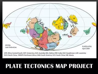
Plate Tectonics Map Project. Create a fictional world complete with continents, oceans, tectonic plates, mountains, earthquakes, volcanoes, and other evidence of a dynamic earth.

E N D
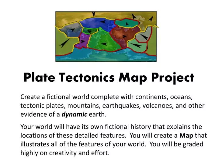
Plate Tectonics Map Project Create a fictional world complete with continents, oceans, tectonic plates, mountains, earthquakes, volcanoes, and other evidence of a dynamic earth. Your world will have its own fictional history that explains the locations of these detailed features. You will create a Map that illustrates all of the features of your world. You will be graded highly on creativity and effort.
Day One – 2 Checkpoints Checkpoint: _____ 10 tectonic plates _____ Convergent, divergent, and transform boundaries are present _____ Arrows to show movement _____ Movement is logical _________________________Teacher Signature Checkpoint: _____ Pangaea has been created and cut into 7 continents _____ Continents named _____ Oceans named _____ Plates named _________________________Teacher Signature So how to start??
Start with a piece of copy paper and pencil (MUST BE A PENCIL!!)
Begin adding arrows showing the motion of each continent Remember you must create all three types of boundaries and the crustal features they create.
Finish showing the motion of each continent with arrows on each Movement must make sense. Must create; faults, rift valleys, volcanic mountains, island arcs, mid-ocean ridges, trenches, & folded mountains.
Take a moment to make a quick copy of your supercontinent as you will need to turn in a sketch of it.
Now you are ready to cut out your continents(keep track of them!)
Re-assemble your continents – then begin to push your continents in the direction of your arrows.
As you move your continents, make sure you are creating all three plate boundaries.
Glue continents down, make sure you will have at least four oceans.
Now add plate boundaries (some should be on land and others under the ocean(must have 10 plate boundaries)
Don’t forget to fill our your worksheets as you are creating your world.
By end of Day 2 you should have your rough draft map and worksheets completed. Remember: you will turn in your rough draft map, worksheeets, and project packet along with you final map.
Due on Friday (2/21) Rough draft map Sketch of your supercontinent 2 project worksheets Project packet Final map of your world (poster size)