Download
1 / 26
270 likes | 476 Vues
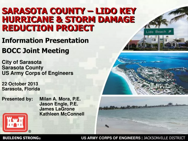
BUILDING STRONG ® US ARMY CORPS OF ENGINEERS | JACKSONVILLE DISTRICT. SARASOTA COUNTY – LIDO KEY HURRICANE & STORM DAMAGE REDUCTION PROJECT. Information Presentation BOCC Joint Meeting . City of Sarasota Sarasota County US Army Corps of Engineers 22 October 2013 Sarasota, Florida

E N D
BUILDING STRONG®US ARMY CORPS OF ENGINEERS | JACKSONVILLE DISTRICT SARASOTA COUNTY – LIDO KEY HURRICANE & STORM DAMAGE REDUCTION PROJECT Information Presentation BOCC Joint Meeting City of Sarasota Sarasota County US Army Corps of Engineers 22 October 2013 Sarasota, Florida Presented by: Milan A. Mora, P.E. Jason Engle, P.E. James LaGrone Kathleen McConnell
2 US ARMY CORPS OF ENGINEERS | Jacksonville District BUILDING STRONG® OVERVIEW – PROJECT SCOPE • Authorized WRDA 1999 • Authority was contingent on a feasibility assessment of the project. • 2002 Feasibility Study with Environmental Assessment (amended April 2004) determined that project was technically sound, environmentally acceptable and economically justified. 1971 1986 2006
3 US ARMY CORPS OF ENGINEERS | Jacksonville District BUILDING STRONG® OVERVIEW – PROJECT FEATURES • Project Scope • Project Length (ft) = 8,280 (R-35 to R43) • Design berm elevation (ft) = +5 NGVD • Approximately 460,000 cy of design and 615,000 cy • of advance material (1,075,000 cy for Initial Const) • Three groins along the southern portion • Borrow Areas: Big Sarasota Pass (BSP) & New Pass • 5-year nourishment interval over 50-year life • 615,000 cy required for each re-nourishment 80 ft Design Berm over 1.6 miles 3 Proposed Sand Sources Groin Field (3) D2 C B
4 US ARMY CORPS OF ENGINEERS | Jacksonville District BUILDING STRONG® PROJECT PLAN • 1) Placement: • Place approximately 1.1M CY of sand on Lido Key • 2) Source: • Obtain Sediment for Nourishment of Lido Key • Egmont Key (Tampa Bay) • Offshore of Longboat Key • Ebb Shoal at Big Sarasota Pass (BSP) • New Pass – Future • 3) Retain: • Construct Three (3) groins at the south end of Lido Key
5 US ARMY CORPS OF ENGINEERS | Jacksonville District BUILDING STRONG® PLACEMENT – LIDO KEY 2013 MHW Line 80’ Design Berm @ 5’ MHW Line - Design Berm MHW Line - Advanced Berm Advanced Berm 150’ 150’ • FDEP Monument R-39 • (Lime Tree Resort/Condos)
6 US ARMY CORPS OF ENGINEERS | Jacksonville District BUILDING STRONG® SOURCE – BSP BORROW AREAS D2 C B
7 US ARMY CORPS OF ENGINEERS | Jacksonville District BUILDING STRONG® RETAIN – SOUTHERN GROINS Beach Nourishment Retain
US ARMY CORPS OF ENGINEERS | Jacksonville District BUILDING STRONG® PROJECT PLAN – BORROW AREA QUESTIONS?
BORROW AREAS? • What are the proposed borrow area footprints? • How will this affect Big Sarasota Pass morphology? • How will this affect Siesta Key? • What are the effects on the navigation channel?
BORROW AREA FOOTPRINTS alt d2, C, B – 1.7 mcY D2 C B
BSP MORPHOLOGY Relic Channel In the long term: These areas will be deeper Flood Marginal Channel Updrift Shoal Flood Marginal Channel Main Ebb Channel Distal Lobe Downdrift Attachment Existing Conditions
HOW WILL THIS AFFECT SIESTA KEY? Results from the CMS morphologic model yields No indication of increased erosion over the Existing Condition at Siesta Key % Increase in wave energy here and here % Decrease in wave energy here and here
EFFECT ON CURRENTNAVIGATION? No significant difference in navigable water depths without and with project Navigable water greater than 6m depth without project Navigable water greater than 6m depth with project
US ARMY CORPS OF ENGINEERS | Jacksonville District BUILDING STRONG® PROJECT PLAN – SOUTHERN GROINS GENERALQUESTIONS?
SOUTH LIDO KEY GROINS • What are the plans for the groins? • How long are they? • How much space is between them? • How big are they? • Can I walk along the beach? • Can I swim in the surf zone? • Can I navigate past them?
HOW LONG? HOW MUCH SPACE IN BETWEEN ? 460’ 800’ 600’ 500’ 350’ 2004 Present Day
US ARMY CORPS OF ENGINEERS | Jacksonville District BUILDING STRONG® PROJECT PLAN – SOUTHERN GROINS HYPOTHETICALQUESTIONS?
What if the groins do not work? • What is the effect on Lido Beach? • What is the effect on Siesta Key? • How will the groins affect the ebb shoal in BSP? • Why nourish the beach if we are installing structures?
WHAT IS THE EFFECT ON LIDO KEY?WHAT IS THE EFFECT ON SIESTA KEY? Sediment Bypassing to BSP Ebb Shoal Downdrift Effects Groins are constructed to anchor the nourishment template – not to intercept Sediment at the expense of downdrift beaches or ebb shoal morphology!
How will the groins affect the ebb shoal in BSP? Sediment Bypassing to BSP Ebb Shoal Downdrift Effects Adequate sediment bypassing at the seaward end of the groin structures will deter the growth of a crescentic shoreline . Adequate bypassing to the Ebb Shoal ensures that BSP will maintain its morphology – seen by lack of erosion in the shoal itself
Why nourish the beach if we are installing structures? Groins are constructed to anchor the nourishment template – not to intercept sediment at the expense of downdrift beaches or ebb shoal morphology! Groin construction without an associated nourishment project can lead to downdrift erosion and a lack of sediment supply to downdrift systems The groins are designed to work with the nourishment design template – should the beach erode shoreward of the design template, Emergency measures are implemented
Groins – Anchor the Nourishment Beach Nourishment 1986 Retain 1983 1981
US ARMY CORPS OF ENGINEERS | Jacksonville District BUILDING STRONG® LIDO KEY SPP Questions/Discussions Milan A. Mora, P.E. Project Manager Jacksonville District Water Resources Branch 701 San Marco Boulevard Jacksonville, FL 32207 904-232-1454 millan.a.mora@usace.army.mil