Download
1 / 31
310 likes | 430 Vues
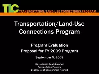
Chittenden County Land Use - Transportation Decision Support System. Chittenden County Metropolitan Planning Organization Chittenden County Regional Planning Commission Vermont Agency of Transportation. http://www.ccmpo.org/planning/dss November 19, 2003. Presentation Overview.

E N D
Chittenden County Land Use - Transportation Decision Support System Chittenden County Metropolitan Planning OrganizationChittenden County Regional Planning CommissionVermont Agency of Transportation http://www.ccmpo.org/planning/dss November 19, 2003
Presentation Overview • Why use the DSS? • Use of DSS within Planning Processes • Structure of Decision Support System (DSS) Software • Current Test Results
What is the Land Use-Transportation Decision Support System (DSS)? • A free-standing, GIS-embedded software that examines the interrelationships of transportation and land use, and provides outputs in support of local and regional planning processes. • The outputs have been designed to assist stakeholders and decision-makers in: • Assessing Existing Conditions • Creating Plans • Implementing Plans • Achieving Plans
Why DSS? • Better integration of transportation model with more detailed land use modeling capabilities. • Tool for examining influences of large “regionally significant” projects. • Visual and quantitative information to assist policy boards in making decisions. • Output informs planning process.
In Support of Planning Step #1 Identify Values Step #2 Determine Indicators Step #3 Develop Assumptions Step #4 Evaluate Current Conditions Step #5 Develop Alternative Plans Step #6 Evaluate Alternative Plans Step #7 Adopt Desired Plan
DSS Software Overview • Snapshot Mode • Parcel Based • Forecast Mode • Resizable Grid (50-200 acres) Snapshot results screen 200 acre grid
“Snapshot” Analysis • Static, Parcel based analysis • Useful in examining specific development proposals • Does not automatically forecast future development • Training for Local Planners completed on July 24, 2002 • Pilot studies ongoing in Shelburne and Charlotte
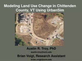
Forecast Analysis • Forecasts location of future housing and employment and associated travel demand • Useful in examining projects with Regional Impacts
Chittenden County Residential Zoning
Chittenden County Non-Residential Zoning
Forecast Accessibility • The “Accessibility” is calculated for each grid cell • Accessibility is an objective measurement that describes the convenience and efficiency of traveling between locations • Accessibility is the inverse of travel time between locations factored to reflect: • The number of origins and destinations • The grid cell’s proximity to roadways
Forecast Attractiveness • The “Attractiveness” is calculated for each grid cell • Each cell’s Accessibility measure is factored to reflect development incentives and/or disincentives
Septic Soil and Municipal Sewer Parameters NOTE: These data reflect the 1996 on-site rules
Housing and Employment Allocation • Based upon the final Attractiveness “scores”, all developable cells are grouped into 10 deciles • The DSS then assigns 50% of the new housing and employment into first decile, 25% into second decile, 12.5% into third decile, etc. • If a decile cannot absorb the appropriated growth, then the excess development goes into the next decile • Within each decile, the cells are randomly chosen
DSS ForecastHypothetical Tests Two Rounds of Testing Round 1 4 Scenarios: • 1A - Base land use and transportation network • 1B - Increased density allowances throughout Region • 1C - Five-lane Route 7 • 1D - Increased density allowances and Five-lane Route 7 Round 2 4 Scenarios • 2A – Base land use and transportation network • 2B – Base land use and express bus service to Jericho & new Milton interchange • 2C – TOD land use and Base transportation network • 2D – TOD land use and express bus service to Jericho & new Milton interchange
Single-Family Residential Hypothetical Testing Scenario 1A Base Land Use and Base Transportation Network Accessibility to Employment (2024) Hypothetical Testing Scenario 1B Extreme Land Use and Base Transportation Network
Single-Family Residential Hypothetical Testing Scenario 1A Base Land Use and Base Transportation Network Attractiveness (2024) Hypothetical Testing Scenario 1B Extreme Land Use and Base Transportation Network
Volume to Capacity Ratio Hypothetical Testing Scenario 1A Base Land Use and Base Transportation Network Hypothetical Testing Scenario 1B Extreme Land Use and Base Transportation Network
Comparison of Housing Growth Allocation Base Case vs. Extreme Scenarios
Comparison of Employment Growth Allocation Base Case vs. Extreme Scenarios
General Conclusions • Land use policies have a stronge influence on Accessibility and Attractiveness • Influence of land use policies dampened by the influence of transportation improvements • Transportation improvements in the urban/suburban core of the County create more accessibility in the Transition and Rural Planning Areas • Existing high allowances for non-residential growth are only slightly impacted by changes to transportation system and/or land use policies • Current land use policies can not accommodate anticipated housing demand
Steering Committee Recommendation • Recommended to CCMPO/CCRPC Boards the DSS software is an appropriate tool to assist in local and regional land use and transportation planning processes.
Next Steps • Model development is an ongoing process. • DSS provides better information for planning. • DSS provides the best analysis possible to date, but will not predict an absolute future.