Download
1 / 15
150 likes | 230 Vues
Florida Department of Transportation’s Unified Basemap Repository. Purpose To provide a comprehensive dataset of roadway geometry and attributes accessible over the internet, managed and maintained through documented procedures, standards, partnerships and cooperative agreements Safetea-lu

E N D
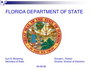
Florida Department of Transportation’s Unified Basemap Repository • Purpose • To provide a comprehensive dataset of roadway geometry and attributes accessible over the internet, managed and maintained through documented procedures, standards, partnerships and cooperative agreements • Safetea-lu • The Florida Unified Roadway Basemap Initiative was conceived as a response to the 2005 SAFETEA-LU (Safe, Accountable, Flexible, and Efficient Transportation Equity Act – A Legacy for Users) legislation that placed an increased emphasis on the coordination and sharing of information to support safety analyses • Status • Navteq data was distributed through the Unified Basemap Repository June 30th, 2009.
Florida Department of Transportation’s Unified Basemap Repository • How do I subscribe to the Florida Department of Transportation's Unified Basemap Repository? • You must have a Florida Department of Transportation Internet Subscriber Account (ISA) and you must have a valid email account at one of our approved domains. • You can create your account by clicking the "Create a new Subscriber Account now" located on the UBR Login page. If you already have an existing Subscriber Account for one of UBR's approved domains, you can skip this step and just log in.
Florida Department of Transportation’s Unified Basemap Repository • How do I subscribe to the Florida Department of Transportation's Unified Basemap Repository? • You will be required to submit a UBR profile the first time you login, and you can update your profile information during any session. • New UBR subscribers and UBR subscribers that change their Subscriber Account email address are required to verify a security token to gain access to the file repository. The security token will be sent via email to your Subscriber Account email address, and you will be required to enter the token the next time you login to the UBR system.
Florida Department of Transportation’s Unified Basemap Repository URL: https://www3.dot.state.fl.us/unifiedbasemaprepository/Default.aspx Contact: Jared R. Causseaux FDOT GIS Coordinator Florida Department of Transportation 605 Suwannee Street, MS 5-L Tallahassee, Florida 32399-0450 (w) 850-245-1715
Florida Department of Transportation’s County Maps • Statewide series of maps depicting the general road system of each county • Produced using MicroStation (soon to be produced using ESRI Software) • Show planimetric information needed for highway planning • Updated using field inventories and FDOT aerial imagery
Florida Department of Transportation’s County Maps Contacts: Jessica Rogers Surveying & Mapping Specialist Jessica.Rogers@dot.state.fl.us 850.245.1576 Andra McMillan Surveying & Mapping Specialist Andra.McMillan@dot.state.fl.us 850.245.1577 http://www.dot.state.fl.us/surveyingand mapping/countymap.shtm
Florida Department of Transportation’s Aerial Photo Look Up System (APLUS) • Our Aerial Photo Archive Collection is Florida’s largest collection of aerial photography • We have over 450,000 digital images that date back the early 1950’s, and over 700,000 aerial photos that date back to the 1940’s • Since going live in August of 2008, the APLUS application has fulfilled over 25,000 customer requests
Aerial Photo Look Up System • The APLUS application allows customers to: • Immediately download aerials for an area under four square miles • Submit a manual request for areas over four square miles, to include county wide imagery • Find out what dates are available for which counties • Download a photo index for each county project • Access links for downloading viewers for our digital imagery
Aerial Photo Look Up System URL: http://www.dot.state.fl.us/surveyingandmapping/apac.shtm Contact: Jared R. Causseaux FDOT GIS Coordinator Florida Department of Transportation 605 Suwannee Street, MS 5-L Tallahassee, Florida 32399-0450 (w) 850-245-1715