Download
1 / 17
170 likes | 463 Vues
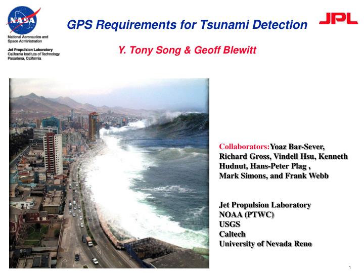
GPS Requirements for Tsunami Detection Y. Tony Song & Geoff Blewitt. Collaborators: Yoaz Bar-Sever, Richard Gross, Vindell Hsu, Kenneth Hudnut, Hans-Peter Plag , Mark Simons, and Frank Webb Jet Propulsion Laboratory NOAA (PTWC) USGS Caltech University of Nevada Reno. Tsunami Basics.

E N D
GPS Requirements for Tsunami DetectionY. Tony Song & Geoff Blewitt Collaborators:Yoaz Bar-Sever, Richard Gross, Vindell Hsu, Kenneth Hudnut, Hans-Peter Plag ,Mark Simons, and Frank Webb Jet Propulsion Laboratory NOAA (PTWC) USGS Caltech University of Nevada Reno
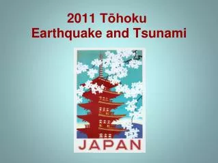
Tsunami Basics • Tsunamis are usually caused by undersea earthquakes. • Tsunami waves travel at a speed of ~800 km/hour (or 200 m/s) in deep oceans. • A meter-height tsunami in the deep ocean can grow to tens of meters at coast. • Unlike wind-driven ocean waves that are only a disturbance of the sea surface, the tsunami wave energy extends to the ocean bottom. 2004 Indian Ocean Tsunami Tsunamis occur after earthquakes
Recent Tsunami Events 11 events in 4 years Conclusion: Earthquake magnitude does not determine tsunami impact.
The Consequence of Late Warnings 2004: tsunami death ~230,000 2006: tsunami death ~730 2007: tsunami death ~54
The Consequence of False Alarms Panic evacuation killed ~100 in March 2005 Since 1982, tsunami warnings based on earthquake magnitude have produced false alarms 16 out of 16 in Pacific (U.S. Government Accountability Office, GAO-06-519). State of Hawaii’s estimation: an evacuation from a tsunami alarm would have cost the state $58.2 million in economic losses (Eddie Bernard, 1996).
This talk is based on: Tsunami Theory Song et al., Horizontal impulses of faulting continental slopes dictate tsunami genesis, Ocean Modell., doi:10.1016/j.ocemod.2007.10.007 (2008) Seismic inversion Approach Song et al., The 26 December 2004 tsunami source estimated from satellite radar altimetry and seismic waves, GRL, 32, doi:10.1029/2005GL023683 (2005). GPS Approach Blewitt, G., et al. Rapid determination of earthquake magnitude using GPS for tsunami warning systems. GRL, 33, L11309, doi:10.1029/2006GL026145, (2006). GPS Approach Song, Y. T., Detecting tsunami genesis and scales directly from coastal GPS stations, GRL, 34, doi:10.1029/2007GL03168 (2007).
1. Tsunami Genesis Tsunami Theory Those earthquakes transfer oceanic energy Knowing how tsunamis are generated by earthquakes is the key to successful prediction. Lateral motions of continental slopes are the main source of tsunami energy
In the Sumatra Tsunami Case • Lateral motions of continental slopes are the main source of tsunami energy • potential energy = 1 (vertical) • kinetic energy = 5 (horizontal)
2. Developing the GPS Method Calculating tsunami source energy from GPS displacements Step 1: GPS displacements Step 2: Seafloor displacement Step 3: Tsunami energy
GPS 30-sec Series Step1: GPS Displacements • Using estimated orbits • Rapid displacement • Data confirm that it arrives mostly with body waves • Can be resolved using 15-minutes after the quake • Accuracy ~ 7 mm • Can be used to estimate earthquake slip model • Model displacements ~ 3 mm • And keep in mind… • Network was far from optimal
Step2: Seafloor Displacement GPS-inverted Seafloor Displacements Seafloor motionsderived from GPS data
Step3: Determining Tsunami Scales • Earthquakes—Richter’s scale (magnitude) • Hurricanes—Simpson’s scale (category) • Tsunamis can be scaled (based on sqrt (ET) ~ tsunami height): • IfST < 5, local warning only. • If ST > 5, basin-wide warnings and modeling are needed. • Early warnings can be issued in few minutes after quake.
Summary: Tsunami Prediction System GPS 3-D Ocean Model seafloor motions Tsunami scales
From Historical Tsunamis to GPS Requirements Tsunami height 1m 5 cm GPS displacement 200 km 200 km
Coastal Real-Time GPS Network NASA Decision Project: GPS-aided Real-Time Earthquake and Tsunami (GREAT) Alert System--Bar-Sever et al Technical Requirements: • Network design (~10 km spacing) • Signal frequency (1 Hz) • Data accuracy (< 1 cm) • R/T GPS orbits and clocks (10 sec) • Data processing ( 2 min) • GPS-inversion seafloor displacement & tsunami energy estimation (2 min) Logistical Requirements: • International collaboration • Systems integration Existing GDGPS (JPL/NASA) Add into GDGPS