Download
1 / 16
160 likes | 169 Vues
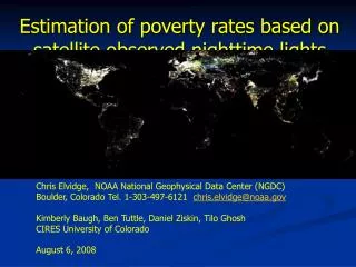
Can Poverty Levels Be Estimated Using Satellite Data?. Chris Elvidge NOAA – National Geophysical Data Center 325 Broadway, E/GC2 Boulder, Colorado 80305, U.S.A Email: chris.elvidge@noaa.gov. K.E. Baugh, B.T. Tuttle, A.T. Howard and P.J. Hayes University of Colorado – CIRES

E N D
Can Poverty Levels Be Estimated Using Satellite Data? Chris Elvidge NOAA – National Geophysical Data Center 325 Broadway, E/GC2 Boulder, Colorado 80305, U.S.A Email: chris.elvidge@noaa.gov K.E. Baugh, B.T. Tuttle, A.T. Howard and P.J. Hayes University of Colorado – CIRES 325 Broadway E/GC2 Boulder, Colorado 80305, U.S.A E.H. Erwin NOAA – National Geophysical Data Center 325 Broadway, E/GC2 Boulder, Colorado 80305, U.S.A July 17, 2006
Global Poverty • The World Bank estimates that 40% of all people live in poverty (2.6 billion). • The primary source for poverty estimates are household surveys and government statistics (from tax reports, etc.). • Poverty levels are reported for entire countries or states.
Problems in Estimating Poverty Levels • It is difficult to define a uniform definition or method for measuring poverty. • National definitions of poverty tend to be subjective. For instance many people counted as in poverty in the USA own automobiles – a sign of wealth in many other countries. • Difficult to reconcile income versus consumption based data from surveys. • Not all countries measure or report poverty levels and the methods and timetables used vary substantially. • It is possible for governments to bias poverty estimates.
World Bank’s World Development Indicator’s Poverty Map - 2005
Estimation of Poverty Using Satellite Data • Global coverage – making estimates where no other data are available. • Standardized measurement. • Uniform timing. • Disaggregated grid of poverty levels has more applications than national level estimates for understanding poverty and planning solutions.
DOE LandScan 2004 Population Density Sources: Census data, MODIS land cover, SRTM topography and high resolution satellite imagery.
Population Count in Poverty Green 1-10, Yellow 11-50, Red > 50
East Timor 85.11 Bhutan 77.7 84.31 PNG 81.45 Laos 73.2 79.50 Myanmar 78.4 76.26 Nepal 80.9 73.03 DPRK 64.94 Mongolia 74.9 56.52 Bangladesh 82.8 52.94 China 46.7 44.60 India 80.6 41.94 Philippines 47.5 41.13 Thailand 32.5 40.39 Vietnam 33.4 28.28 Indonesia 52.4 33.38 Sri Lanka 50.7 30.24 Malaysia 9.3 18.23 Japan 7.03 ROK 2.0 6.54 ROC 6.33 Singapore 5.47 $2/day Satellite Poverty Estimates in South and East Asia(in percent)
Issues Found • High poverty rates assumed for population with no detected lights – which may overestimate poverty in wealthier countries. • The nighttime lights product used has saturation in urban centers – introducing inaccuracies in poverty estimates in urban cores. • There are cultural and technological differences in lighting that have not been accounted for.
Conclusions • The first consistent global map of poverty levels has been produced. • Poverty levels have been estimated in a large number of countries where data were not available previously. • Discrepancies between reported poverty levels and the satellite estimates probably arise both from inaccuracies in the reported data and the satellite data / methodology / assumptions. • A new class of poverty map has been produced and can be expectd to impove in accuracy over time.