Download
1 / 32
320 likes | 416 Vues
Humanities Field Trip 2011. By: John-Michael McIntyre. What?. For our second term as MYP 5 Humanities students we learnt about, the physical processes affecting Barbados. We looked at: mass movement, long shore drift, erosion, and coastal management etc.

E N D
Humanities Field Trip 2011 By: John-Michael McIntyre
What? • For our second term as MYP 5 Humanities students we learnt about, the physical processes affecting Barbados. • We looked at: mass movement, long shore drift, erosion, and coastal management etc. • At the end of our unit we decided that it would be a good idea if we took all the knowledge we learnt and went on a field trip. • So we planned and got ready. In the end we went to: the east coast, Mullins Bay, and the Board walk.
Who? • MYP 5: Me, Owen McCleery, Jade Forsberg, Adam Pitt, Ryan Thomas, Abigail Davis, and AlizeeSailly. • Teachers: Mr. Piers Tainsh( humanities teacher), and Mr. Colby Hilker( driver). • Lecturers: Mr. Hinds( CZMU).
When? • February 16th 2011
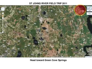
Where? • The East Coast( just north of Barclay Park). • Mullins Bay( the West Coast). • The Board Walk( the South Coast).
Why? • To see real life examples of what we had been learning about in our country of Barbados.
The East Coast The first stop
What is the East Coast? • The East Coast is a part of Barbados where there are no living coral reefs. • Its beaches are filled with the water coming from the Atlantic Ocean which means that it has the rougher beaches of Barbados. • Because of all the sediment that comes in from South America the east coast has a lot of hills made out of sediment and clay. This sediment is also the reason why there are no coral reefs.
Quartz In this picture you can see evidence of quartz on the east coast. This picture was taken just north of Barclay Park on a large rock which was filled with quartz. These quartz would’ve come from the South Americas.
Oxidation This is a picture with a rock that has been oxidized. Oxidation is when things begin to rust or when Ferris oxide affects the object. You can see when something has been oxidized by the orange brown colour it has just like rust.
The Clay This is some sediment and some clay that has built up over time and has become hard. Even though it is solid and hard they break off easily and are kind of brittle.
Mullins Bay Second Stop
What is Mullins Bay? • Mullins Bay is located on the western side of Barbados. • It is an area that has greatly been affected by coastal erosion and poor coastal management. • Because of the poor coastal management there have been businesses that have had to shut down and people are now starting to protest.
The Coastal Management • In Mullins Bay there are a lot of limestone groynes in place. • These groynes were put in place so that erosion wouldn’t happen and that the parts of the beach where there were hotels would get more sand etc. • However because the consultants did not do a good job the groynes actually began to destroy other parts of the beach because of long shore drift.
This is a diagram of Long shore Drift. What happens is the wind pushes the waves on an almost 90 degree angle and then between the swash and backwash it begins to angle the beach. When groynes are in place it makes some parts of the beach build up sand while other parts which are not protected by the beach lose sand and then coastal erosion starts to begin. This is what happened at Mullins Bay.
Picture #1 B. A.
Picture #2 C. B. A.
This is on the other side of the groynes where the beach is not protected. Notice that much of the land is eroded because the waves have been hitting that part of land and over time it eroded. Also notice the trees that have fallen into the water also because of erosion. This is all because of long shore drift and the groynes.
This is a picture of one of the main groynes in Mullins Bay. Notice how because of the groyne that the sand has built up a lot on one part of the beach.
The Board Walk The third and final stop
What is the Board Walk? • The Board walk was a project started by the government of Barbados. • It was made to help with tourism and also to help with the locals who are commuting by foot. • The Board walk is 1.2km long and was about $9.8 million. • The wood of the boardwalk is imported from Guyana because that specific type of wood is much more resilient to the ocean waves. • The board walk is both a fun recreational spot as well as a vital protection against coastal erosion etc.
Economic effects of the Board Walk • The Board walk benefits the local economy because many stalls and vendors are now set up around it so when tourists go walking they will see the stalls and end up buying things. • It also benefits the area and land owners. Now that the boardwalk is there people don’t have to worry about erosion and there houses being destroyed. Because of the nice view of the beach and the fact that the land is protected the prices for houses etc. have gone up a large amount.
Geographical effects of the Board Walk • The Boardwalk serves as a kind of barrier protecting the roads and buildings from the dangers of coastal erosion. • It has many groynes stemming out of it to protect the beaches. However unlike Mullins bay these groynes were put correctly and are Canadian granite so there are not a lot of threats of any beach build ups. • Because of the Board walk long shore drift is no longer a threat.
Groynes This is a picture of some groynes located by the Boardwalk. These groynes were put in place to lessen the effects of long shore drift and coastal erosion. These groynes are made out Canadian granite.
The Board Walk This is the board walk. It is 1.2 km long. The wood is imported from Guyana because of its resilience to the sea water. This project cost about 9.8 million U.S.D.
The CZMU The CZMU stands for the coastal zone management unit. During our trip one of their employees came and lectured us about the boardwalk project. They are responsible for maintaining the boardwalk and other coasts in Barbados.
The Protection Around the Board walk there are various headlands etc. This is half of a picture of one. The headlands stick out and are made to be aesthetically pleasing. They’re surrounded by Canadian granite for further protection.
The Beaches. There are many beaches on by the Boardwalk. In this picture because of these groynes and the waves this beach has become a sort of mini bay.
In Conclusion… • In conclusion we learnt a lot more about these different aspects of the physical processes affecting Barbados. • We had a lot of fun doing this unit and going on this trip. • We now know how to take care of our coasts and how to get involved.