Download
1 / 26
260 likes | 422 Vues
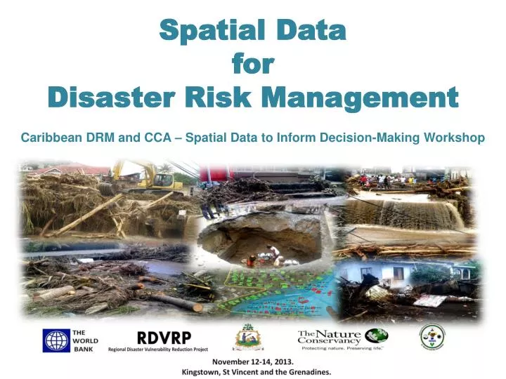
Spatial Data for Disaster Risk Management Caribbean DRM and CCA – Spatial D ata to Inform Decision-Making Workshop. Dimensions of DRM:. Risk Identification. Risk Identification. Risk. Vulnerability. Exposure. Hazard.

E N D
Spatial Data for Disaster Risk ManagementCaribbean DRM and CCA – Spatial Data to Inform Decision-Making Workshop
Risk Identification Risk Vulnerability Exposure Hazard
Dangerous phenomenon that may cause loss of life, injury, property damage, loss of livelihoods, etc. Risk Vulnerability Exposure Hazard
Risk Exposure Vulnerability Assets (people, property etc.) present in hazard zones that are thereby subject to potential loss Hazard
Risk Vulnerability Exposure The characteristics of an asset (community, system etc.) that make it susceptible to the damaging effects of a hazard Hazard
The likelihood of damage, loss, injury or other negative consequences of an event Risk Exposure Vulnerability Hazard
Collection of information on past events and past damages→ Insights on the mechanisms (why, how, what the effects were etc.) • Translate this understanding into a model→ Where may future events take place, with what probability and what possible consequences could be What type of analysis you choose depends very much on the use you want to give it…
Avoidance of future risks Mitigation of present risks
Policies and laws (building codes, land use planning, etc.) • Legislative framework and actions to avoid the exacerbation of hazards • Retrofitting of buildings • Resettlement • Hazard mitigation measures (Dams and seawalls, slope stabilization, reforestation, etc.)
Yes Can you avoid the risk? Yes No Can you mitigate the risk? Risk Reduction No Yes Can you transfer the risk? Risk Transfer No Risk Retaining Financial protection – the impact will still take place Financial liquidity directly after an event Figure modified after UNISDR
Early warning systems • Shelter facilities and evacuation plans • Stockpiling • Networks of emergency responders • Etc. Build an emergency response and management capability before a disaster occurs
Rehabilitation and reconstruction • Where to build (relocation of facilities, infrastructure and even entire villages/cities) • How to build (building codes etc.) “Build back better”
“Understanding Risk” as Basis • Understanding risk is the prerequisite for all further DRM activities • There is not a “one size fits all” risk assessment – the type of information required depends on a multitude of factors
“Understanding Risk” as Basis One size DOESN’T fit all The information you need/ the analyses you want to carry out depend on: • Objective of the hazard/ vulnerability/ exposure/ risk analysis • Temporal scale • Spatial scale / area of interest
One size DOESN’T fit all Objective Distribution of hazards Distribution of risks
One size DOESN’T fit all Objective • Screening • Initial assessment/ overview Prioritize interventions Implement risk mitigation measures • Collection of detailed data • In-depth analysis
One size DOESN’T fit all Temporal Scale
One size DOESN’T fit all Spatial Scale
“Understanding Risk” as Basis High Data and information needs: • For direct use • As input data for analyses Multitude of Actors is involved
“Understanding Risk” as Basis Flood hazard analysis as example: Precipitation Topography Land use Discharge Soils
“Understanding Risk” as Basis Spatial Data Infrastructure: • Storage of data • Management • Visualization • Sharing
“Understanding Risk” as Basis Crucial part of the SDI: Metadata • Objective of the hazard/ vulnerability/ exposure/ risk analysis • Temporal scale • Spatial scale / area of interest • Quality of the input data/ analysis • Year of creation • Etc.
“Understanding Risk” as Basis • Clearly define what you need to know • Make the most out of all data and information that is already available • ¡Be aware of Limitations! • Search for adequate ways to complement what you have with what you need Be aware of limitations