Download
1 / 22
220 likes | 564 Vues
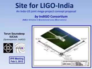
GPS Explorer: Overview and Extension to INDIGO http://geoapp.ucsd.edu http://indigo.nasa.gov Paul Jamason | Scripps Orbit and Permanent Array Center (SOPAC ) IGS Analysis Center Workshop, Miami, 2008 GPS Data Products for Solid Earth Science; NASA REASON CAN

E N D
GPS Explorer - IGS AC Workshop - Miami 2008 GPS Explorer: Overview and Extension to INDIGOhttp://geoapp.ucsd.eduhttp://indigo.nasa.gov Paul Jamason | Scripps Orbit and Permanent Array Center (SOPAC ) IGS Analysis Center Workshop, Miami, 2008
GPS Explorer - IGS AC Workshop - Miami 2008 GPS Data Products for Solid Earth Science; NASA REASON CAN PI’s: Frank Webb, JPL; Yehuda Bock, SOPAC; Sharon Kedar, JPL Ruey-Juin Chang, Peng Fang, Paul Jamason, Ian MacLeod, Linette Prawirodirdjo, Melinda Squibb, George Wadsworth (SOPAC); Danan Dong, Sue Owen (JPL) Modeling On-the-Fly Solutions for Earth Science; NASA ACCESS Project PI’s: Marlon Pierce, Indiana University (and above PI’s) Robert Granat, Jay Parker (JPL), Galip Aydin (IU) (and above) INDIGO: Inter-Service Data Integration for Geodetic Operations; NASA REASON CAN PI: Ruth Neilan (JPL/IGS) Co-I’s: Angie Moore, Frank Webb (JPL); Dave Stowers (JPL/IGS); Carey Noll (NASA/GSFC/CDDIS); Mike Pearlman (CFA/ILRS); Dirk Behrend (NVI/IVS) GPS Explorer/INDIGO: Participants
GPS Explorer - IGS AC Workshop - Miami 2008 GPS Explorer Background • 5-year NASA REASoN project (GPS Data Products): deliver analysis products using newer IT standards • Portlet-based web portal; web 2.0 (mapping, inter-portlet communication) • Develop/use standard formats (XML) and methods (web services) for improved metadata and data exchange • NASA ACCESS project (MOSES): users perform modeling via portlets • Apply various time series models (QOCA, RDAHMM) • Extend to INDIGO: integration of multiple space geodetic techniques • Leverage GPS Explorer technologies • GNSS/VLBI/SLR/DORIS: provide uniform methods of data retrieval
GPS Explorer - IGS AC Workshop - Miami 2008 GPS Explorer Framework • Uses the • java-based windows in web portal with user controls; can be used in other portal frameworks (JSR-168 standard) • user accounts; save data/results for future viewing • Employs a workflow/dashboard approach • users select and save groups of GPS sites via mapping portlet. Data queries, modeling operations are performed on these in other tabbed pages. • Inter-portlet communication • Dynamic content produced via calls to back-end web services
GPS Explorer - IGS AC Workshop - Miami 2008 GPS Explorer Portal: Content • Mapping Interface • SOMI: Scripps Online Mapping Interface • University of Minnesota MapServer; input data layers stored at SOPAC (e.g., fault lines) • Draw bounding boxes to dynamically select sites • Recent performance boost - faster map loading • Migrating to OpenLayers • open source version of Google Maps • Processed GPS coordinates • millions of xyz coordinates from SOPAC/JPL/REASON combination/PBO combination • dynamically queryable and exportable to urls • GPS Time Series, Velocities, Strain Maps
GPS Explorer - IGS AC Workshop - Miami 2008 GPS Explorer Web Demonstration
GPS Explorer - IGS AC Workshop - Miami 2008 GPS Explorer Portal: Geophysical Resource Web Services • Standardized approach to data submission/retrieval • Inter-agency data exchange of processing metadata, coordinates • Use XML standards • Geography Markup Language (GML): represent features/geometry/reference systems/time • observation collections; filter encoding • transfer XML via SOAP/web services • Independent server-side code • GPS Explorer is only a client • Call web services from other web pages/sites, command-line utilities, etc.
GPS Explorer - IGS AC Workshop - Miami 2008 SOPAC INDIGO Support: XML IGS Site Logs • Overview: http://sopac.ucsd.edu/projects/xml
<igsSiteLog xmlns="http://sopac.ucsd.edu/ns/geodesy/doc/igsSiteLog/2004" xmlns:mi="http://sopac.ucsd.edu/ns/geodesy/doc/igsSiteLog/monumentInfo/2004" xmlns:equip="http://sopac.ucsd.edu/ns/geodesy/doc/igsSiteLog/equipment/2004" xsi:schemaLocation="http://sopac.ucsd.edu/ns/geodesy/doc/igsSiteLog/2004 http://sopac.ucsd.edu/ns/geodesy/doc/igsSiteLog/2004/igsSiteLog.xsd" xmlns:xsi="http://www.w3.org/2001/XMLSchema-instance"> <siteIdentification> <mi:siteName>Scripps 5 - Mt. Soledad</mi:siteName> <mi:fourCharacterID>SIO5</mi:fourCharacterID> <mi:monumentInscription>SIO5 ECCS</mi:monumentInscription> <mi:iersDOMESNumber>40460M006</mi:iersDOMESNumber> </siteIdentification> <siteLocation> <mi:city>La Jolla</mi:city> <mi:state>California</mi:state> <mi:country>USA</mi:country> <mi:approximatePositionITRF> <mi:xCoordinateInMeters>-2456115.13</mi:xCoordinateInMeters> <mi:yCoordinateInMeters>-4768905.79</mi:yCoordinateInMeters> <mi:zCoordinateInMeters>3439232.44</mi:zCoordinateInMeters> <mi:latitude-North>+325024.00</mi:latitude-North> <mi:longitude-East>-1171500.00</mi:longitude-East> <mi:elevation-m_ellips.>185.53</mi:elevation-m_ellips.> </mi:approximatePositionITRF> </siteLocation> <gnssReceiver> <equip:receiverType>ASHTECH Z-XII3</equip:receiverType> <equip:satelliteSystem>GPS</equip:satelliteSystem> <equip:serialNumber>LP02814</equip:serialNumber> <equip:firmwareVersion>CD00</equip:firmwareVersion> <equip:dateInstalled>2002-05-15T00:00Z</equip:dateInstalled> <equip:dateRemoved>2003-01-09T00:00Z</equip:dateRemoved> </gnssReceiver> <gnssAntenna> <equip:antennaType>ASH701945B_M</equip:antennaType> <equip:serialNumber>CR519991867</equip:serialNumber> <equip:antennaReferencePoint>BPA</equip:antennaReferencePoint> <equip:marker-arpUpEcc.>0.0083</equip:marker-arpUpEcc.> <equip:dateInstalled>2002-05-15T00:00Z</equip:dateInstalled> <equip:dateRemoved>2004-09-29T00:00Z</equip:dateRemoved> <equip:notes></equip:notes> </gnssAntenna> Sample XML IGS Site Log
GPS Explorer - IGS AC Workshop - Miami 2008 GPS Explorer Portal: INDIGO • SOPAC and INDIGO • Utilize IT resources and JPL collaboration in support of IGS • Potential development areas: • Include all GNSS sites at CDDIS/JPL/IGN • Extend GPS Explorer capabilities to include SLR/VLBI/DORIS • Site mapping • Common data exploration/visualization tools • Global Seamless Archive Center (publication of data archive holdings) • Incorporate GPS analysis products • Web services wrapper
GPS Explorer - IGS AC Workshop - Miami 2008 GPS Explorer Portal: Future • Focus on IGS support via INDIGO • How can GPSE serve as common interface for user access to data/metadata? • Add “Products” tab • Portal name change? • Evaluate/implement feedback from user survey, NASA website developers • Ingest/display new data sources • Cross-browser compatibility • Interactive Strain Maps
GPS Explorer - IGS AC Workshop - Miami 2008 Conclusion/Discussion • Feedback • GPS Explorer: http://geoapp.ucsd.edu • Click on “Feature Requests” at top of any page • pjamason-at-ucsd.edu