Download
1 / 16
160 likes | 167 Vues
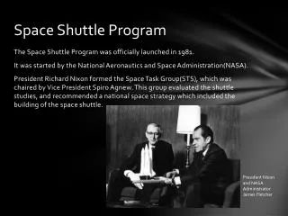
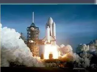
Use of MODIS SST for Space Shuttle Operations Support. March 3, 2010 SPoRT Collaborative Partners Workshop Brian Hoeth – Lead Forecaster NWS Spaceflight Meteorology Group Johnson Space Center, Houston, TX. Presentation Outline. Overview of SMG Shuttle operations

E N D
Use of MODIS SST for Space Shuttle Operations Support March 3, 2010 SPoRT Collaborative Partners Workshop Brian Hoeth – Lead Forecaster NWS Spaceflight Meteorology Group Johnson Space Center, Houston, TX
Presentation Outline • Overview of SMG Shuttle operations • “This is who we are and this is what we do” • NASA Weather Flight Rules • General Use of MODIS SST • Offshore stratocumulus -> low cloud ceilings • Offshore showers • “AFD” examples • SST example during Shuttle launch operations • Snapshot pictures of IR Satellite and MODIS SST • Audio Clip of Weather Briefing to NASA Flight Director • Satellite Loop of what happened
SPACEFLIGHT METEOROLOGY GROUP Quick Look DOC / NOAA / NWS Unit • Reimbursable agreement between NASA and NOAA / NWS • 5 Lead Forecasters, 3 Technique Development Unit Meteorologists, MIC, Admin Assistant Forecasts and Weather Support for Shuttle Landings and Simulations • Launch Aborts (CONUS and TAL); On-orbits; End-of-Mission landings • Upper wind forecasts for ascent loads and descent analysis • Briefings to Flight Directors, Astronauts, Mission Management Team • Weather documentation and verification
CONUS Landing Sites Kennedy Space Center (KSC) Edwards AFB, CA (EDW) White Sands Space Harbor, NM (WSSH) -> Northrup Strip (NOR) Transoceanic Abort Landing Sites (TAL) Zaragoza, Spain (ZZA) Moron, Spain (MRN) • Istres, France (FMI)
SHUTTLE WEATHER FLIGHT RULES DAYLIGHT END OF MISSION (EOM) LANDING AT KENNEDY SPACE CENTER NOTE: Flight Rules vary depending on landing site, day vs night, type of landing, and duration of mission. * Cloud ceiling limits for Return to Launch Site (RTLS) on launch day >= 5,000 ft ** Precipitation limits for RTLS on launch day >= 20 nm
General Benefits of SST product • Stratocumulus clouds • Offshore stratocumulus clouds line up fairly well with the “Gulf Stream” • Rainshowers / Thunderstorms • “Gulf Stream” acts as a convergence boundary • High Pressure in Atlantic east of KSC -> southeast flow
In-House AFD Example #1 “Kind of interesting today with respect to clouds. Over the Gulf of Mexico...cloudy areas correlate very well with warmer SSTs however virtually no correlation between cloudy areas and warmer SSTs on the Atlantic side. Seeing no decrease in stratocu whatsoever coming over the cooler waters towards the western Florida coast. In fact...some areas are showing an increase in the stratocu as it approaches the coast. Obviously some other mechanism going on here...now if I can just figure it out!” “Looking at LAPS soundings from just offshore...the inversion has lifted from around 4k feet at 12Z this morning when there were virtually no clouds over the cooler waters to around 8k feet this afternoon. Cross sections also show decent omega in the 4-8k foot range this afternoon with negative boyancy below this level. Maybe the higher the inversion...the less influence the cooler water has.“ “Now getting increasing line of showers along initial convergence line moving onshore with cloud tops to about 11k feet. Water vaport showing shortwave moving over east-central Fl so maybe this was mechanism for lifting the inversion. "
In-House AFD Example #2 “KSC...sfc high over OH continues to move east ward towards mid-Atlantic states. FL winds should begin the swing around to the east then south-southeast tonight. Aftn radar has has some -SHRA along the west wall of the Gulf Stream. Fading in and out with the SST composite and visible satellite shows this nicely. Mean steering flow overnight should parallel the coast so I don't expect any PCPN concerns for tonight although a stray -SHRA could skip barely inside 30 over the water. “
Audio Clip – 8 Feb 2010 Shuttle Launch SMG Weather Briefing to NASA Flight Director • Example of associating offshore stratocumulus clouds to MODIS SSTs • Flight Director prompts forecaster for SST data • Forecaster fades the combined satellite and SST data in and out
Launch-1 Hour Infrared (3.9 Micron) Satellite Image0815 UTC on 02/08/10 ~3,500 to 4,000 ft ceiling moved through the Shuttle Landing Facility (KTTS) and the Cape Balloon Facility (KXMR) KTTS KXMR
Summary • Using the SST product, SMG has been able to associate certain weather phenomena w/ the “Gulf Stream” • Stratocumulus clouds / low ceilings • Rainshowers / Thunderstorms • SST product very useful for SMG forecasters as visual aid! • Fading in/out of satellite (or radar) + SST • Used to brief NASA Flight Directors, astronauts, & other customers • Can’t explain away/answer all weather questions w/ SST • SST good for general use, but oftentimes other phenomena in play • WARNING! WARNING! -> • Customer DOES try to use SST in situations that do not apply
Questions?/Suggestions? Contact: Brian.Hoeth@noaa.gov