Download
1 / 25
250 likes | 378 Vues
A fuzzy modeling approach to wild land mapping in Scotland. Steffen Fritz, Linda See and Steve Carver. Paper outline. Aims of this study Methods of wilderness mapping The Scottish situation - Remoteness and Apparent Naturalness The internet questionnaire Visibility and distance analysis

E N D
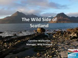
A fuzzy modeling approach to wild land mapping in Scotland Steffen Fritz, Linda See and Steve Carver
Paper outline • Aims of this study • Methods of wilderness mapping • The Scottish situation - Remoteness and Apparent Naturalness • The internet questionnaire • Visibility and distance analysis • Incorporating Naismith’s Rule with Dijkstra’s shortest path algorithm to map remoteness • The fuzzy model for apparent naturalness • Combining remoteness and apparent naturalness • Further research • Conclusions
Aims and Objectives • Develop a mapping tool to map perceived wild land areas on a local level • Model can be applied to Scotland and to other areas in Europe • Model takes into account measurable factors such as remoteness and apparent naturalness • Information is acquired with the help of an internet questionnaire • each individual produces a different wild land map • remoteness and apparent naturalness criteria can be combined and weighted according to its importance
Methods of wilderness mapping • The way you define wilderness will influence the way you are going to map it. • Ecological vs perceptual definition • Rob Lesslie: ‘undeveloped land which is relatively remote and undisturbed by, the process and influence of settled people’ • The whole of Australia was mapped using 4 criteria: naturalness, apparent naturalness, remoteness from access and remoteness from settlement
Methods of wilderness mapping • Definition by Nash ‘There is no specific material thing that is wilderness. The term designates a quality that produces a certain mood or feeling in a given individual and, as a consequence, may be assigned by the person to a specific place” • Huxley (1974) ‘"wilderness is where one feels oneself to be in a wild place, according to the sensibility of one's particular experience and knowledge on a global and local scale." • Kliskey and Kearsley (1993) mapped multiple perceptions on wilderness based on that definition.
The Scottish situation • Landscape has been dramatically altered due to its long settlement and land use history • since ‘pure wilderness’ does not exist in Scotland it is better referred to as wild land • people still value the land according to factors such as remoteness and the absence of human artefacts and as such perceive it as wild.
The internet questionnaire • Questions • 1. Profile • 2. General questions about hiking • 3. Mapping Remoteness - the long walk in • 4. Impact of certain man man features on personal wild land perception such as hill roads, roads, builtup areas, isolated buildings, coniferous plantations, pylons, shielings (old crofts), grazing (sheep, cattle), arable land, ski lifts
Mapping Remoteness • Using Naismith Rule (1892) to map pedestrian travel times • Modified by Langmuir (1984) • 5 km/h plus 0.5 hour per 300 m of ascent, • minus 10 minutes per 300 m descent for slopes between 5° and 12°, • plus 10 minutes per 300 m descent for slopes greater than 12°.
Non purist low wild land < 20 minutes medium wild land 20 - 40 minutes high wild land 40 - 80 minutes
Purist low wild land < 60 minutes medium wild land 360 minutes high wild land 720 minutes
Visibility and Distance Analysis • Done on a 50m resolution using EDX data for each feature (roads, hillroads, buildings, built-up, coniferous plantations) • Euclidean distance was calculated for visible and non visible features
Man Made Features • Roads • Hill Roads • Pylons • Coniferous Plantations • Grazing • Arable Land • built-up area • isolated building • ski-lift • hydroelectric power plant • shieling • quarry
Current Problems and Further Research • Visibility Analysis is very computational intensive • OR operator for factor maps is problematic • length of feature is not taken into account • Validation - further research will focus on interactive maps and some kind of ground truthing • Photographs as additional aid • Grouping of respondents - purist groups - composite maps
Conclusions • Wild land is not easy to map and it can only be done up to a certain degree using measurable criteria • Internet questionnaire is very useful to capture information on overall individuals perception of wild land • Naismith surfaces can be used to measure perceived remoteness remoteness on a local level • Apparent Naturalness can be measured within a fuzzy modeling framework • Applications: • Quantitative data on wild land is very useful in decision making e.g. public inquiry, if then modeling • Relative wild areas can be ‘objectively’ compared