Download
1 / 10
100 likes | 189 Vues
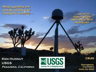
Progress on Reducing GPS Errors - Horizontal and Vertical. Courtesy of JPL. Kenneth W. Hudnut U. S. Geological Survey Pasadena, California. Southern California Earthquake Center --- U. S. Geological Survey Workshop on Active Deformation in the Northern LA Region

E N D
Progress on Reducing GPS Errors - Horizontal and Vertical Courtesy of JPL Kenneth W. Hudnut U. S. Geological Survey Pasadena, California Southern California Earthquake Center --- U. S. Geological Survey Workshop on Active Deformation in the Northern LA Region Caltech; Pasadena, California --- October 26, 2005
San Gabriel Valley Tectonics • San Andreas system - oblique component (new understanding of this within past decade w/ GPS) • Thrust fault systems • Rigid motion of San Gabriel mountains massif perpend. to SAF • Observed by Savage et al., 1992 • Confirmed by SCEC CMM3 and SCIGN results • Along-strike variations in deep structure (LARSE) • Cross-faults • Block rotations SCEC CFM v.2
Statement of Problems • Must understand complex fault interactions to understand fault system behavior • Some questions (also addressed in SCEC Nov. 2004 workshop & AGU FM04): • How does the San Andreas fault interact with abutting and nearby structures? • How do these secondary and tertiary structures interact with the San Andreas? • How is the Big Bend influencing the region - has approach to frictional lock-up caused bypasses such as the Eastern California Shear Zone and San Jacinto fault? • How may ruptures propagate along these fault systems? • Is there along-strike variation in strain along the San Gabriel Mtn. front? • How might such variation correspond to geological or deep structural evidence? • High hazard due to proximity of faults to Los Angeles greater metro area
Differences in Geological & Geodetic Rates • Sierra Madre – Cucamonga fault zone • Geologic rate of 0.5 mm/yr • Geodetic rate of a • Raymond fault • Geologic rate of 1.5-4 mm/yr • Geodetic rate of b • Discuss - are these rates best available? • Geologic rates compiled from FAD & literature • Geodetic rates from CMM3 and SCIGN • a + b ~ 6-8 mm/yr Courtesy of B. Meade
Uplifting Thoughts or ‘Condemned to Repeat’ History? • How fast are the mountains going up? • Nikolaidis et al. vertical rates from SCIGN -suggested rate changes Courtesy of R. Nikolaidis, UCSD dissertation
Gyros How good is GPS? Reasonable to expect 0.1 mm/yr in both horizontal and vertical (but not there yet) Courtesy of John Langbein (USGS)
How do the data look? SCEC Crustal Motion Map 3 (CMM3) and SCIGN combined (JPL & SOPAC) merged solutions are now readily availalable, and can be explored using various web-based and Matlab tools (figures shown are from GGMatlab by Tom Herring, MIT) - Older stations (CHIL, MTWI, TABL) have longer running data but are noisier than the new SCIGN standard installations - Horizontal velocities allow sophisticated modeling and interpretation (see Argus et al., 2005), yet vertical rates are still not robust at the mm/yr level - Appears all sites going down at 2 mm/yr (?!) AGU FM04
Summary • We can potentially better understand the Northern LA Basin fault system in all of its complexity, but… • Must pursue a similar course for a longer time, and more will continue to be learned about deep geometry, activity, and overall geodynamics of the system • Perseverance and patience is especially required on geodetic rates - these take time to be well observed - can eventually obtain precise vertical rates after many more years • We must understand the fault interactions if we are to predict aspects of future behavior within the San Andreas fault system and adjacent San Gabriel Mtns. massif and San Gabriel Valley