Download

1 / 7
110 likes | 367 Vues
The Lowlands. page 138: #s 2, 4, 6, 7. 2a) How thick is the sedimentary rock in the Interior Plains and why is it so thick?. The sedimentary rock in the Interior Plains is several thousand metres thick and took millions of years to form.

E N D
The Lowlands page 138: #s 2, 4, 6, 7
2a) How thick is the sedimentary rock in the Interior Plains and why is it so thick? The sedimentary rock in the Interior Plains is several thousand metres thick and took millions of years to form. The sediments were eroded from the Canadian Shield and the Rocky Mountains and deposited in the shallow seas that covered the Interior Plains during Paleozoic Era.
2b) Why are the ancient coral reefs of the Interior Plains important today? The ancient coral reefs of the Interior Plains are important today because they are the site of significant oil & gas deposits, which are buried thousands of metres below the surface of the land today.
5) Parts of the southern portion of Canada’s Interior Plains are often called “Canada’s breadbasket.” Why? After the last ice age a large lake occupied the area that became southern Saskatchewan and Manitoba. Once drained the lake bottom became the site of deep fertile soils. So much wheat, flax, canola, and other crops are grown in this area that it is known as Canada’s breadbasket.
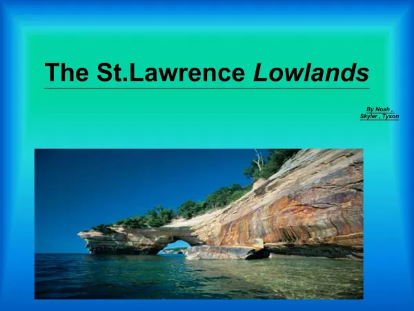
6) Copy the paragraph and insert the correct term. To the south of the Canadian Shield is the Great Lakes - St. Lawrence Lowlands. Like the Interior Plains, the lowlands are underlain by sedimentary rock. The St. Lawrence Lowlands were created when land between two faults collapsed creating a rift valley. The landscape of the Great Lakes Lowlands is largely the result of glaciation. The Great Lakes were carved out by glaciers. The Niagara escarpment is the single biggest feature of the lowlands.
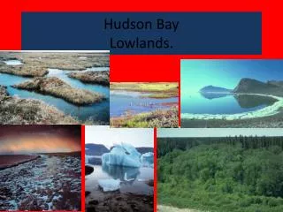
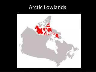
7a) Describe the characteristics of the Hudson bay Lowlands and Arctic Lowlands. Characteristics of the Hudson Bay Lowlands include: - a flat low area covered by swampy forests sedimentary rock that rests on top of the ancient rock of the shield. Characteristics of the Arctic Lowlands include: - a series of islands in the far north that have a gently rolling landscape - ground that remains frozen for most of the year.
7b) What minerals are present in the Arctic Lowlands? How did they get there? The Arctic Lowlands contain lignite (a form of low grade coal), oil, and natural gas deposits. These were created during the paleozoic when much of the area was a tropical swamp, or in the coral reefs formed in the shallow seas.